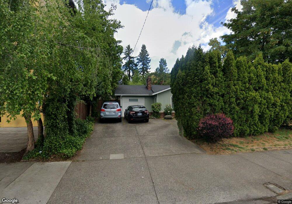
14735 E Burnside St Portland, OR 97233
Hazelwood NeighborhoodEstimated Value: $342,000 - $411,000
3
Beds
1
Bath
1,004
Sq Ft
$375/Sq Ft
Est. Value
About This Home
This home is located at 14735 E Burnside St, Portland, OR 97233 and is currently estimated at $376,145, approximately $374 per square foot. 14735 E Burnside St is a home located in Multnomah County with nearby schools including Glenfair Elementary School, Hauton B Lee Middle School, and Reynolds High School.
Ownership History
Date
Name
Owned For
Owner Type
Purchase Details
Closed on
Feb 20, 1998
Sold by
Robinson Jon R
Bought by
Perez Martha S and Maldonado Jose A
Current Estimated Value
Home Financials for this Owner
Home Financials are based on the most recent Mortgage that was taken out on this home.
Original Mortgage
$101,570
Outstanding Balance
$17,363
Interest Rate
6.97%
Mortgage Type
FHA
Estimated Equity
$358,782
Create a Home Valuation Report for This Property
The Home Valuation Report is an in-depth analysis detailing your home's value as well as a comparison with similar homes in the area
Home Values in the Area
Average Home Value in this Area
Purchase History
| Date | Buyer | Sale Price | Title Company |
|---|---|---|---|
| Perez Martha S | $102,000 | Ticor Title Insurance |
Source: Public Records
Mortgage History
| Date | Status | Borrower | Loan Amount |
|---|---|---|---|
| Open | Perez Martha S | $101,570 |
Source: Public Records
Tax History Compared to Growth
Tax History
| Year | Tax Paid | Tax Assessment Tax Assessment Total Assessment is a certain percentage of the fair market value that is determined by local assessors to be the total taxable value of land and additions on the property. | Land | Improvement |
|---|---|---|---|---|
| 2025 | $3,774 | $161,350 | -- | -- |
| 2024 | $3,582 | $156,660 | -- | -- |
| 2023 | $3,443 | $152,100 | $0 | $0 |
| 2022 | $3,391 | $147,670 | $0 | $0 |
| 2021 | $3,347 | $143,370 | $0 | $0 |
| 2020 | $3,021 | $139,200 | $0 | $0 |
| 2019 | $2,867 | $135,150 | $0 | $0 |
| 2018 | $2,841 | $131,220 | $0 | $0 |
| 2017 | $2,740 | $127,400 | $0 | $0 |
| 2016 | $2,611 | $123,690 | $0 | $0 |
| 2015 | $2,474 | $120,090 | $0 | $0 |
| 2014 | $2,270 | $116,600 | $0 | $0 |
Source: Public Records
Map
Nearby Homes
- 94 NE 148th Ave Unit 1
- 90 NE 148th Ave Unit 2
- 14816 NE Couch St Unit 3
- 14822 NE Couch St Unit 4
- 14834 NE Couch St Unit 6
- 14828 NE Couch St Unit 5
- 14840 NE Couch St Unit 7
- 14846 NE Couch St Unit 8
- 14852 NE Couch St Unit 9
- 14858 NE Couch St Unit 10
- 14864 NE Couch St Unit 11
- 14870 NE Couch St Unit 12
- 14876 NE Couch St Unit 13
- 14888 NE Couch St Unit 15
- 14894 NE Couch St Unit 16
- 300 NE 148th Ave
- 15161 E Burnside St
- 15159 E Burnside St
- 15157 E Burnside St
- 15155 E Burnside St
- 19 NE 148 Ave Unit 1
- 19 NE 148 Ave
- 19 NE 148th Ave Unit 1
- 19 NE 148th Ave
- 36 NE 147th Ave
- 14715 E Burnside St
- 55 NE 148th Ave
- 14811 E Burnside St
- 16 NE 148th Ave
- 14740 E Burnside St Unit 14742
- 132 NE 147th Ave
- 14641 E Burnside St
- 38 NE 148th Ave
- 109 NE 148th Ave
- 136 NE 147th Ave
- 90 NE 148th Ave Unit 1
- 94 NE 148th Ave Unit 2
- 14736 NE Couch St
- 14732 NE Couch St
- 14724 NE Couch St