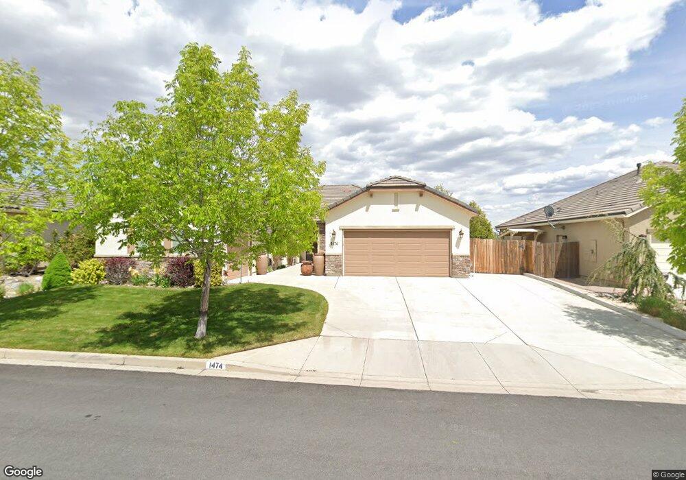
1474 Bluewood Dr Reno, NV 89523
Mae Anne Avenue NeighborhoodEstimated Value: $768,000 - $808,000
4
Beds
3
Baths
2,380
Sq Ft
$330/Sq Ft
Est. Value
About This Home
This home is located at 1474 Bluewood Dr, Reno, NV 89523 and is currently estimated at $786,334, approximately $330 per square foot. 1474 Bluewood Dr is a home with nearby schools including Sarah Winnemucca Elementary School, B D Billinghurst Middle School, and Robert McQueen High School.
Ownership History
Date
Name
Owned For
Owner Type
Purchase Details
Closed on
Dec 13, 2012
Sold by
Estancia Reno Llc
Bought by
Hilton Janet E and Spahr Michael A
Current Estimated Value
Purchase Details
Closed on
Oct 8, 2009
Sold by
Estancia West Llc
Bought by
Estancia Reno Llc
Create a Home Valuation Report for This Property
The Home Valuation Report is an in-depth analysis detailing your home's value as well as a comparison with similar homes in the area
Home Values in the Area
Average Home Value in this Area
Purchase History
| Date | Buyer | Sale Price | Title Company |
|---|---|---|---|
| Hilton Janet E | $345,000 | First American Title Sparks | |
| Estancia Reno Llc | -- | First Amer Title Howard Hugh | |
| Estancia West Llc | -- | First Amer Title Howard Hugh |
Source: Public Records
Tax History
| Year | Tax Paid | Tax Assessment Tax Assessment Total Assessment is a certain percentage of the fair market value that is determined by local assessors to be the total taxable value of land and additions on the property. | Land | Improvement |
|---|---|---|---|---|
| 2026 | $3,983 | $184,670 | $64,733 | $119,938 |
| 2024 | $5,164 | $178,278 | $56,018 | $122,261 |
| 2023 | $5,016 | $175,328 | $60,015 | $115,313 |
| 2022 | $4,870 | $144,661 | $49,193 | $95,468 |
| 2021 | $4,728 | $143,735 | $49,193 | $94,542 |
| 2020 | $4,587 | $141,860 | $47,460 | $94,400 |
| 2019 | $4,455 | $137,325 | $47,040 | $90,285 |
| 2018 | $4,304 | $121,605 | $34,230 | $87,375 |
| 2017 | $4,152 | $117,858 | $30,660 | $87,198 |
| 2016 | $4,073 | $119,248 | $30,464 | $88,784 |
| 2015 | $4,065 | $115,501 | $27,370 | $88,131 |
| 2014 | $3,946 | $110,100 | $26,180 | $83,920 |
| 2013 | -- | $104,497 | $22,260 | $82,237 |
Source: Public Records
Map
Nearby Homes
- 1705 Sierra Highlands Dr
- 0 Simons Dr
- 3320 Heights Dr
- 3271 Heights Dr
- 3286 Heights Dr
- 1596 Grazer Way
- 1598 Grazer Way
- 1584 Grazer Way
- 5833 Altitude St
- 3264 Barbara Cir
- 5857 Morgan Horse St
- Walker Plan at Monarch
- Humboldt Plan at Monarch
- 5861 Morgan Horse St
- 0000 Mccarran
- 4761 Scenic Hill Cir
- 2224 Escalera Way
- 6052 Bankside Way
- 4692 Canyon Ridge Ln Unit 3
- 5722 Golden Eagle Dr
- 1480 Bluewood Dr
- 1468 Bluewood Dr
- 1486 Bluewood Dr
- 1467 Bluewood Dr
- 1462 Bluewood Dr
- 1473 Bluewood Dr
- 1479 Mount Grant Dr
- 1471 Mount Grant Dr
- 1479 Bluewood Dr
- 1461 Bluewood Dr
- 1492 Bluewood Dr
- 1497 Mount Grant Dr
- 1463 Mount Grant Dr
- 1455 Mount Grant Dr
- 1456 Bluewood Dr
- 1485 Bluewood Dr
- 1499 Mount Grant Dr
- 1498 Bluewood Dr
- 1447 Mount Grant Dr
- 1449 Bluewood Dr
Your Personal Tour Guide
Ask me questions while you tour the home.