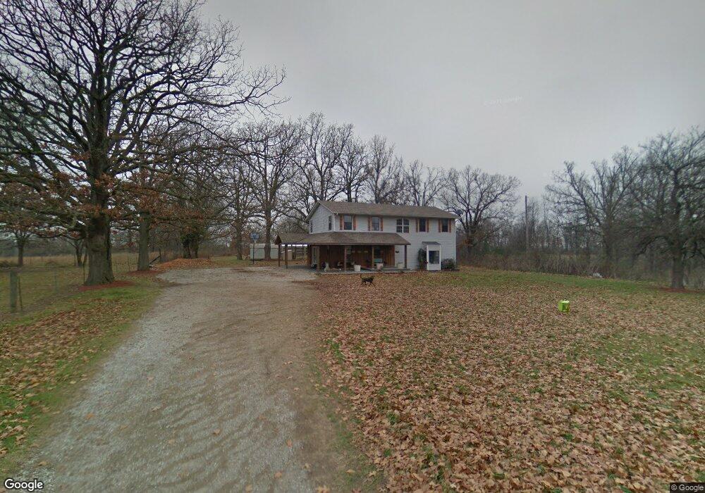
14747 Farm Road 1085 Cassville, MO 65625
Estimated Value: $287,000 - $474,081
4
Beds
3
Baths
2,620
Sq Ft
$144/Sq Ft
Est. Value
About This Home
This home is located at 14747 Farm Road 1085, Cassville, MO 65625 and is currently estimated at $376,270, approximately $143 per square foot. 14747 Farm Road 1085 is a home located in Barry County with nearby schools including Eunice Thomas Elementary School, Cassville Intermediate School, and Cassville Middle School.
Ownership History
Date
Name
Owned For
Owner Type
Purchase Details
Closed on
Dec 21, 2018
Sold by
Homesley Mary
Bought by
Cisco Mark and Cisco Brittney
Current Estimated Value
Home Financials for this Owner
Home Financials are based on the most recent Mortgage that was taken out on this home.
Original Mortgage
$90,000
Outstanding Balance
$57,482
Interest Rate
4.9%
Mortgage Type
Seller Take Back
Estimated Equity
$318,788
Purchase Details
Closed on
Jan 12, 2017
Sold by
Hasler Walter and Hasler Glenda
Bought by
Cisco Mark and Cisco Brittney
Purchase Details
Closed on
Jul 14, 2010
Sold by
Secretary Of Hud
Bought by
Maher Allen and Maher Melissa
Home Financials for this Owner
Home Financials are based on the most recent Mortgage that was taken out on this home.
Original Mortgage
$53,100
Interest Rate
4.76%
Mortgage Type
New Conventional
Create a Home Valuation Report for This Property
The Home Valuation Report is an in-depth analysis detailing your home's value as well as a comparison with similar homes in the area
Home Values in the Area
Average Home Value in this Area
Purchase History
| Date | Buyer | Sale Price | Title Company |
|---|---|---|---|
| Cisco Mark | -- | Security Abstract & Title | |
| Cisco Mark | -- | Barry County Abstract & Titl | |
| Maher Allen | -- | None Available |
Source: Public Records
Mortgage History
| Date | Status | Borrower | Loan Amount |
|---|---|---|---|
| Open | Cisco Mark | $90,000 | |
| Open | Cisco Mark | $243,900 | |
| Previous Owner | Maher Allen | $53,100 |
Source: Public Records
Tax History Compared to Growth
Tax History
| Year | Tax Paid | Tax Assessment Tax Assessment Total Assessment is a certain percentage of the fair market value that is determined by local assessors to be the total taxable value of land and additions on the property. | Land | Improvement |
|---|---|---|---|---|
| 2025 | $2,341 | $52,317 | $1,759 | $50,558 |
| 2024 | $2,341 | $47,833 | $1,759 | $46,074 |
| 2023 | $2,197 | $47,833 | $1,759 | $46,074 |
| 2022 | $1,008 | $47,643 | $1,569 | $46,074 |
| 2021 | $995 | $21,556 | $1,189 | $20,367 |
| 2020 | $995 | $21,556 | $1,189 | $20,367 |
| 2018 | $757 | $16,801 | $1,201 | $15,600 |
| 2017 | $715 | $16,872 | $2,185 | $14,687 |
| 2016 | $695 | $15,295 | $1,615 | $13,680 |
| 2015 | -- | $15,295 | $1,615 | $13,680 |
| 2014 | -- | $13,509 | $1,615 | $11,894 |
| 2012 | -- | $0 | $0 | $0 |
Source: Public Records
Map
Nearby Homes
- 15223 State Highway 37
- 000-B Farm Road 1090
- 000-A Farm Road 1090
- 10106 N Maple St
- 10603 N Main St
- 3110 Main St
- 1408 Nottingham Dr
- 1407 Nottingham Dr
- 106 Rosedale St
- 1002 Lake Road Dr
- 1421 Oakhill Dr
- 1400 Old Exeter Rd
- 13915 Farm Road 1115
- 000 Farm Road 2140
- 303 Melton Way
- 301 Blackberry Ct
- 000 Luney Dr
- 1102 Sapp St
- 1605 Chappell Dr
- 000 Farm Road 1047
- 8397 Farm Road 2150
- 8442 Farm Road 2150
- 14865 Farm Road 1085
- 14937 Farm Road 1085
- 8471 Farm Road 2150
- 14827 Farm Road 1085
- 000 Farm Road 2150
- 14821 Farm Road 1085
- 14783 Farm Road 1085
- 14804 Farm Road 1085
- 8104 Farm Road 2150
- 8722 Farm Road 2150
- 14632 Farm Road 1085
- 8812 Farm Road 2150
- 8812 Farm Road 2150
- 8511 Farm Road 2145
- 0 000 Farm Road 2145 Unit 1227197
- 15111 Farm Road 1090
- 7848 Farm Road 2150
- 14292 Farm Road 1085