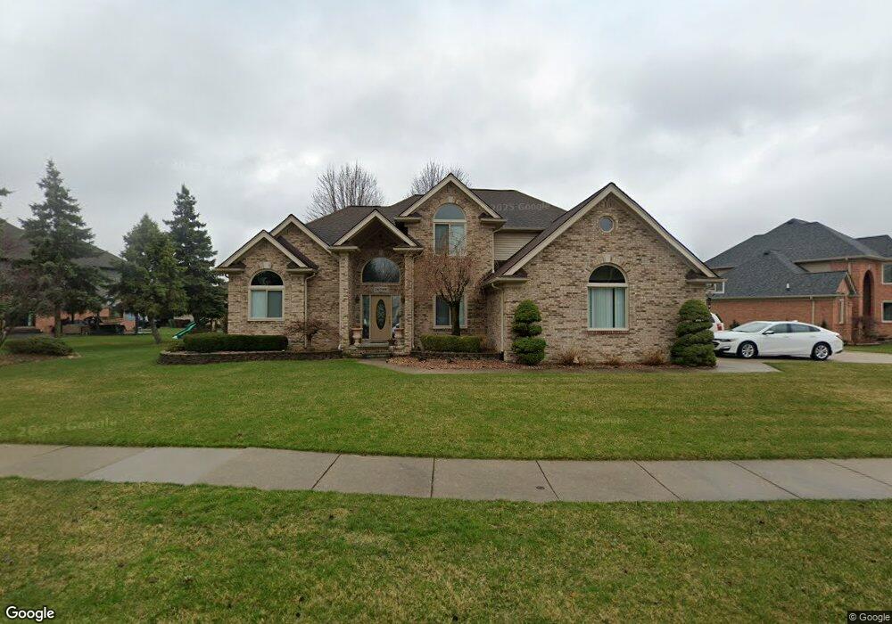
14748 Sparrow Dr Shelby Township, MI 48315
Estimated Value: $516,000 - $550,000
3
Beds
3
Baths
2,493
Sq Ft
$213/Sq Ft
Est. Value
About This Home
This home is located at 14748 Sparrow Dr, Shelby Township, MI 48315 and is currently estimated at $530,100, approximately $212 per square foot. 14748 Sparrow Dr is a home located in Macomb County with nearby schools including Browning Elementary School, Bemis Junior High School, and Henry Ford II High School.
Ownership History
Date
Name
Owned For
Owner Type
Purchase Details
Closed on
May 5, 2006
Sold by
Maglich Linda and Apone Frances
Bought by
Maglich Thomas L and Maglich Linda
Current Estimated Value
Home Financials for this Owner
Home Financials are based on the most recent Mortgage that was taken out on this home.
Original Mortgage
$100,000
Interest Rate
6.72%
Mortgage Type
New Conventional
Purchase Details
Closed on
Mar 11, 1997
Sold by
Nest Dev Co
Bought by
Apone L and Apone F
Create a Home Valuation Report for This Property
The Home Valuation Report is an in-depth analysis detailing your home's value as well as a comparison with similar homes in the area
Home Values in the Area
Average Home Value in this Area
Purchase History
| Date | Buyer | Sale Price | Title Company |
|---|---|---|---|
| Maglich Thomas L | -- | Mta | |
| Apone L | $57,500 | -- |
Source: Public Records
Mortgage History
| Date | Status | Borrower | Loan Amount |
|---|---|---|---|
| Closed | Maglich Thomas L | $100,000 |
Source: Public Records
Tax History Compared to Growth
Tax History
| Year | Tax Paid | Tax Assessment Tax Assessment Total Assessment is a certain percentage of the fair market value that is determined by local assessors to be the total taxable value of land and additions on the property. | Land | Improvement |
|---|---|---|---|---|
| 2025 | $4,746 | $244,700 | $0 | $0 |
| 2024 | $2,809 | $230,900 | $0 | $0 |
| 2023 | $2,660 | $205,400 | $0 | $0 |
| 2022 | $4,291 | $193,600 | $0 | $0 |
| 2021 | $4,174 | $180,900 | $0 | $0 |
| 2020 | $2,449 | $174,300 | $0 | $0 |
| 2019 | $3,821 | $168,300 | $0 | $0 |
| 2018 | $3,775 | $161,400 | $0 | $0 |
| 2017 | $3,707 | $152,250 | $45,300 | $106,950 |
| 2016 | $3,681 | $152,250 | $0 | $0 |
| 2015 | $3,628 | $138,300 | $0 | $0 |
| 2012 | -- | $0 | $0 | $0 |
Source: Public Records
Map
Nearby Homes
- 47630 Robins Nest Dr
- 13808 Stone Falcon Dr
- 14760 Ashton Ln
- 14930 Crofton Dr
- 14257 Mandarin Dr
- 14229 Mandarin Dr
- 14710 Palmetto Ct
- 14892 Carver Ct
- 47387 Royal Rd
- 15280 Valerie Dr
- 15297 Spruce Dr
- 14890 Dover Ct Unit 80
- 48535 Sugarbush Ct
- 48619 Sugarbush Ct Unit 282
- 47630 Barbara Rd
- 48679 Aberdeen Ct
- 47550 Barbara Rd
- 48459 Cheyenne Ct
- 15430 Windmill Dr
- 48409 Presidential Dr
- 14710 Sparrow Dr
- 47857 Robins Nest Dr
- 47835 Robins Nest Dr
- 14689 Raven Ct
- 14688 Sparrow Dr
- 47819 Robins Nest Dr
- 14799 Blue Jay Ct
- 14765 Sparrow Dr
- 14777 Sparrow Dr
- 14667 Raven Ct
- 14745 Sparrow Dr
- 14656 Sparrow Dr
- 14721 Sparrow Dr
- 14785 Sparrow Dr
- 47834 Robins Nest Dr
- 14827 Blue Jay Ct
- 47812 Robins Nest Dr
- 14693 Sparrow Dr
- 14635 Raven Ct
- 47790 Robins Nest Dr