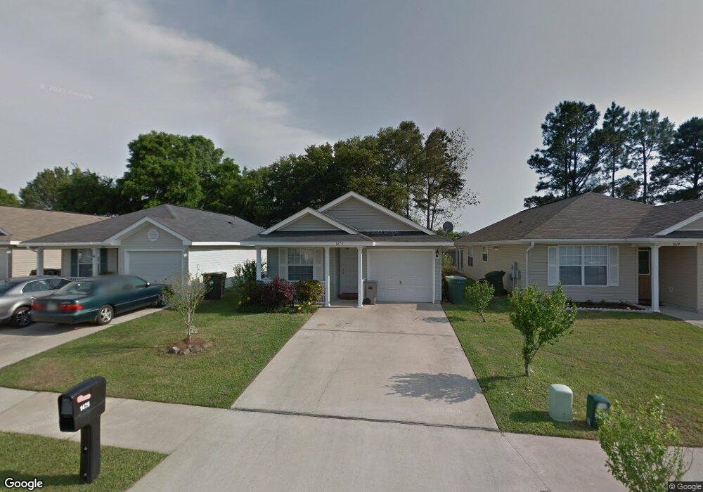
1475 Dunhurst Dr Pensacola, FL 32534
Estimated Value: $209,041 - $223,000
--
Bed
2
Baths
1,257
Sq Ft
$173/Sq Ft
Est. Value
About This Home
This home is located at 1475 Dunhurst Dr, Pensacola, FL 32534 and is currently estimated at $217,510, approximately $173 per square foot. 1475 Dunhurst Dr is a home located in Escambia County with nearby schools including Lincoln Park Elementary School, Beulah Middle School, and J.M. Tate Senior High School.
Ownership History
Date
Name
Owned For
Owner Type
Purchase Details
Closed on
Nov 9, 2020
Sold by
Demouy Augustine F
Bought by
Leche Michael Todd
Current Estimated Value
Home Financials for this Owner
Home Financials are based on the most recent Mortgage that was taken out on this home.
Original Mortgage
$144,851
Outstanding Balance
$128,897
Interest Rate
2.8%
Mortgage Type
VA
Estimated Equity
$88,613
Purchase Details
Closed on
Mar 16, 2006
Sold by
The Mitchell Co Inc
Bought by
Demouy Augustine F
Create a Home Valuation Report for This Property
The Home Valuation Report is an in-depth analysis detailing your home's value as well as a comparison with similar homes in the area
Home Values in the Area
Average Home Value in this Area
Purchase History
| Date | Buyer | Sale Price | Title Company |
|---|---|---|---|
| Leche Michael Todd | $150,000 | Emerald Coast Title Inc | |
| Demouy Augustine F | $146,000 | -- |
Source: Public Records
Mortgage History
| Date | Status | Borrower | Loan Amount |
|---|---|---|---|
| Open | Leche Michael Todd | $144,851 |
Source: Public Records
Tax History Compared to Growth
Tax History
| Year | Tax Paid | Tax Assessment Tax Assessment Total Assessment is a certain percentage of the fair market value that is determined by local assessors to be the total taxable value of land and additions on the property. | Land | Improvement |
|---|---|---|---|---|
| 2024 | $2,382 | $186,913 | $25,000 | $161,913 |
| 2023 | $2,382 | $165,760 | $0 | $0 |
| 2022 | $2,144 | $150,691 | $15,000 | $135,691 |
| 2021 | $1,278 | $123,064 | $0 | $0 |
| 2020 | $1,621 | $109,792 | $0 | $0 |
| 2019 | $1,560 | $104,467 | $0 | $0 |
| 2018 | $1,513 | $98,998 | $0 | $0 |
| 2017 | $1,497 | $95,730 | $0 | $0 |
| 2016 | $1,497 | $94,122 | $0 | $0 |
| 2015 | $1,445 | $90,812 | $0 | $0 |
| 2014 | $1,404 | $87,835 | $0 | $0 |
Source: Public Records
Map
Nearby Homes
- 8964 Abbington Dr
- 1518 Farragut Way
- 8920 Brigade Trail
- 8916 Brigade Trail
- 8913 Brigade Trail
- 8907 Abbington Dr
- 1433 Claridge Place
- 1463 Keylan Cove
- 1412 Croquet Dr
- 9200 Bowman Ave
- 1830 Mary Jo Way
- 1921 Larkspur Cir
- 1904 Mary Jo Way
- 1755 Mary Jo Way
- 1783 Mary Jo Way
- 1760 Paisleigh Dr
- 1772 Paisleigh Dr
- 1422 Starlight Dr
- 116 Mt Pilot St
- 1403 Twilight Dr
- 1471 Dunhurst Dr
- 1479 Dunhurst Dr
- 1467 Dunhurst Dr
- 1483 Dunhurst Dr
- 1463 Dunhurst Dr
- 1487 Dunhurst Dr
- 9048 Camelot Place
- 1454 Newcastle Way
- 1457 Dunhurst Dr
- 1460 Newcastle Way
- 1491 Dunhurst Dr
- 1453 Dunhurst Dr
- 1474 Dunhurst Dr
- 1478 Dunhurst Dr
- 1470 Dunhurst Dr
- 1482 Dunhurst Dr
- 1466 Dunhurst Dr
- 1449 Dunhurst Dr
- 1486 Dunhurst Dr
- 1448 Newcastle Way