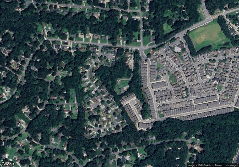
1475 Dupree Rd Woodstock, GA 30189
Estimated Value: $216,000 - $345,000
2
Beds
1
Bath
884
Sq Ft
$320/Sq Ft
Est. Value
About This Home
This home is located at 1475 Dupree Rd, Woodstock, GA 30189 and is currently estimated at $282,687, approximately $319 per square foot. 1475 Dupree Rd is a home located in Cherokee County with nearby schools including Woodstock Elementary School, Woodstock Middle School, and Woodstock High School.
Ownership History
Date
Name
Owned For
Owner Type
Purchase Details
Closed on
Dec 31, 1993
Sold by
Hussey Melissa G
Bought by
Westbrook David L
Current Estimated Value
Home Financials for this Owner
Home Financials are based on the most recent Mortgage that was taken out on this home.
Original Mortgage
$46,550
Interest Rate
7.1%
Create a Home Valuation Report for This Property
The Home Valuation Report is an in-depth analysis detailing your home's value as well as a comparison with similar homes in the area
Home Values in the Area
Average Home Value in this Area
Purchase History
| Date | Buyer | Sale Price | Title Company |
|---|---|---|---|
| Westbrook David L | $49,000 | -- |
Source: Public Records
Mortgage History
| Date | Status | Borrower | Loan Amount |
|---|---|---|---|
| Closed | Westbrook David L | $46,550 |
Source: Public Records
Tax History Compared to Growth
Tax History
| Year | Tax Paid | Tax Assessment Tax Assessment Total Assessment is a certain percentage of the fair market value that is determined by local assessors to be the total taxable value of land and additions on the property. | Land | Improvement |
|---|---|---|---|---|
| 2025 | $1,683 | $74,528 | $22,800 | $51,728 |
| 2024 | $1,566 | $68,728 | $17,080 | $51,648 |
| 2023 | $1,149 | $69,568 | $17,080 | $52,488 |
| 2022 | $1,312 | $55,888 | $17,080 | $38,808 |
| 2021 | $842 | $31,848 | $7,960 | $23,888 |
| 2020 | $852 | $32,208 | $7,960 | $24,248 |
| 2019 | $807 | $30,600 | $7,960 | $22,640 |
| 2018 | $808 | $30,520 | $7,960 | $22,560 |
| 2017 | $785 | $73,800 | $7,640 | $21,880 |
| 2016 | $744 | $69,700 | $7,640 | $20,240 |
| 2015 | $761 | $70,500 | $7,640 | $20,560 |
| 2014 | $675 | $63,000 | $6,960 | $18,240 |
Source: Public Records
Map
Nearby Homes
- 109 Village Green Ave
- 89 Batten Board Way
- The Seaside B Plan at The Village at Towne Lake
- The Seaside A Plan at The Village at Towne Lake
- 756 Stickley Oak Way
- 930 Kings Ct
- 108 Batten Board Way
- 306 Gray Shingle Ln
- 114 Batten Board Way
- 865 Cherrydale Ln
- 322 Gray Shingle Ln
- 648 Stickley Oak Way
- 687 Stickley Oak Way
- 685 Stickley Oak Way
- 2020 Bascomb Carmel Rd
- 574 Brashy St
- 467 Chandler Ln
- 578 Brashy St
- 463 Chandler Ln
- 583 S Club Dr
- 1479 Dupree Rd
- 204 Lexington Ct
- 113 Lexington Parke Dr
- 115 Lexington Parke Dr
- 117 Lexington Parke Dr
- 823 Stickley Oak Way
- 111 Lexington Parke Dr
- 202 Lexington Ct
- 730 Stickley Oak Way
- 119 Lexington Parke Dr
- 813 Stickley Oak Way
- 205 Lexington Ct
- 116 Village Green Ave
- 118 Village Green Ave
- 122 Village Green Ave
- 109 Lexington Parke Dr
- 112 Village Green Ave
- 121 Lexington Parke Dr
- 105 Lexington Parke Dr
- 120 Village Green Ave
