Estimated Value: $271,000 - $300,000
3
Beds
2
Baths
1,299
Sq Ft
$220/Sq Ft
Est. Value
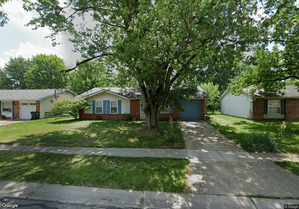
About This Home
This home is located at 1475 Windward Dr, Mason, OH 45040 and is currently estimated at $285,725, approximately $219 per square foot. 1475 Windward Dr is a home located in Warren County with nearby schools including Mason Intermediate Elementary School, Mason Middle School, and William Mason High School.
Ownership History
Date
Name
Owned For
Owner Type
Purchase Details
Closed on
Aug 29, 2007
Sold by
Ash Joel Patrick and Ash Angela Renee
Bought by
Malott Christopher M and Egbers Laura E
Current Estimated Value
Home Financials for this Owner
Home Financials are based on the most recent Mortgage that was taken out on this home.
Original Mortgage
$128,900
Outstanding Balance
$80,308
Interest Rate
6.71%
Mortgage Type
Purchase Money Mortgage
Estimated Equity
$205,417
Purchase Details
Closed on
Sep 9, 2002
Sold by
Vano'Flen Diana
Bought by
Ash Joel P and Ash Angela R
Home Financials for this Owner
Home Financials are based on the most recent Mortgage that was taken out on this home.
Original Mortgage
$115,192
Interest Rate
6.41%
Mortgage Type
FHA
Purchase Details
Closed on
May 4, 1987
Sold by
Abney Gabriele B and Abney Gabriele B
Bought by
Vanoflen and Diana Aka
Purchase Details
Closed on
Nov 3, 1980
Sold by
Abney Abney and Abney James R
Create a Home Valuation Report for This Property
The Home Valuation Report is an in-depth analysis detailing your home's value as well as a comparison with similar homes in the area
Home Values in the Area
Average Home Value in this Area
Purchase History
| Date | Buyer | Sale Price | Title Company |
|---|---|---|---|
| Malott Christopher M | $128,900 | Stewart Advanced Land Title | |
| Ash Joel P | $117,000 | -- | |
| Vanoflen | $54,900 | -- | |
| -- | $15,000 | -- |
Source: Public Records
Mortgage History
| Date | Status | Borrower | Loan Amount |
|---|---|---|---|
| Open | Malott Christopher M | $128,900 | |
| Previous Owner | Ash Joel P | $115,192 |
Source: Public Records
Tax History
| Year | Tax Paid | Tax Assessment Tax Assessment Total Assessment is a certain percentage of the fair market value that is determined by local assessors to be the total taxable value of land and additions on the property. | Land | Improvement |
|---|---|---|---|---|
| 2025 | $2,923 | $72,020 | $24,500 | $47,520 |
| 2024 | $2,923 | $72,020 | $24,500 | $47,520 |
| 2023 | $2,548 | $53,039 | $10,762 | $42,276 |
| 2022 | $2,515 | $53,039 | $10,763 | $42,277 |
| 2021 | $2,383 | $53,039 | $10,763 | $42,277 |
| 2020 | $2,259 | $43,120 | $8,750 | $34,370 |
| 2019 | $2,077 | $43,120 | $8,750 | $34,370 |
| 2018 | $2,084 | $43,120 | $8,750 | $34,370 |
| 2017 | $1,965 | $37,951 | $8,274 | $29,677 |
| 2016 | $2,024 | $37,951 | $8,274 | $29,677 |
| 2015 | $2,028 | $37,951 | $8,274 | $29,677 |
| 2014 | $2,032 | $35,470 | $7,730 | $27,730 |
| 2013 | $2,036 | $40,140 | $8,750 | $31,390 |
Source: Public Records
Map
Nearby Homes
- 1475 St Lawrence Dr
- 968 Olympia Dr
- 792 Majken Place
- 899 Tradewind Dr
- 8335 Charming Manor
- 1041 Sheffield Dr
- 6300 Amber Ct
- 7966 Country Green Ct
- 6411 Coverage Ct
- 6404 Coverage Ct
- 6394 Coverage Ct
- 6382 Coverage Ct
- 6378 Coverage Ct
- 6364 Coverage Ct
- 6354 Coverage Ct
- 6379 Coverage Ct
- 6375 Coverage Ct
- 6358 Coverage Ct
- 6403 Nicholas Way
- 6393 Nicholas Way
- 1479 Windward Dr
- 1465 Windward Dr
- 1472 Windsong Ct
- 1459 Windward Dr
- 1485 Windward Dr
- 1466 Windsong Ct
- 1474 Windward Dr
- 1458 Windsong Ct
- 1480 Windward Dr
- 1466 Windward Dr
- 1476 Windsong Ct
- 1453 Windward Dr
- 6542 Butler Warren Rd
- 6560 Butler Warren Rd
- 1486 Windward Dr
- 1460 Windward Dr
- 1452 Windsong Ct
- 6572 Butler Warren Rd
- 1445 Windward Dr
- 1454 Windward Dr
Your Personal Tour Guide
Ask me questions while you tour the home.