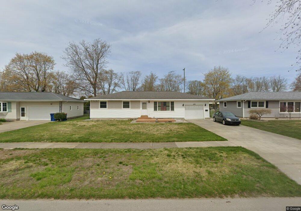
1476 W Summit Ave Muskegon, MI 49441
Roosevelt Park NeighborhoodEstimated Value: $211,796 - $230,000
2
Beds
1
Bath
1,092
Sq Ft
$203/Sq Ft
Est. Value
About This Home
This home is located at 1476 W Summit Ave, Muskegon, MI 49441 and is currently estimated at $221,199, approximately $202 per square foot. 1476 W Summit Ave is a home located in Muskegon County with nearby schools including Mona Shores High School, West Shore Lutheran School, and St. Francis De Sales Elementary School.
Ownership History
Date
Name
Owned For
Owner Type
Purchase Details
Closed on
May 9, 2013
Sold by
Hilliard Gary Merle
Bought by
Hilliard Gary M and Gary M Hilliard Trust
Current Estimated Value
Purchase Details
Closed on
Dec 12, 2011
Sold by
Hilliard Gary Merle and Andersen Lorie A
Bought by
Hilliard Gary Merle
Home Financials for this Owner
Home Financials are based on the most recent Mortgage that was taken out on this home.
Original Mortgage
$14,000
Interest Rate
4.02%
Mortgage Type
Future Advance Clause Open End Mortgage
Create a Home Valuation Report for This Property
The Home Valuation Report is an in-depth analysis detailing your home's value as well as a comparison with similar homes in the area
Home Values in the Area
Average Home Value in this Area
Purchase History
| Date | Buyer | Sale Price | Title Company |
|---|---|---|---|
| Hilliard Gary M | -- | None Available | |
| Hilliard Gary Merle | -- | None Available |
Source: Public Records
Mortgage History
| Date | Status | Borrower | Loan Amount |
|---|---|---|---|
| Closed | Hilliard Gary Merle | $14,000 |
Source: Public Records
Tax History Compared to Growth
Tax History
| Year | Tax Paid | Tax Assessment Tax Assessment Total Assessment is a certain percentage of the fair market value that is determined by local assessors to be the total taxable value of land and additions on the property. | Land | Improvement |
|---|---|---|---|---|
| 2025 | $2,125 | $89,700 | $0 | $0 |
| 2024 | $815 | $80,200 | $0 | $0 |
| 2023 | $780 | $71,800 | $0 | $0 |
| 2022 | $1,937 | $62,200 | $0 | $0 |
| 2021 | $1,845 | $57,100 | $0 | $0 |
| 2020 | $1,824 | $52,500 | $0 | $0 |
| 2019 | $1,790 | $50,700 | $0 | $0 |
| 2018 | $1,748 | $45,100 | $0 | $0 |
| 2017 | $1,708 | $45,300 | $0 | $0 |
| 2016 | $649 | $39,900 | $0 | $0 |
| 2015 | -- | $34,300 | $0 | $0 |
| 2014 | -- | $38,400 | $0 | $0 |
| 2013 | -- | $36,000 | $0 | $0 |
Source: Public Records
Map
Nearby Homes
- 1521 Cornell Rd
- 1377 Princeton Rd
- 2881 Cornell Ct
- 1582 Haverhill Rd
- 1480 Marlboro Rd
- 1448 Marlboro Rd
- 1689 Bonneville Dr
- 1752 Bonneville Dr
- 3246 Royal Oak Rd
- 1564 Montague Ave
- 2552 Wickham Dr
- 1405 Winchester Dr
- 1733 Woodside Rd
- 1059 W Summit Ave
- 1705 Montague Ave
- 1543 Randolph Ave
- 1729 Winchester Dr
- 3320 Davis Rd
- 1408 Lexington Ave
- 1744 W Norton Ave
- 1468 W Summit Ave
- 1466 W Summit Ave
- 1488 W Summit Ave
- 1475 Cornell Rd
- 1465 Cornell Rd
- 1487 Cornell Rd
- 1498 W Summit Ave
- 1475 W Summit Ave
- 1456 W Summit Ave
- 1487 W Summit Ave
- 1497 Cornell Rd
- 1465 W Summit Ave
- 1491 W Summit Ave
- 1497 W Summit Ave
- 1455 Cornell Rd
- 1510 W Summit Ave
- 1455 W Summit Ave
- 1446 W Summit Ave
- 1509 Cornell Rd
- 1445 Cornell Rd