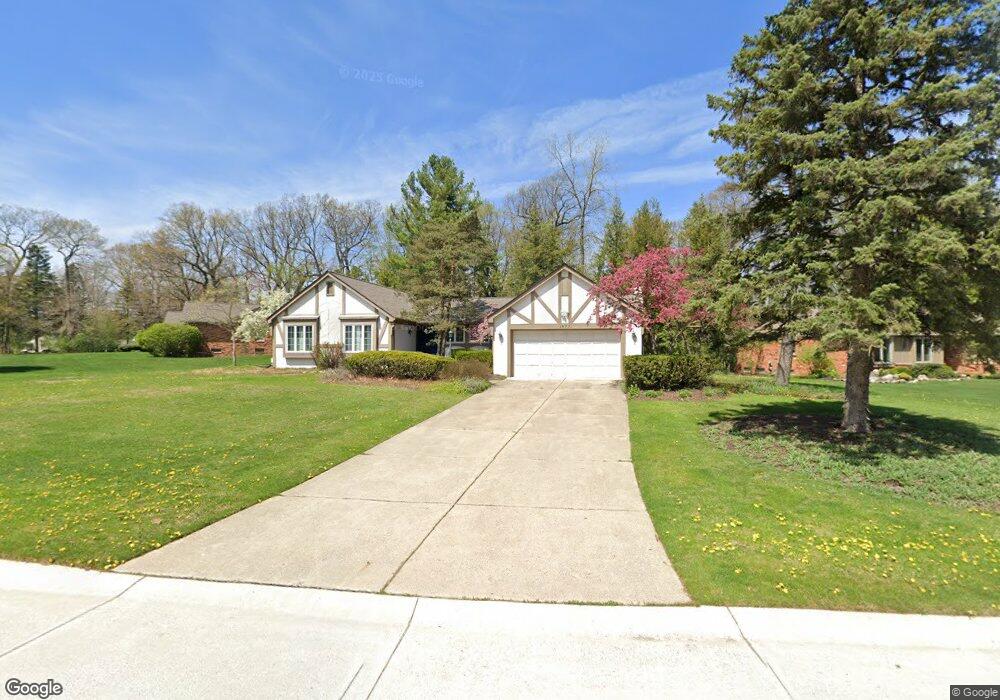
1477 Ashover Dr Unit Bldg-Unit Bloomfield Hills, MI 48304
Estimated Value: $454,000 - $471,000
3
Beds
4
Baths
1,969
Sq Ft
$235/Sq Ft
Est. Value
About This Home
This home is located at 1477 Ashover Dr Unit Bldg-Unit, Bloomfield Hills, MI 48304 and is currently estimated at $462,607, approximately $234 per square foot. 1477 Ashover Dr Unit Bldg-Unit is a home located in Oakland County with nearby schools including R. Grant Graham Elementary School, Avondale Middle School, and Avondale High School.
Ownership History
Date
Name
Owned For
Owner Type
Purchase Details
Closed on
Oct 17, 2025
Sold by
Morouse Michelle E
Bought by
Mcclelland Joseph D
Current Estimated Value
Purchase Details
Closed on
Jan 30, 2025
Sold by
Morouse Michelle E
Bought by
Morouse Michelle E and Michelle E Morouse Living Trust
Purchase Details
Closed on
Feb 9, 2018
Sold by
Varkie Richard P and Varkie Mellanie S
Bought by
Morouse Michelle E
Create a Home Valuation Report for This Property
The Home Valuation Report is an in-depth analysis detailing your home's value as well as a comparison with similar homes in the area
Home Values in the Area
Average Home Value in this Area
Purchase History
| Date | Buyer | Sale Price | Title Company |
|---|---|---|---|
| Mcclelland Joseph D | $450,000 | None Listed On Document | |
| Morouse Michelle E | -- | None Listed On Document | |
| Morouse Michelle E | -- | None Listed On Document | |
| Morouse Michelle E | $315,000 | Metro Hills Title Agency Llc |
Source: Public Records
Tax History Compared to Growth
Tax History
| Year | Tax Paid | Tax Assessment Tax Assessment Total Assessment is a certain percentage of the fair market value that is determined by local assessors to be the total taxable value of land and additions on the property. | Land | Improvement |
|---|---|---|---|---|
| 2024 | $3,766 | $225,560 | $0 | $0 |
| 2023 | $3,593 | $205,020 | $0 | $0 |
| 2022 | $6,694 | $183,230 | $0 | $0 |
| 2021 | $6,565 | $181,430 | $0 | $0 |
| 2020 | $3,309 | $177,390 | $0 | $0 |
| 2019 | $6,609 | $172,570 | $0 | $0 |
| 2018 | $4,170 | $159,290 | $0 | $0 |
| 2017 | $4,106 | $155,550 | $0 | $0 |
| 2016 | $4,100 | $153,620 | $0 | $0 |
| 2015 | -- | $135,160 | $0 | $0 |
| 2014 | -- | $125,080 | $0 | $0 |
| 2011 | -- | $99,630 | $0 | $0 |
Source: Public Records
Map
Nearby Homes
- 1470 Timberview Trail
- 1339 Knollcrest Cir
- 1204 S Timberview Trail Unit E 23
- 1289 Greenglen Ct
- 1285 Greenglen Ct
- 6965 N Adams Rd
- 1299 Winchcombe Dr
- 1105 Ivyglen Cir
- 6950 Killarney Dr
- 1926 Hickory Bark Ln
- 1916 Squirrel Valley Dr
- 624 Slocum Dr
- 6678 Johnathon Dr
- 3072 Henrydale St
- 3221 Bessie St
- 3164 Bessie St
- 3443 Nichols Rd
- 1717 Brandywine Dr
- 3077 Claret Ln
- 3397 Eastwood Dr
- 1499 Ashover Dr
- 1433 Ashover Dr
- 1511 Ashover Dr
- 1707 Ledbury Dr
- 1725 Ledbury Dr
- 1484 Ashover Dr
- 1496 Ashover Dr
- 1472 Ashover Dr
- 1523 Ashover Dr
- 1691 Ledbury Dr
- 1424 Ashover Dr
- 1436 Ashover Dr
- 1460 Ashover Dr
- 1448 Ashover Dr
- 1538 Ashover Cir
- 1571 Ashover Dr
- 1675 Ledbury Dr
- 1690 Ledbury Dr
- 1389 Ashover Dr
- 1546 Ashover Cir