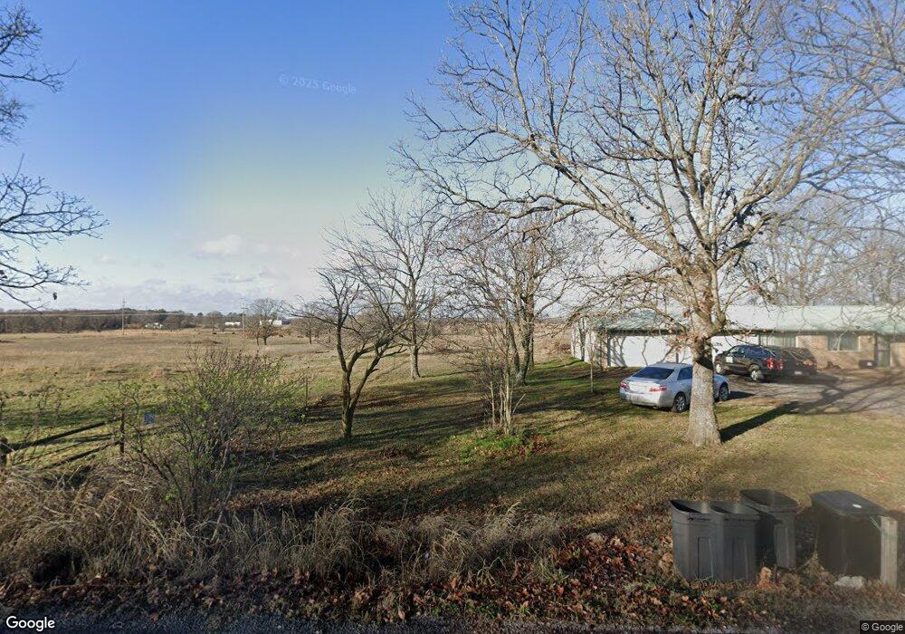
14771 N 520 Rd Tahlequah, OK 74464
Estimated Value: $202,000 - $294,000
3
Beds
2
Baths
1,629
Sq Ft
$152/Sq Ft
Est. Value
About This Home
This home is located at 14771 N 520 Rd, Tahlequah, OK 74464 and is currently estimated at $247,995, approximately $152 per square foot. 14771 N 520 Rd is a home located in Cherokee County with nearby schools including Cherokee Elementary School, Greenwood Elementary School, and Tahlequah Middle School.
Ownership History
Date
Name
Owned For
Owner Type
Purchase Details
Closed on
Oct 31, 2005
Sold by
Wren Justin K and Wren Monica
Bought by
Saxon Regina D
Current Estimated Value
Home Financials for this Owner
Home Financials are based on the most recent Mortgage that was taken out on this home.
Original Mortgage
$148,397
Interest Rate
5.75%
Mortgage Type
New Conventional
Purchase Details
Closed on
Aug 10, 2004
Sold by
Alexander J and Alexander Kearns K
Bought by
Justin and Monica Wren
Create a Home Valuation Report for This Property
The Home Valuation Report is an in-depth analysis detailing your home's value as well as a comparison with similar homes in the area
Home Values in the Area
Average Home Value in this Area
Purchase History
| Date | Buyer | Sale Price | Title Company |
|---|---|---|---|
| Saxon Regina D | $145,000 | None Available | |
| Justin | $125,500 | -- |
Source: Public Records
Mortgage History
| Date | Status | Borrower | Loan Amount |
|---|---|---|---|
| Closed | Saxon Regina D | $148,397 |
Source: Public Records
Tax History Compared to Growth
Tax History
| Year | Tax Paid | Tax Assessment Tax Assessment Total Assessment is a certain percentage of the fair market value that is determined by local assessors to be the total taxable value of land and additions on the property. | Land | Improvement |
|---|---|---|---|---|
| 2025 | $1,554 | $19,336 | $1,540 | $17,796 |
| 2024 | $1,554 | $19,714 | $1,540 | $18,174 |
| 2023 | $1,554 | $20,131 | $3,168 | $16,963 |
| 2022 | $1,358 | $20,131 | $3,168 | $16,963 |
| 2021 | $1,342 | $19,916 | $3,129 | $16,787 |
| 2020 | $1,301 | $19,336 | $3,024 | $16,312 |
| 2019 | $1,378 | $18,773 | $2,921 | $15,852 |
| 2018 | $1,336 | $18,119 | $2,822 | $15,297 |
| 2017 | $1,303 | $17,592 | $2,727 | $14,865 |
| 2016 | $1,271 | $17,080 | $2,686 | $14,394 |
| 2015 | $1,313 | $16,582 | $1,540 | $15,042 |
| 2014 | $1,313 | $17,669 | $1,586 | $16,083 |
Source: Public Records
Map
Nearby Homes
- 100 Career Tech
- 540 N Moccasin
- 501 Airport
- 401 Airport
- 520 N Moccasin
- 951 Main
- 500 N Moccasin
- TBD Blk 1 Lot 7 E Stelly Hollow Rd
- 100 Main
- 331 Main
- 900 Airport
- 601 Airport
- 221 Main
- 600 N Moccasin
- 200 Main
- TBD Blk 1 Lot 3 Stelly Hollow Rd
- 441 Main
- 149 W Oak Hill Cir
- 2315 N Grand Ave
- 20819 E Steely Hollow Rd
- 14798 N 520 Rd
- 14780 N 520 Rd
- 0 Woodsman Cir Unit 1629061
- 0 Woodsman Cir Unit 1629059
- 0 Woodsman Cir Unit 1629056
- 0 Woodsman Cir Unit 1629066
- 000 W Fox
- 212 W Arden
- 700 N Moccasin
- 111 Main
- 800 N Woodard
- 1001 Main
- 1051 W Allen
- 1061 W Allen
- 1090 Wilcox
- 1071 W Allen
- 15233 N 520
- 1020 N Heritage
- 1016 N Heritage
- 16101 W Bryant