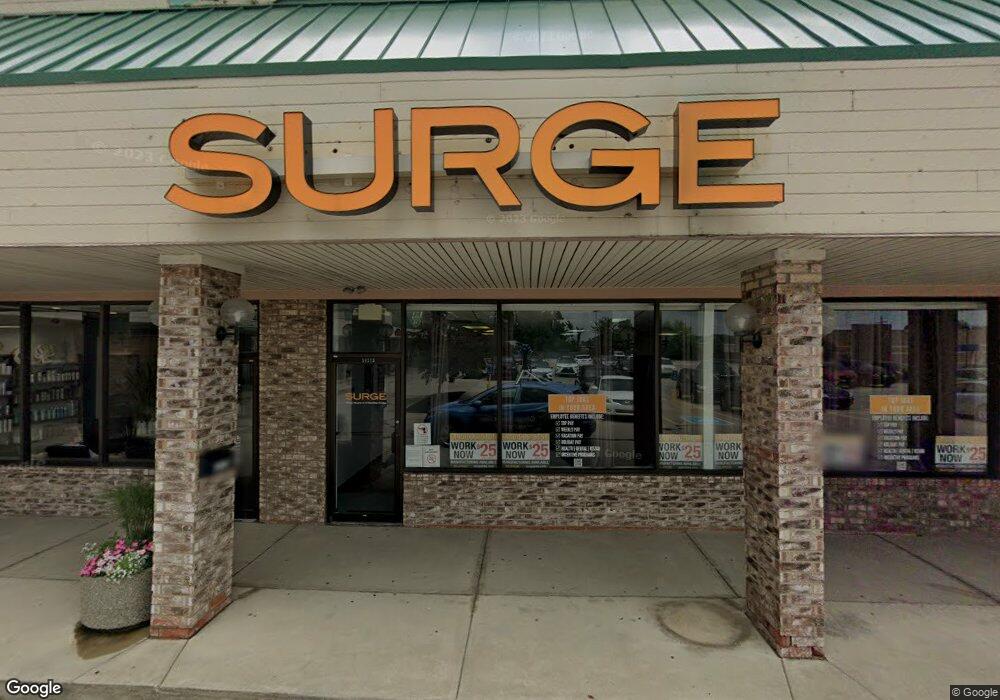
14773 Pearl Rd Strongsville, OH 44136
--
Bed
--
Bath
2,000
Sq Ft
5.86
Acres
About This Home
This home is located at 14773 Pearl Rd, Strongsville, OH 44136. 14773 Pearl Rd is a home located in Cuyahoga County with nearby schools including Strongsville High School, Strongsville Academy, and Sts Joseph & John Interparochial School.
Ownership History
Date
Name
Owned For
Owner Type
Purchase Details
Closed on
Jul 3, 2007
Sold by
K & F Property Strongsville Llc
Bought by
Rite Aid Of Ohio Inc
Purchase Details
Closed on
Dec 7, 2005
Sold by
K & F Partnership
Bought by
K & F Property Strongsville Llc
Home Financials for this Owner
Home Financials are based on the most recent Mortgage that was taken out on this home.
Original Mortgage
$7,000,000
Interest Rate
6.2%
Mortgage Type
Purchase Money Mortgage
Purchase Details
Closed on
Sep 29, 2003
Sold by
Strongsville Plaza Corp
Bought by
K & F Partnership
Home Financials for this Owner
Home Financials are based on the most recent Mortgage that was taken out on this home.
Original Mortgage
$5,660,000
Interest Rate
6.4%
Mortgage Type
Purchase Money Mortgage
Purchase Details
Closed on
Jan 1, 1990
Bought by
Strongsville Plaza Corp
Create a Home Valuation Report for This Property
The Home Valuation Report is an in-depth analysis detailing your home's value as well as a comparison with similar homes in the area
Home Values in the Area
Average Home Value in this Area
Purchase History
| Date | Buyer | Sale Price | Title Company |
|---|---|---|---|
| Rite Aid Of Ohio Inc | $425,000 | Continental Title Agency | |
| K & F Property Strongsville Llc | -- | -- | |
| K & F Partnership | $6,470,000 | General Title Agency Inc | |
| Strongsville Plaza Corp | -- | -- |
Source: Public Records
Mortgage History
| Date | Status | Borrower | Loan Amount |
|---|---|---|---|
| Previous Owner | K & F Property Strongsville Llc | $7,000,000 | |
| Previous Owner | K & F Partnership | $5,660,000 |
Source: Public Records
Tax History Compared to Growth
Tax History
| Year | Tax Paid | Tax Assessment Tax Assessment Total Assessment is a certain percentage of the fair market value that is determined by local assessors to be the total taxable value of land and additions on the property. | Land | Improvement |
|---|---|---|---|---|
| 2024 | $134,033 | $1,867,460 | $625,835 | $1,241,625 |
| 2023 | $144,844 | $1,772,750 | $670,530 | $1,102,220 |
| 2022 | $144,473 | $1,772,750 | $670,530 | $1,102,220 |
| 2021 | $145,322 | $1,772,750 | $670,530 | $1,102,220 |
| 2020 | $149,691 | $1,772,750 | $670,530 | $1,102,220 |
| 2019 | $145,424 | $5,065,000 | $1,915,800 | $3,149,200 |
| 2018 | $121,257 | $1,772,750 | $670,530 | $1,102,220 |
| 2017 | $126,857 | $1,592,650 | $550,730 | $1,041,920 |
| 2016 | $126,135 | $1,409,110 | $550,730 | $858,380 |
| 2015 | $124,087 | $1,409,110 | $550,730 | $858,380 |
| 2014 | $124,087 | $1,601,260 | $625,840 | $975,420 |
Source: Public Records
Map
Nearby Homes
- 18630 Shurmer Rd
- 19160 Wheelers Ln
- 19513 Lunn Rd
- 18162 Fawn Cir
- 19620 Porters Ln Unit 15F
- 14112 Settlers Way
- 17069 Partridge Dr
- 20078 Trapper Trail
- 19311 Bradford Ct
- 19297 Lauren Way
- 13156 Olympus Way
- 13099 Olympus Way
- 17289 Akita Ct Unit 4508
- 15279 Walnut Creek Dr
- 13066 Olympus Way
- 19908 Stoughton Dr
- 13513 Suncrest Ct
- 17259 Woodshire Dr
- 18248 Meadow Ln
- 15017 Regency Dr
- 14741 Pearl Rd
- 15147 Pearl Rd
- 18663 Southporte
- 15044 Wilmington Dr
- 15052 Wilmington Dr
- 18647 Southporte
- 15167 Pearl Rd
- 18631 Southporte
- 15032 Wilmington Dr
- 15066 Wilmington Dr
- 18672 Southporte
- 18615 Southporte
- 15098 Wilmington Dr
- 15000 Wilmington Dr
- 18656 Southporte
- 18599 Southporte
- 18640 Southporte
- 15116 Wilmington Dr
- 18781 Cook Ave
- 18827 Cook Ave
