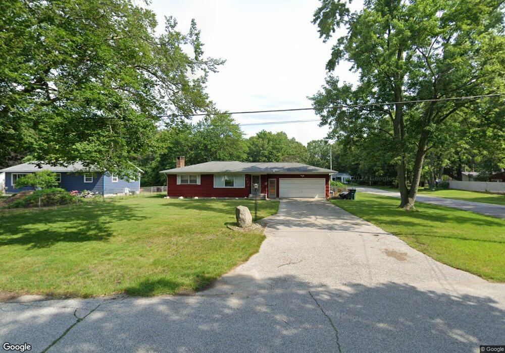
1478 Airport Rd Norton Shores, MI 49444
Estimated Value: $205,000 - $213,343
2
Beds
1
Bath
926
Sq Ft
$225/Sq Ft
Est. Value
About This Home
This home is located at 1478 Airport Rd, Norton Shores, MI 49444 and is currently estimated at $208,586, approximately $225 per square foot. 1478 Airport Rd is a home located in Muskegon County with nearby schools including Mona Shores High School, Edgewood Elementary Academy, and Dr. Martin Luther King Academy.
Ownership History
Date
Name
Owned For
Owner Type
Purchase Details
Closed on
Aug 19, 2024
Sold by
Birch Martin L
Bought by
Birch Martin L and Waldron Ryan A
Current Estimated Value
Purchase Details
Closed on
Jun 23, 2015
Sold by
Hansen Irene D and Hansen Roger Leslie
Bought by
Birch Martin
Home Financials for this Owner
Home Financials are based on the most recent Mortgage that was taken out on this home.
Original Mortgage
$60,800
Interest Rate
3.82%
Mortgage Type
New Conventional
Create a Home Valuation Report for This Property
The Home Valuation Report is an in-depth analysis detailing your home's value as well as a comparison with similar homes in the area
Home Values in the Area
Average Home Value in this Area
Purchase History
| Date | Buyer | Sale Price | Title Company |
|---|---|---|---|
| Birch Martin L | -- | None Listed On Document | |
| Birch Martin | $76,000 | Safe Title Inc |
Source: Public Records
Mortgage History
| Date | Status | Borrower | Loan Amount |
|---|---|---|---|
| Previous Owner | Birch Martin | $60,800 |
Source: Public Records
Tax History Compared to Growth
Tax History
| Year | Tax Paid | Tax Assessment Tax Assessment Total Assessment is a certain percentage of the fair market value that is determined by local assessors to be the total taxable value of land and additions on the property. | Land | Improvement |
|---|---|---|---|---|
| 2025 | $1,973 | $84,800 | $0 | $0 |
| 2024 | $1,546 | $77,500 | $0 | $0 |
| 2023 | $1,477 | $69,100 | $0 | $0 |
| 2022 | $1,800 | $58,800 | $0 | $0 |
| 2021 | $1,749 | $53,600 | $0 | $0 |
| 2020 | $1,730 | $49,400 | $0 | $0 |
| 2019 | $1,698 | $45,400 | $0 | $0 |
| 2018 | $1,658 | $42,300 | $0 | $0 |
| 2017 | $1,620 | $42,100 | $0 | $0 |
| 2016 | $1,254 | $39,400 | $0 | $0 |
| 2015 | -- | $37,000 | $0 | $0 |
| 2014 | $1,368 | $37,200 | $0 | $0 |
| 2013 | -- | $36,300 | $0 | $0 |
Source: Public Records
Map
Nearby Homes
- 1454 Airport Rd
- 4060 Buck St
- V/L 4535 Thompson Rd
- 1201 Shettler Rd
- 1130 Englewood Ave
- 3835 Molly Blvd
- 1068 Englewood Ave
- 4535 Thompson Rd
- 4468 Spruce Ct
- 3835 Ellen St
- 4476 Cedar Ln Unit 54
- 4677 Harvey St
- 1067 Aspen Dr
- 1065 Wilson Ct
- 4769 Harvey St
- 945 Petrie Ave
- 4638 Lauren Dr
- 1404 E Ellis Rd
- 4102 Highgate Rd
- 4563 Keener St
- 1466 Airport Rd
- 4165 Sandybrook Ct
- 1504 Airport Rd
- 1469 Airport Rd
- 1477 Airport Rd
- 1489 Airport Rd
- 1435 Airport Rd
- 4146 Sandybrook Ct
- 1430 Airport Rd
- 1509 Airport Rd
- 1520 Airport Rd
- 4230 Orchard Rd
- 1416 Airport Rd
- 4155 Eastlake Rd
- 1519 Airport Rd
- 4169 Eastlake Rd
- 4209 Orchard Rd
- 4268 Orchard Rd
- 4235 Eastlake Rd
- 1408 Airport Rd