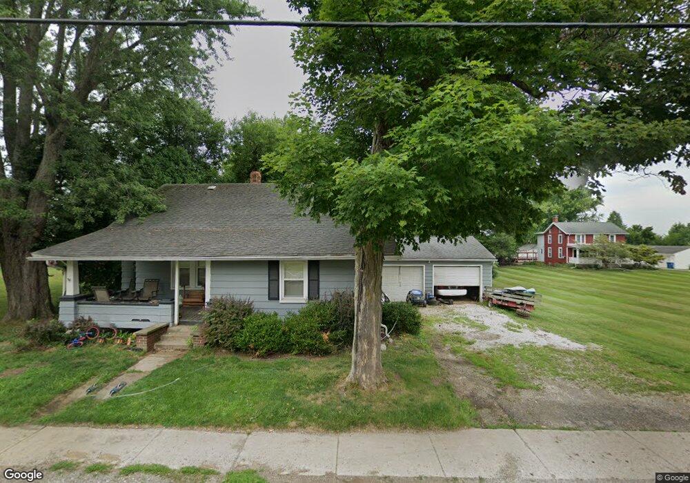
14780 S Pricetown Rd Damascus, OH 44619
Estimated Value: $107,000 - $212,000
2
Beds
1
Bath
1,204
Sq Ft
$115/Sq Ft
Est. Value
About This Home
This home is located at 14780 S Pricetown Rd, Damascus, OH 44619 and is currently estimated at $139,052, approximately $115 per square foot. 14780 S Pricetown Rd is a home located in Mahoning County with nearby schools including West Branch Middle School and West Branch High School.
Ownership History
Date
Name
Owned For
Owner Type
Purchase Details
Closed on
Apr 14, 2022
Sold by
Polinori Erica
Bought by
Polinori Ricky
Current Estimated Value
Purchase Details
Closed on
Sep 18, 1972
Bought by
Frantz Kathleen T
Create a Home Valuation Report for This Property
The Home Valuation Report is an in-depth analysis detailing your home's value as well as a comparison with similar homes in the area
Home Values in the Area
Average Home Value in this Area
Purchase History
| Date | Buyer | Sale Price | Title Company |
|---|---|---|---|
| Polinori Ricky | -- | None Listed On Document | |
| Polinori Ricky | -- | None Listed On Document | |
| Frantz Kathleen T | -- | -- |
Source: Public Records
Tax History Compared to Growth
Tax History
| Year | Tax Paid | Tax Assessment Tax Assessment Total Assessment is a certain percentage of the fair market value that is determined by local assessors to be the total taxable value of land and additions on the property. | Land | Improvement |
|---|---|---|---|---|
| 2024 | $1,137 | $28,190 | $3,400 | $24,790 |
| 2023 | $1,079 | $28,190 | $3,400 | $24,790 |
| 2022 | $931 | $20,610 | $2,780 | $17,830 |
| 2021 | $905 | $20,610 | $2,780 | $17,830 |
| 2020 | $909 | $20,610 | $2,780 | $17,830 |
| 2019 | $853 | $17,760 | $2,780 | $14,980 |
| 2018 | $850 | $17,760 | $2,780 | $14,980 |
| 2017 | $837 | $17,760 | $2,780 | $14,980 |
| 2016 | $847 | $18,210 | $2,780 | $15,430 |
| 2015 | $824 | $18,210 | $2,780 | $15,430 |
| 2014 | $829 | $18,210 | $2,780 | $15,430 |
| 2013 | $826 | $18,210 | $2,780 | $15,430 |
Source: Public Records
Map
Nearby Homes
- 14930 S Pricetown Rd
- 14831 Smith Goshen Rd
- 14980 Salem Alliance Rd
- 28339 Misty Morning Ln
- 29979 Salem-Alliance Rd
- 30051 Sr 62
- 17394 State Route 62
- 27443 State Route 62
- 35 Bayview Dr
- 17880 State Route 62
- 1497 Lake Front Dr
- 1511 Lake Front Dr
- 1445 Georgetown Damascus Rd
- 18061 Derr Ave
- 29655 Buck Rd
- 26223 Wildwood Dr
- 27696 Buck Rd
- 14609 S Duck Creek Rd
- 31085 Georgetown Rd
- 18 Boxwood Dr
- 14762 S Pricetown Rd
- 14798 S Pricetown Rd
- 14818 S Pricetown Rd
- 14738 S Pricetown Rd
- 15962 4th St
- 14724 S Pricetown Rd
- 14789 S Pricetown Rd
- 14801 S Pricetown Rd
- 14765 S Pricetown Rd
- 14825 S Pricetown Rd
- 14840 S Pricetown Rd
- 14743 S Pricetown Rd
- 14854 S Pricetown Rd
- 530 Georgetown Damascus Rd
- 14844 S Pricetown Rd
- 14706 S Pricetown Rd
- 14815 S Pricetown Rd
- 14717 S Pricetown Rd
- 15962 4th St
- 15351 3rd St