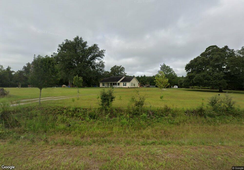
14786 Ten Mile Rd Surrency, GA 31563
Estimated Value: $198,000 - $267,492
3
Beds
2
Baths
1,824
Sq Ft
$129/Sq Ft
Est. Value
About This Home
This home is located at 14786 Ten Mile Rd, Surrency, GA 31563 and is currently estimated at $235,873, approximately $129 per square foot. 14786 Ten Mile Rd is a home.
Ownership History
Date
Name
Owned For
Owner Type
Purchase Details
Closed on
Nov 6, 2018
Sold by
Eason Louis
Bought by
Davis Markus
Current Estimated Value
Purchase Details
Closed on
Mar 9, 2012
Sold by
Edwards Olvid C
Bought by
Davis Markus
Purchase Details
Closed on
Apr 4, 2005
Sold by
Eason Joann
Bought by
Eason Miranda Patricia
Purchase Details
Closed on
Mar 19, 1999
Bought by
Edwards Olvid C and Edwards Judy
Purchase Details
Closed on
Mar 18, 1999
Sold by
Floyd E Randall
Bought by
Edwards Olvid C and Edwards Judy
Purchase Details
Closed on
Jun 19, 1998
Bought by
Eason Joann
Create a Home Valuation Report for This Property
The Home Valuation Report is an in-depth analysis detailing your home's value as well as a comparison with similar homes in the area
Purchase History
| Date | Buyer | Sale Price | Title Company |
|---|---|---|---|
| Davis Markus | $6,000 | -- | |
| Davis Markus | $157,000 | -- | |
| Eason Miranda Patricia | -- | -- | |
| Edwards Olvid C | $35,000 | -- | |
| Edwards Olvid C | $35,000 | -- | |
| Eason Joann | $2,000 | -- |
Source: Public Records
Tax History
| Year | Tax Paid | Tax Assessment Tax Assessment Total Assessment is a certain percentage of the fair market value that is determined by local assessors to be the total taxable value of land and additions on the property. | Land | Improvement |
|---|---|---|---|---|
| 2025 | $1,404 | $84,160 | $18,120 | $66,040 |
| 2024 | $1,404 | $60,320 | $10,960 | $49,360 |
| 2023 | $1,333 | $60,359 | $10,999 | $49,360 |
| 2022 | $1,314 | $56,929 | $10,999 | $45,930 |
| 2021 | $1,313 | $56,929 | $10,999 | $45,930 |
| 2020 | $1,367 | $56,929 | $10,999 | $45,930 |
| 2019 | $1,396 | $56,929 | $10,999 | $45,930 |
| 2018 | $1,346 | $54,163 | $9,120 | $45,043 |
| 2017 | $1,346 | $54,163 | $9,120 | $45,043 |
| 2016 | $1,346 | $54,163 | $9,120 | $45,043 |
| 2015 | $1,348 | $54,163 | $9,120 | $45,043 |
| 2014 | $1,478 | $52,877 | $7,834 | $45,043 |
| 2013 | -- | $54,315 | $7,395 | $46,920 |
Source: Public Records
Map
Nearby Homes
- 286 Carter Bight Landing Rd
- 0 Lee Woods Rd Unit 18062646
- 2286 Carter Bight Landing Rd
- 315 Getaway Ln
- 0 Lee Woods Rd Unit 11355226
- 163 High Bluff Rd
- Rivers Edge Rd Hwy 178
- 0 Georgia 121
- 4102 Ga State 178 Hwy
- 96 Annie Holt Rd
- 965 Oquinn Loop
- 0 O'Quinn Loop
- 0 Oquinn Loop
- 4985 Georgia 169
- 5041 Georgia 169
- 0 Robert Chapel Cemetery Rd Unit 10519584
- 468 Half Moon Lake Rd
- Rd
- Tract 4 Brentwood Rd
- Tbd Baxter Durrence Rd
- 14638 10 Mile Rd
- 14638 Ten Mile Rd
- 14640 Ten Mile Rd
- 302 Curtis Tillman Rd
- 14632 10 Mile Rd
- 470 Curtis Tillman Rd
- 14495 Ten Mile Rd
- 14630 Ten Mile Rd
- 15023 Ten Mile Rd
- 15110 Ten Mile Rd
- 15101 Ten Mile Rd
- 6363 Fire Tower Rd
- 6545 Fire Tower Rd
- 289 Hershel Tillman Rd
- 6176 Fire Tower Rd
- 355 Hershel Tillman Rd
- 6376 Fire Tower Rd
- 414 Hershel Tillman Rd
- 359 Cabin Trail
Your Personal Tour Guide
Ask me questions while you tour the home.