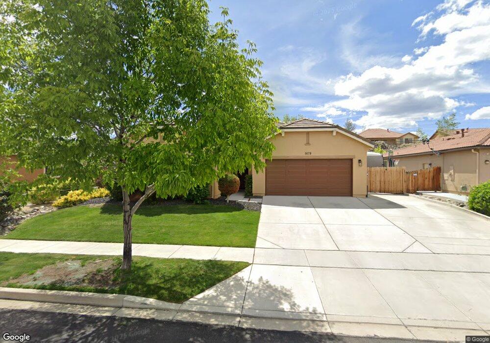
1479 Bluewood Dr Reno, NV 89523
Mae Anne Avenue NeighborhoodEstimated Value: $619,140 - $668,000
3
Beds
2
Baths
1,747
Sq Ft
$365/Sq Ft
Est. Value
About This Home
This home is located at 1479 Bluewood Dr, Reno, NV 89523 and is currently estimated at $638,285, approximately $365 per square foot. 1479 Bluewood Dr is a home with nearby schools including Sarah Winnemucca Elementary School, B D Billinghurst Middle School, and Robert McQueen High School.
Ownership History
Date
Name
Owned For
Owner Type
Purchase Details
Closed on
Jun 27, 2013
Sold by
Estancia Reno Llc
Bought by
Claman Justin Brady and Claman Lachelle Marlyse
Current Estimated Value
Home Financials for this Owner
Home Financials are based on the most recent Mortgage that was taken out on this home.
Original Mortgage
$260,864
Outstanding Balance
$188,326
Interest Rate
3.98%
Mortgage Type
VA
Estimated Equity
$449,959
Purchase Details
Closed on
Oct 8, 2009
Sold by
Estancia West Llc
Bought by
Estancia Reno Llc
Create a Home Valuation Report for This Property
The Home Valuation Report is an in-depth analysis detailing your home's value as well as a comparison with similar homes in the area
Home Values in the Area
Average Home Value in this Area
Purchase History
| Date | Buyer | Sale Price | Title Company |
|---|---|---|---|
| Claman Justin Brady | $255,500 | First American Title Sparks | |
| Estancia Reno Llc | -- | First Amer Title Howard Hugh | |
| Estancia West Llc | -- | First Amer Title Howard Hugh |
Source: Public Records
Mortgage History
| Date | Status | Borrower | Loan Amount |
|---|---|---|---|
| Open | Claman Justin Brady | $260,864 |
Source: Public Records
Tax History Compared to Growth
Tax History
| Year | Tax Paid | Tax Assessment Tax Assessment Total Assessment is a certain percentage of the fair market value that is determined by local assessors to be the total taxable value of land and additions on the property. | Land | Improvement |
|---|---|---|---|---|
| 2026 | $3,056 | $141,065 | $43,155 | $97,910 |
| 2025 | $3,875 | $140,182 | $41,090 | $99,092 |
| 2024 | $3,763 | $133,079 | $37,345 | $95,734 |
| 2023 | $3,763 | $130,300 | $40,010 | $90,290 |
| 2022 | $3,654 | $107,657 | $32,795 | $74,862 |
| 2021 | $3,549 | $107,128 | $32,795 | $74,333 |
| 2020 | $3,443 | $105,814 | $31,640 | $74,174 |
| 2019 | $3,343 | $102,118 | $31,360 | $70,758 |
| 2018 | $3,245 | $91,695 | $22,820 | $68,875 |
| 2017 | $3,150 | $89,136 | $20,440 | $68,696 |
| 2016 | $3,071 | $89,014 | $19,040 | $69,974 |
| 2015 | $3,064 | $86,265 | $16,870 | $69,395 |
| 2014 | $2,974 | $82,343 | $15,680 | $66,663 |
| 2013 | -- | $73,494 | $8,106 | $65,388 |
Source: Public Records
Map
Nearby Homes
- 1705 Sierra Highlands Dr
- 0 Simons Dr
- 1500 Backer Way
- 3271 Heights Dr
- 5857 Morgan Horse St
- 5870 Blue Horizon Dr
- Walker Plan at Monarch
- Humboldt Plan at Monarch
- 5861 Morgan Horse St
- 5882 Grand Row Way
- 1630 Icelandic Way
- 1634 Icelandic Way
- 1638 Icelandic Way
- 3295 Sandra Dr
- 1625 Icelandic Way
- 3264 Barbara Cir
- 5540 Daybreak Dr
- 0000 Mccarran
- 5455 Montego Ct
- 5722 Golden Eagle Dr
- 1473 Bluewood Dr
- 1485 Bluewood Dr
- 1467 Bluewood Dr
- 1491 Bluewood Dr
- 1486 Bluewood Dr
- 1480 Bluewood Dr
- 1466 Hogadon Way
- 1460 Hogadon Way
- 1474 Bluewood Dr
- 1472 Hogadon Way
- 1454 Hogadon Way
- 1461 Bluewood Dr
- 1497 Bluewood Dr
- 1492 Bluewood Dr
- 1478 Hogadon Way
- 1468 Bluewood Dr
- 1498 Bluewood Dr
- 1448 Hogadon Way
- 1484 Hogadon Way
- 1462 Bluewood Dr