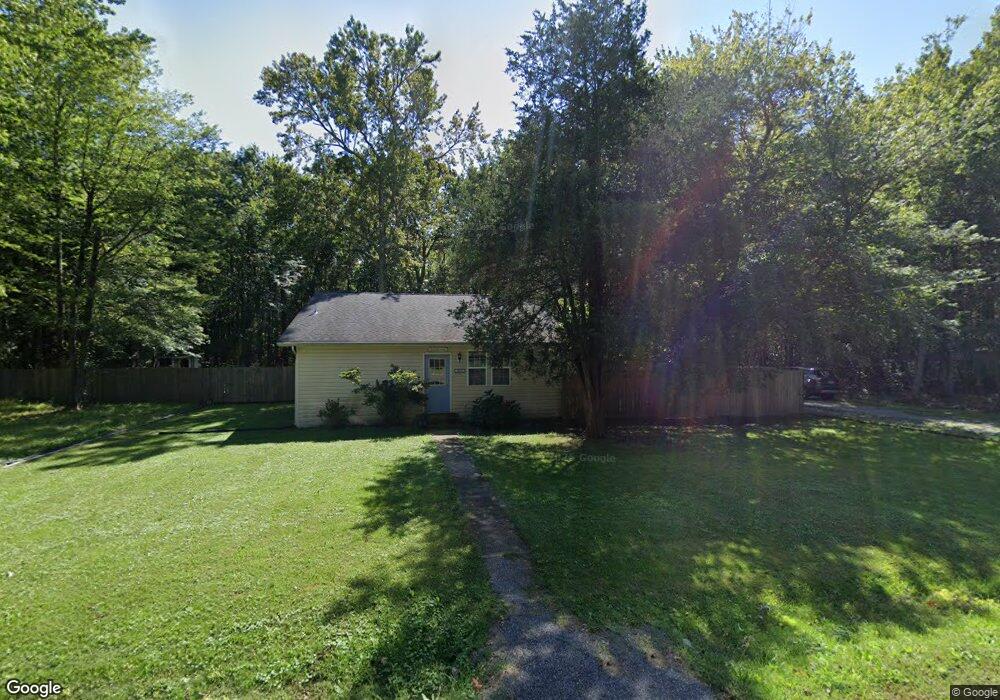
1479 Cedarhurst Rd Shady Side, MD 20764
Estimated Value: $317,000 - $398,000
3
Beds
2
Baths
1,394
Sq Ft
$262/Sq Ft
Est. Value
About This Home
This home is located at 1479 Cedarhurst Rd, Shady Side, MD 20764 and is currently estimated at $365,340, approximately $262 per square foot. 1479 Cedarhurst Rd is a home located in Anne Arundel County with nearby schools including Shady Side Elementary School, Southern Middle School, and Southern High School.
Ownership History
Date
Name
Owned For
Owner Type
Purchase Details
Closed on
Feb 18, 2017
Sold by
Boarman Edward L
Bought by
Gear Shaleen Renee
Current Estimated Value
Home Financials for this Owner
Home Financials are based on the most recent Mortgage that was taken out on this home.
Original Mortgage
$227,272
Outstanding Balance
$187,749
Interest Rate
4.12%
Mortgage Type
New Conventional
Estimated Equity
$177,591
Purchase Details
Closed on
Nov 20, 1984
Bought by
Boarman Edward L
Create a Home Valuation Report for This Property
The Home Valuation Report is an in-depth analysis detailing your home's value as well as a comparison with similar homes in the area
Home Values in the Area
Average Home Value in this Area
Purchase History
| Date | Buyer | Sale Price | Title Company |
|---|---|---|---|
| Gear Shaleen Renee | $223,000 | Titlemax Llc | |
| Boarman Edward L | $27,000 | -- |
Source: Public Records
Mortgage History
| Date | Status | Borrower | Loan Amount |
|---|---|---|---|
| Open | Gear Shaleen Renee | $227,272 |
Source: Public Records
Tax History
| Year | Tax Paid | Tax Assessment Tax Assessment Total Assessment is a certain percentage of the fair market value that is determined by local assessors to be the total taxable value of land and additions on the property. | Land | Improvement |
|---|---|---|---|---|
| 2025 | $3,194 | $263,833 | -- | -- |
| 2024 | $3,194 | $252,067 | $0 | $0 |
| 2023 | $3,098 | $240,300 | $147,300 | $93,000 |
| 2022 | $2,903 | $237,333 | $0 | $0 |
| 2020 | $2,770 | $231,400 | $147,300 | $84,100 |
| 2019 | $2,724 | $225,667 | $0 | $0 |
| 2018 | $2,230 | $219,933 | $0 | $0 |
| 2017 | $2,566 | $214,200 | $0 | $0 |
| 2016 | -- | $214,200 | $0 | $0 |
| 2015 | -- | $214,200 | $0 | $0 |
| 2014 | -- | $214,800 | $0 | $0 |
Source: Public Records
Map
Nearby Homes
- 1461 Cedarhurst Rd
- 0 Haile Pkwy Unit MDAA2127474
- 1445 & 1447 Haile Pkwy
- 1160 Oak Ave
- 1436 Haile Pkwy
- 1176 Spruce Ave
- 1168 Maple Ave
- 5191 Spring Ave
- 1411 Haile Pkwy
- 1428 Haile Pkwy
- 0 Shady Side Rd Unit MDAA2113156
- 0 Shady Side Rd Unit MDAA2113166
- 1199 Oak Ave
- 1451 Shady Rest Rd
- 1419 Shady Rest Rd
- 5218 Nick Rd
- 4949 Idlewilde Rd
- 1330 Jordan Dr
- 5235 Al Jones Dr
- 5250 Al Jones Dr
- 1481 Cedarhurst Rd
- 1469 Cedarhurst Rd
- 1478 Cedarhurst Rd
- 1480 Cedarhurst Rd
- 1482 Cedarhurst Rd
- 1474 Cedarhurst Rd
- 1470 Cedarhurst Rd
- 1487 Cedarhurst Rd
- 1491 Cedarhurst Rd
- 1502 Cedarhurst Rd
- 1466 Cedarhurst Rd
- 1489 Cedarhurst Rd
- 0 Grove Ave Unit 1008125514
- 0 Grove Ave Unit AA6908859
- 0 Grove Ave Unit 1000130805
- 1500 Cedarhurst Rd
- 1504 Cedarhurst Rd
- 1506 Cedarhurst Rd
- 1486 Cedarhurst Rd
- 1467 Cedarhurst Rd
Your Personal Tour Guide
Ask me questions while you tour the home.