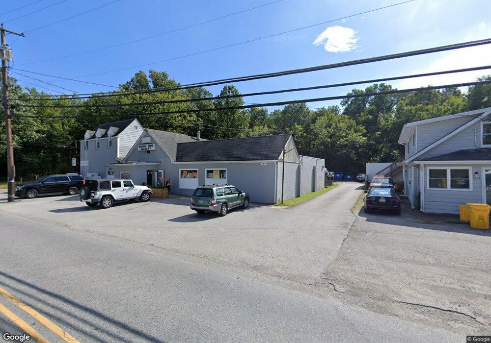
1479 Snug Harbor Rd Shady Side, MD 20764
Estimated Value: $947,000
Studio
--
Bath
7,715
Sq Ft
$123/Sq Ft
Est. Value
About This Home
This home is located at 1479 Snug Harbor Rd, Shady Side, MD 20764 and is currently estimated at $947,000, approximately $122 per square foot. 1479 Snug Harbor Rd is a home located in Anne Arundel County with nearby schools including Shady Side Elementary School, Southern Middle School, and Southern High School.
Ownership History
Date
Name
Owned For
Owner Type
Purchase Details
Closed on
Jun 6, 2023
Sold by
Catterton Catherine Elizabeth Le
Bought by
Catterton Catherine Elizabeth
Current Estimated Value
Purchase Details
Closed on
Feb 19, 2019
Sold by
Catterton Catherine Elizabeth and Estate Of Benjamin V Catterton
Bought by
Catterton Catherine E and Catterton Benjamin V
Purchase Details
Closed on
Aug 16, 1978
Bought by
Catterton Benjamin and Catterton Catherine E
Home Financials for this Owner
Home Financials are based on the most recent Mortgage that was taken out on this home.
Original Mortgage
$250,000
Interest Rate
9.78%
Create a Home Valuation Report for This Property
The Home Valuation Report is an in-depth analysis detailing your home's value as well as a comparison with similar homes in the area
Home Values in the Area
Average Home Value in this Area
Purchase History
| Date | Buyer | Sale Price | Title Company |
|---|---|---|---|
| Catterton Catherine Elizabeth | -- | None Listed On Document | |
| Catterton Catherine E | -- | None Available | |
| Catterton Benjamin | $170,000 | -- |
Source: Public Records
Mortgage History
| Date | Status | Borrower | Loan Amount |
|---|---|---|---|
| Previous Owner | Catterton Benjamin | $250,000 |
Source: Public Records
Tax History
| Year | Tax Paid | Tax Assessment Tax Assessment Total Assessment is a certain percentage of the fair market value that is determined by local assessors to be the total taxable value of land and additions on the property. | Land | Improvement |
|---|---|---|---|---|
| 2025 | $7,197 | $611,000 | $274,600 | $336,400 |
| 2024 | $7,197 | $611,000 | $274,600 | $336,400 |
| 2023 | $7,185 | $613,800 | $274,600 | $339,200 |
| 2022 | $6,739 | $600,900 | $0 | $0 |
| 2020 | $6,476 | $575,100 | $213,000 | $362,100 |
| 2019 | $3,755 | $550,600 | $0 | $0 |
| 2018 | $5,335 | $526,100 | $0 | $0 |
| 2017 | $5,550 | $501,600 | $0 | $0 |
| 2016 | $662 | $465,133 | $0 | $0 |
| 2015 | $662 | $428,700 | $0 | $0 |
| 2014 | -- | $392,200 | $0 | $0 |
Source: Public Records
Map
Nearby Homes
- 1462 Snug Harbor Rd
- 4846 Woods Wharf Rd
- 1451 Shady Rest Rd
- 1419 Shady Rest Rd
- 4949 Idlewilde Rd
- 1302 Spruce St
- 1225 Juniper St
- 1241 Steamboat Rd
- 1330 Jordan Dr
- 1340 E West Shady Side Rd
- 1379 McDonald Rd
- 4908 Aspen St
- 4951 Dogwood St
- 5191 Spring Ave
- 0 Shady Side Rd Unit MDAA2113156
- 0 Shady Side Rd Unit MDAA2113166
- 1650 Cedar Ln
- 1209 Johnson Dr
- 1161 Steamboat Rd
- 1461 Cedarhurst Rd
- 1475 Snug Harbor Rd
- 1474 Snug Harbor Rd
- 1484 Snug Harbor Rd
- 1486 Snug Harbor Rd
- 1467 Snug Harbor Rd
- 1466 Snug Harbor Rd
- 1493 Snug Harbor Rd
- 1463 Snug Harbor Rd
- 1490 Snug Harbor Rd
- 1264 Woods Road A
- 1264 Woods Rd
- 1264 A Woods Wharf Rd
- 1464 Snug Harbor Rd
- 1449 Snug Harbor Rd
- 1459 Snug Harbor Rd
- 4853 Woods Wharf Rd
- 1478 Gross Cir
- 1500 Snug Harbor Rd
- 1480 Snug Harbor Rd
- 1441 Snug Harbor Rd
Your Personal Tour Guide
Ask me questions while you tour the home.