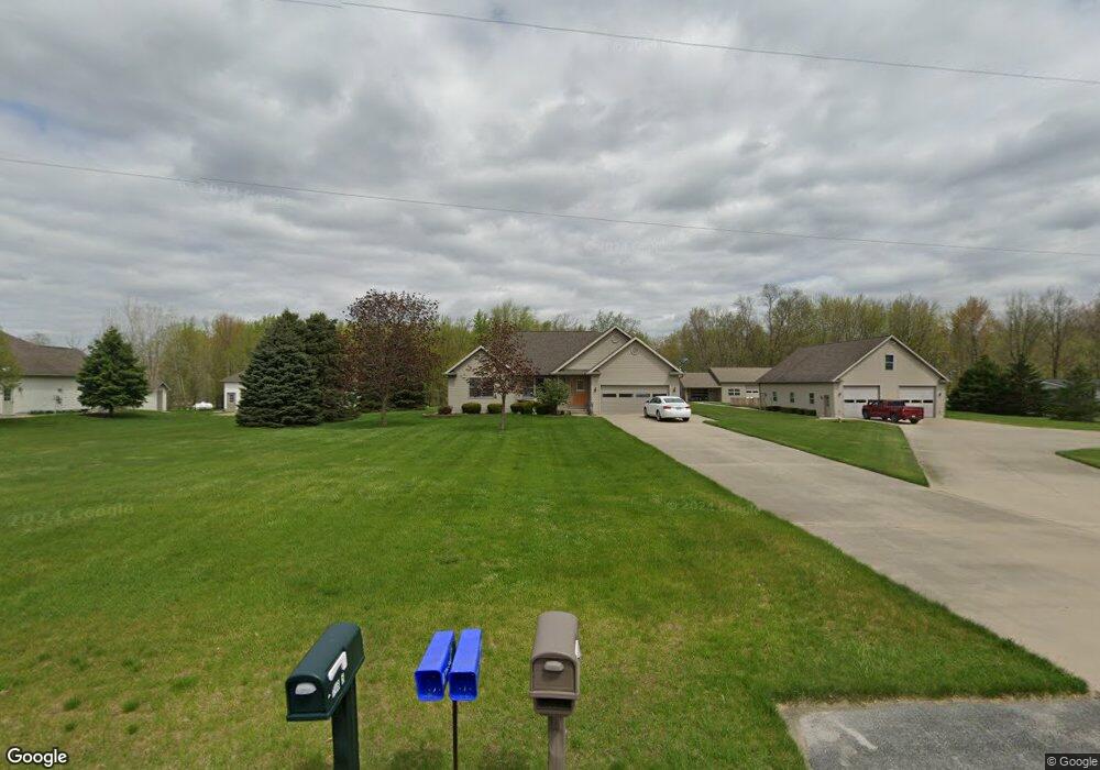
14798 Brant Rd Saint Charles, MI 48655
Estimated Value: $277,000 - $334,000
3
Beds
2
Baths
1,492
Sq Ft
$200/Sq Ft
Est. Value
About This Home
This home is located at 14798 Brant Rd, Saint Charles, MI 48655 and is currently estimated at $297,842, approximately $199 per square foot. 14798 Brant Rd is a home located in Saginaw County with nearby schools including St. Charles Elementary School and St. Charles Community Middle/High School.
Ownership History
Date
Name
Owned For
Owner Type
Purchase Details
Closed on
Apr 26, 2018
Sold by
Rosser Timothy and Rosser Victoria
Bought by
Rosser Timothy A and Rosser Victoria
Current Estimated Value
Purchase Details
Closed on
Aug 6, 2003
Home Financials for this Owner
Home Financials are based on the most recent Mortgage that was taken out on this home.
Original Mortgage
$80,000
Interest Rate
5.8%
Mortgage Type
Purchase Money Mortgage
Purchase Details
Closed on
Nov 13, 2000
Sold by
Urbain Donald J and Urbain Linda M
Bought by
Urbain Donald E and Urbain Kristine K
Home Financials for this Owner
Home Financials are based on the most recent Mortgage that was taken out on this home.
Original Mortgage
$65,000
Interest Rate
7.39%
Mortgage Type
Purchase Money Mortgage
Create a Home Valuation Report for This Property
The Home Valuation Report is an in-depth analysis detailing your home's value as well as a comparison with similar homes in the area
Home Values in the Area
Average Home Value in this Area
Purchase History
| Date | Buyer | Sale Price | Title Company |
|---|---|---|---|
| Rosser Timothy A | -- | -- | |
| -- | $140,000 | -- | |
| Rosser Timothy | $140,000 | Ltic | |
| Urbain Donald E | -- | -- |
Source: Public Records
Mortgage History
| Date | Status | Borrower | Loan Amount |
|---|---|---|---|
| Previous Owner | Rosser Timothy | $80,000 | |
| Previous Owner | Urbain Donald E | $65,000 |
Source: Public Records
Tax History Compared to Growth
Tax History
| Year | Tax Paid | Tax Assessment Tax Assessment Total Assessment is a certain percentage of the fair market value that is determined by local assessors to be the total taxable value of land and additions on the property. | Land | Improvement |
|---|---|---|---|---|
| 2025 | $3,671 | $147,400 | $0 | $0 |
| 2024 | $1,145 | $140,800 | $0 | $0 |
| 2023 | $1,090 | $138,900 | $0 | $0 |
| 2022 | $3,100 | $121,200 | $0 | $0 |
| 2021 | $2,878 | $107,900 | $0 | $0 |
| 2020 | $2,821 | $110,900 | $0 | $0 |
| 2019 | $2,708 | $110,200 | $12,000 | $98,200 |
| 2018 | $951 | $104,100 | $0 | $0 |
| 2017 | $2,205 | $93,400 | $0 | $0 |
| 2016 | $2,187 | $82,100 | $0 | $0 |
| 2014 | -- | $76,700 | $0 | $64,700 |
| 2013 | -- | $78,400 | $0 | $0 |
Source: Public Records
Map
Nearby Homes
- 15852 W Brant Rd
- 12100 Raucholz Rd
- 10854 S Hemlock Rd
- 10505 S Hemlock Rd
- 13869 Hanchett Rd
- 8700 S Hemlock Rd
- 12034 Carr Rd
- 0 W Walnut St Unit 50159593
- 12000 W Townline Rd
- 710 Chesaning St
- 135 W Walnut St
- 123 E Maple St
- 13715 Baldwin Rd
- vl E Maple St
- 120 S Miami St
- 213 E Oak St
- 7899 Beaver Rd
- 19270 W Brant Rd
- 12385 Baumgartner Rd
- 14550 W Brady Rd
- 14764 Brant Rd
- 14775 Ring Rd
- 14775 Ring Rd
- 14805 Brant Rd
- 14815 Brant Rd
- 14700 Brant Rd
- 14650 Brant Rd
- 14808 Brant Rd
- 10787 S Raucholz Rd
- 11251 S Raucholz Rd
- 15020 Brant Rd
- 14487 Brant Rd
- 15015 W Brant Rd
- 15015 Brant Rd
- 14448 Brant Rd
- 14448 Brant Rd
- 14425 Brant Rd
- 15246 Brant Rd
- 10720 S Raucholz Rd
- 10622 S Raucholz Rd