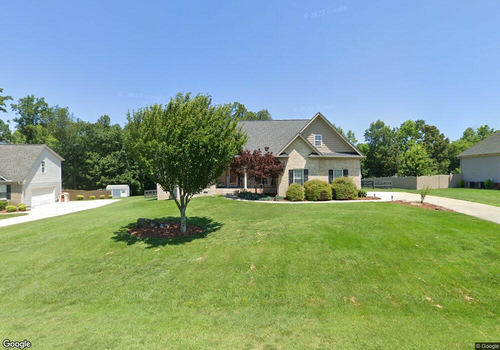
148 Brookfield Dr Stokesdale, NC 27357
Estimated Value: $422,000 - $516,000
4
Beds
3
Baths
2,381
Sq Ft
$198/Sq Ft
Est. Value
About This Home
This home is located at 148 Brookfield Dr, Stokesdale, NC 27357 and is currently estimated at $471,908, approximately $198 per square foot. 148 Brookfield Dr is a home located in Rockingham County with nearby schools including Huntsville Elementary School, John W. Dillard Academy, and Western Rockingham Middle School.
Ownership History
Date
Name
Owned For
Owner Type
Purchase Details
Closed on
Dec 4, 2008
Sold by
Vp Builders Llc
Bought by
Robbins Brian E and Robbins Susan
Current Estimated Value
Home Financials for this Owner
Home Financials are based on the most recent Mortgage that was taken out on this home.
Original Mortgage
$260,561
Interest Rate
4.94%
Mortgage Type
FHA
Create a Home Valuation Report for This Property
The Home Valuation Report is an in-depth analysis detailing your home's value as well as a comparison with similar homes in the area
Home Values in the Area
Average Home Value in this Area
Purchase History
| Date | Buyer | Sale Price | Title Company |
|---|---|---|---|
| Robbins Brian E | $264,000 | None Available |
Source: Public Records
Mortgage History
| Date | Status | Borrower | Loan Amount |
|---|---|---|---|
| Previous Owner | Robbins Brian E | $260,561 |
Source: Public Records
Tax History Compared to Growth
Tax History
| Year | Tax Paid | Tax Assessment Tax Assessment Total Assessment is a certain percentage of the fair market value that is determined by local assessors to be the total taxable value of land and additions on the property. | Land | Improvement |
|---|---|---|---|---|
| 2025 | $3,406 | $466,150 | $33,000 | $433,150 |
| 2024 | $3,329 | $466,150 | $33,000 | $433,150 |
| 2023 | $3,329 | $281,723 | $30,000 | $251,723 |
| 2022 | $2,346 | $281,723 | $30,000 | $251,723 |
| 2021 | $2,240 | $281,723 | $30,000 | $251,723 |
| 2020 | $2,374 | $286,203 | $30,000 | $256,203 |
| 2019 | $2,390 | $286,203 | $30,000 | $256,203 |
| 2018 | $2,203 | $263,655 | $53,000 | $210,655 |
| 2017 | $2,208 | $263,655 | $53,000 | $210,655 |
| 2015 | $2,242 | $263,655 | $53,000 | $210,655 |
| 2014 | -- | $263,655 | $53,000 | $210,655 |
Source: Public Records
Map
Nearby Homes
- 215 Northcrest Dr
- 230 Welcome Home Rd
- 325 Twin Creeks Dr
- 478 Price Farm Rd
- 223 Twin Creeks Dr
- 0 Rockwood Dr
- 129 W Holly Oak Way
- 128 Willowbrooke Way
- Belhaven Plan at Neal Farm
- Penwell Plan at Neal Farm
- Taylor Plan at Neal Farm
- Freeport Plan at Neal Farm
- 130 W Holly Oak Way
- 113 W Farm Loop
- 177 E Farm Loop
- 119 W Holly Oak Way
- 410 Willowbrooke Way
- 406 Willowbrooke Way
- 250 Deerfield Ct
- 163 E Farm Loop
- 138 Brookfield Dr
- 158 Brookfield Dr
- 155 Brookfield Dr
- 143 Brookfield Dr
- 128 Brookfield Dr
- 135 Brookfield Dr
- 177 Brookfield Dr
- 112 Brookfield Dr
- 125 Brookfield Dr
- 176 Brookfield Dr
- 117 Brookfield Dr
- 248 Lemons Rd
- 184 Brookfield Dr
- 314 Lemons Rd
- 188 Northcrest Dr
- 200 Northcrest Dr
- 196 Brookfield Dr
- 195 Brookfield Dr
- 261 Lemons Rd
- 212 Northcrest Dr