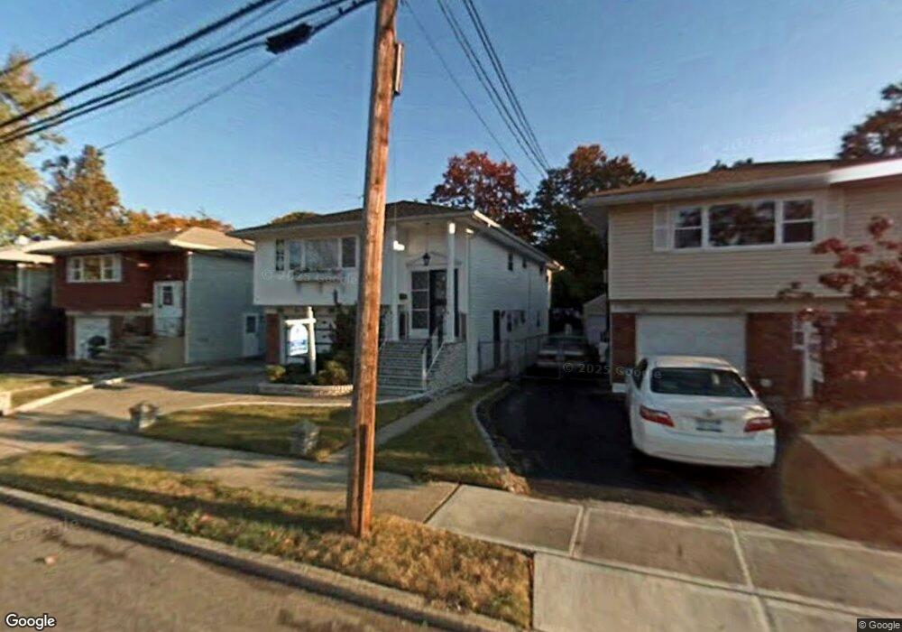
148 Buckingham Place Unit 1 Lynbrook, NY 11563
Estimated Value: $782,707 - $821,000
1
Bed
1
Bath
1,242
Sq Ft
$646/Sq Ft
Est. Value
About This Home
This home is located at 148 Buckingham Place Unit 1, Lynbrook, NY 11563 and is currently estimated at $801,854, approximately $645 per square foot. 148 Buckingham Place Unit 1 is a home located in Nassau County with nearby schools including Davison Avenue Intermediate School, Maurice W. Downing Primary K-2 School, and Howard T Herber Middle School.
Ownership History
Date
Name
Owned For
Owner Type
Purchase Details
Closed on
Jun 30, 2025
Sold by
Akaeze Chukwuma J
Bought by
Ngu Khang Tu and Macklin Shands Essiba
Current Estimated Value
Home Financials for this Owner
Home Financials are based on the most recent Mortgage that was taken out on this home.
Original Mortgage
$640,000
Outstanding Balance
$638,918
Interest Rate
6.86%
Mortgage Type
New Conventional
Estimated Equity
$162,936
Purchase Details
Closed on
Nov 4, 1996
Sold by
Ennis Terence
Bought by
Akaeze Chukwuma
Create a Home Valuation Report for This Property
The Home Valuation Report is an in-depth analysis detailing your home's value as well as a comparison with similar homes in the area
Home Values in the Area
Average Home Value in this Area
Purchase History
| Date | Buyer | Sale Price | Title Company |
|---|---|---|---|
| Ngu Khang Tu | $800,000 | Westcor Land Title Ins Co | |
| Akaeze Chukwuma | $177,000 | -- | |
| Akaeze Chukwuma | $177,000 | -- |
Source: Public Records
Mortgage History
| Date | Status | Borrower | Loan Amount |
|---|---|---|---|
| Open | Ngu Khang Tu | $640,000 |
Source: Public Records
Tax History Compared to Growth
Tax History
| Year | Tax Paid | Tax Assessment Tax Assessment Total Assessment is a certain percentage of the fair market value that is determined by local assessors to be the total taxable value of land and additions on the property. | Land | Improvement |
|---|---|---|---|---|
| 2025 | $8,795 | $449 | $156 | $293 |
| 2024 | $935 | $433 | $150 | $283 |
| 2023 | $7,589 | $452 | $157 | $295 |
| 2022 | $7,589 | $452 | $157 | $295 |
| 2021 | $7,451 | $448 | $156 | $292 |
| 2020 | $3,839 | $567 | $423 | $144 |
| 2019 | $7,001 | $567 | $374 | $193 |
| 2018 | $6,416 | $605 | $0 | $0 |
| 2017 | $5,721 | $642 | $399 | $243 |
| 2016 | $6,649 | $680 | $350 | $330 |
| 2015 | $1,066 | $718 | $369 | $349 |
| 2014 | $1,066 | $718 | $369 | $349 |
| 2013 | $1,120 | $822 | $423 | $399 |
Source: Public Records
Map
Nearby Homes
- 44 Madison St
- 80 Oak St
- 9 Christabel St
- 44 Jefferson Ave
- 85 Edmund St
- 24 Lawrence Ave
- 118 Edmund St
- 5 Lawrence Ave
- 58 Chestnut St
- 437 Yale Ave
- 4 Hilton St
- 212 Lakeview Ave
- 45 Lynbrook Ave
- 291 Denton Ave
- 318 Vincent Ave
- 53 Ocean Ave
- 17 Aberdeen St
- 1269 Dekoven St
- 61 Maine Ave Unit F6
- 61 Maine Ave Unit D 14
- 146 Buckingham Place
- 150 Buckingham Place
- 152 Buckingham Place
- 144 Buckingham Place
- 142 Buckingham Place
- 161 Buckingham Place
- 48 Allen St
- 140 Buckingham Place
- 137 Buckingham Place
- 44 Allen St
- 40 Allen St
- 40 Allen St
- 136 Buckingham Place
- 135 Buckingham Place
- 34 Allen St
- 130 Buckingham Place
- 133 Oak St
- 77 Monroe St
- 164 Ocean Ave
- 71 Monroe St