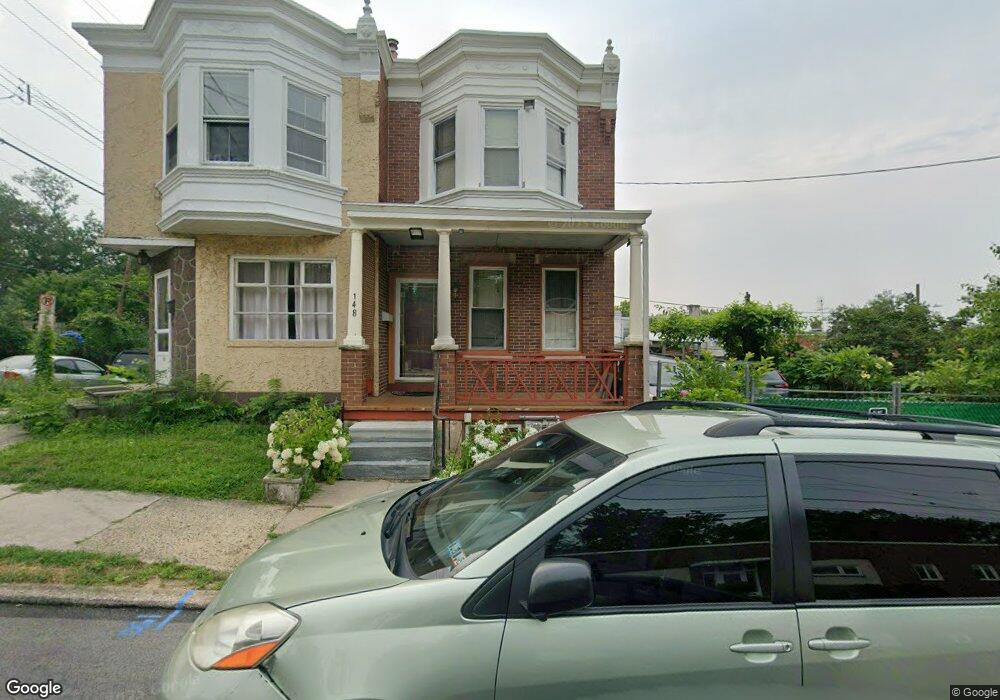
148 Forrest Ave Unit 3 Norristown, PA 19401
Estimated Value: $211,000 - $251,000
3
Beds
2
Baths
1,240
Sq Ft
$192/Sq Ft
Est. Value
About This Home
This home is located at 148 Forrest Ave Unit 3, Norristown, PA 19401 and is currently estimated at $238,211, approximately $192 per square foot. 148 Forrest Ave Unit 3 is a home located in Montgomery County with nearby schools including Charles Blockson Middle School, Whitehall Elementary School, and East Norriton Middle School.
Ownership History
Date
Name
Owned For
Owner Type
Purchase Details
Closed on
Sep 22, 2011
Sold by
Sao Daly
Bought by
Sao Daly and Kheun Nach
Current Estimated Value
Purchase Details
Closed on
May 14, 2007
Sold by
Sao Daly and Sao Artikas
Bought by
Sao Daly
Purchase Details
Closed on
Nov 25, 1996
Sold by
Schantz Elmer R and Macfaun Adelaide E
Bought by
Sao Daly and Sao Artikas
Create a Home Valuation Report for This Property
The Home Valuation Report is an in-depth analysis detailing your home's value as well as a comparison with similar homes in the area
Home Values in the Area
Average Home Value in this Area
Purchase History
| Date | Buyer | Sale Price | Title Company |
|---|---|---|---|
| Sao Daly | -- | None Available | |
| Sao Daly | -- | None Available | |
| Sao Daly | $48,000 | -- |
Source: Public Records
Tax History Compared to Growth
Tax History
| Year | Tax Paid | Tax Assessment Tax Assessment Total Assessment is a certain percentage of the fair market value that is determined by local assessors to be the total taxable value of land and additions on the property. | Land | Improvement |
|---|---|---|---|---|
| 2025 | $4,477 | $72,940 | $20,510 | $52,430 |
| 2024 | $4,477 | $72,940 | $20,510 | $52,430 |
| 2023 | $4,437 | $72,940 | $20,510 | $52,430 |
| 2022 | $4,341 | $72,940 | $20,510 | $52,430 |
| 2021 | $4,320 | $72,940 | $20,510 | $52,430 |
| 2020 | $4,121 | $72,940 | $20,510 | $52,430 |
| 2019 | $55 | $72,940 | $20,510 | $52,430 |
| 2018 | $2,446 | $72,940 | $20,510 | $52,430 |
| 2017 | $3,715 | $72,940 | $20,510 | $52,430 |
| 2016 | $3,686 | $72,940 | $20,510 | $52,430 |
| 2015 | $3,532 | $72,940 | $20,510 | $52,430 |
| 2014 | $3,532 | $72,940 | $20,510 | $52,430 |
Source: Public Records
Map
Nearby Homes
- 0 Sheridan Ln Unit PAMC2130926
- 0 Sheridan Ln Unit PAMC2131012
- 134 W Main St
- 1115 W Main St
- 243 Buttonwood St
- 1022 W Lafayette St
- 1014 W Main St
- 0 Centre Unit 430 PAMC2099854
- 1009 W Main St
- 1633 Williams Way
- 519 Noble St
- 564 Hamilton St
- 924 W Main St
- 606 Selma St
- 19 Roberts Alley
- 1016 Thomas Barone St
- 392 Joseph St
- 13 Stanbridge St
- 1635 W Marshall W Marshall St
- 417 Centre Ave
- 150 Forrest Ave
- 149 Rosemont Ave
- 147 Rosemont Ave
- 151 Rosemont Ave
- 2171 W Lafayette St
- 145 Rosemont Ave
- 143 Rosemont Ave
- 122 Forrest Ave
- 141 Rosemont Ave
- 200 Forrest Ave
- 139 Rosemont Ave
- 120 Forrest Ave
- 202 Forrest Ave
- 137 Rosemont Ave
- 118 Forrest Ave
- 204 Forrest Ave
- 135 Rosemont Ave
- 116 Forrest Ave
- 206 Forrest Ave
- 133 Rosemont Ave Unit 13