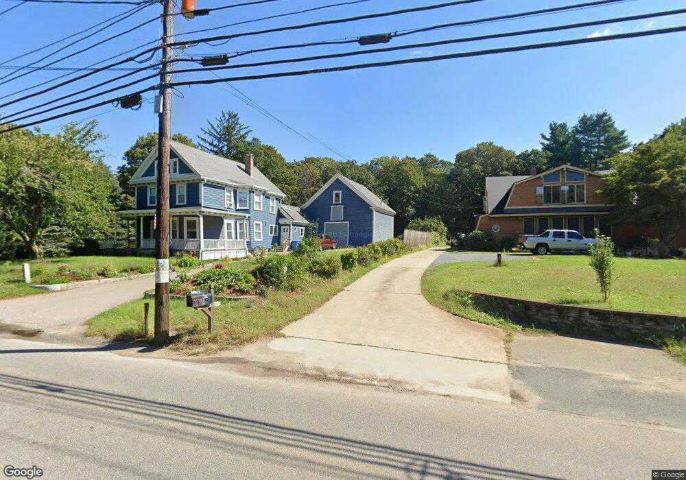
148 Franklin St Wrentham, MA 02093
Estimated Value: $664,000 - $764,000
3
Beds
2
Baths
2,203
Sq Ft
$318/Sq Ft
Est. Value
About This Home
This home is located at 148 Franklin St, Wrentham, MA 02093 and is currently estimated at $700,362, approximately $317 per square foot. 148 Franklin St is a home located in Norfolk County with nearby schools including Delaney Elementary School and Charles E Roderick.
Ownership History
Date
Name
Owned For
Owner Type
Purchase Details
Closed on
Mar 17, 2021
Sold by
Collins Donna M and Collins Philip
Bought by
Donna M Collins Ret
Current Estimated Value
Purchase Details
Closed on
Sep 17, 2010
Sold by
Bukis Brian P and Prewitt Patricia K
Bought by
Collins Philip and Collins Donna M
Home Financials for this Owner
Home Financials are based on the most recent Mortgage that was taken out on this home.
Original Mortgage
$248,000
Interest Rate
4.51%
Mortgage Type
Purchase Money Mortgage
Purchase Details
Closed on
Mar 15, 1991
Sold by
Grogan Terry E
Bought by
Bukis Brian P
Home Financials for this Owner
Home Financials are based on the most recent Mortgage that was taken out on this home.
Original Mortgage
$128,700
Interest Rate
9.46%
Mortgage Type
Purchase Money Mortgage
Create a Home Valuation Report for This Property
The Home Valuation Report is an in-depth analysis detailing your home's value as well as a comparison with similar homes in the area
Home Values in the Area
Average Home Value in this Area
Purchase History
| Date | Buyer | Sale Price | Title Company |
|---|---|---|---|
| Donna M Collins Ret | -- | None Available | |
| Collins Philip | $310,000 | -- | |
| Bukis Brian P | $171,600 | -- |
Source: Public Records
Mortgage History
| Date | Status | Borrower | Loan Amount |
|---|---|---|---|
| Previous Owner | Collins Philip | $248,000 | |
| Previous Owner | Bukis Brian P | $15,000 | |
| Previous Owner | Bukis Brian P | $128,000 | |
| Previous Owner | Bukis Brian P | $128,700 | |
| Previous Owner | Bukis Brian P | $172,000 |
Source: Public Records
Tax History Compared to Growth
Tax History
| Year | Tax Paid | Tax Assessment Tax Assessment Total Assessment is a certain percentage of the fair market value that is determined by local assessors to be the total taxable value of land and additions on the property. | Land | Improvement |
|---|---|---|---|---|
| 2025 | $7,130 | $615,200 | $286,500 | $328,700 |
| 2024 | $6,827 | $568,900 | $286,500 | $282,400 |
| 2023 | $6,753 | $535,100 | $250,800 | $284,300 |
| 2022 | $6,741 | $493,100 | $256,200 | $236,900 |
| 2021 | $6,495 | $461,600 | $228,000 | $233,600 |
| 2020 | $5,804 | $407,300 | $174,000 | $233,300 |
| 2019 | $5,539 | $392,300 | $165,700 | $226,600 |
| 2018 | $5,196 | $364,900 | $165,900 | $199,000 |
| 2017 | $4,888 | $343,000 | $162,700 | $180,300 |
| 2016 | $4,688 | $328,300 | $158,000 | $170,300 |
| 2015 | $4,522 | $301,900 | $151,900 | $150,000 |
| 2014 | $4,460 | $291,300 | $146,100 | $145,200 |
Source: Public Records
Map
Nearby Homes
- 10 Nature View Dr
- 15 Nature View Dr
- 270 Dedham St
- 1 Lorraine Metcalf Dr
- 131 Creek St Unit 7
- 570 Franklin St
- 362 East St
- 11 Earle Stewart Ln
- Lot 3 - 14 Earle Stewart Ln
- 246 Forest Grove Ave
- Lot 1 - Blueberry 2 Car Plan at King Philip Estates
- Lot 8 - Blueberry 2 Car Plan at King Philip Estates
- Lot 5 - Hughes 2 car Plan at King Philip Estates
- Lot 6 - Blueberry 3 Car Plan at King Philip Estates
- Lot 2 - Camden 2 Car Plan at King Philip Estates
- Lot 7 - Cedar Plan at King Philip Estates
- Lot 4 - Hemingway 2 Car Plan at King Philip Estates
- Lot 3 - Blueberry 2 Car Plan at King Philip Estates
- 319 Taunton St
- 50 Reed Fulton Ave Unit Lot 61
- 138 Franklin St
- 132 Franklin St
- 132 Franklin St Unit 132 Franklin St Unit
- 132 Franklin St
- 132 Franklin St Unit 2
- 132 Franklin St Unit 1
- 2 Shears St
- 2 Shears St Unit 1
- LOT 25 Manchester Dr
- LOT 13 Hales Pond Ln
- LOT 23 Manchester Dr
- B Old Quarry Rd
- 165 Franklin St
- 133 Franklin St
- 4 Shears St
- 124 Franklin St
- 118 Franklin St
- 18 Shears St
- 16 Shears St
- 16 Shears St