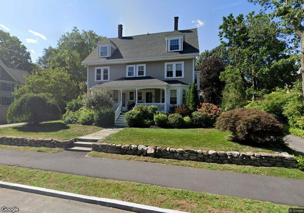
148 Hubbard St Concord, MA 01742
Estimated Value: $1,186,000 - $1,423,939
4
Beds
4
Baths
2,002
Sq Ft
$655/Sq Ft
Est. Value
About This Home
This home is located at 148 Hubbard St, Concord, MA 01742 and is currently estimated at $1,310,985, approximately $654 per square foot. 148 Hubbard St is a home located in Middlesex County with nearby schools including Alcott Elementary School, Concord Middle School, and Concord Carlisle High School.
Ownership History
Date
Name
Owned For
Owner Type
Purchase Details
Closed on
Dec 17, 2015
Sold by
Moore Diana R and Moore Robert B
Bought by
Belton Nigel and Belton Shelley
Current Estimated Value
Purchase Details
Closed on
Aug 24, 2011
Sold by
Wakefield Leslie M
Bought by
Moore Diana R and Moore Robert B
Home Financials for this Owner
Home Financials are based on the most recent Mortgage that was taken out on this home.
Original Mortgage
$500,625
Interest Rate
4.53%
Mortgage Type
Purchase Money Mortgage
Purchase Details
Closed on
Aug 17, 1998
Sold by
Tyrwhitt Rt and Olson Don H
Bought by
Wakefield Leslie M
Home Financials for this Owner
Home Financials are based on the most recent Mortgage that was taken out on this home.
Original Mortgage
$150,000
Interest Rate
6.94%
Mortgage Type
Purchase Money Mortgage
Create a Home Valuation Report for This Property
The Home Valuation Report is an in-depth analysis detailing your home's value as well as a comparison with similar homes in the area
Home Values in the Area
Average Home Value in this Area
Purchase History
| Date | Buyer | Sale Price | Title Company |
|---|---|---|---|
| Belton Nigel | $780,000 | -- | |
| Moore Diana R | $667,500 | -- | |
| Wakefield Leslie M | $380,000 | -- |
Source: Public Records
Mortgage History
| Date | Status | Borrower | Loan Amount |
|---|---|---|---|
| Previous Owner | Moore Diana R | $500,625 | |
| Previous Owner | Wakefield Leslie M | $150,000 |
Source: Public Records
Tax History
| Year | Tax Paid | Tax Assessment Tax Assessment Total Assessment is a certain percentage of the fair market value that is determined by local assessors to be the total taxable value of land and additions on the property. | Land | Improvement |
|---|---|---|---|---|
| 2025 | $170 | $1,279,800 | $0 | $1,279,800 |
| 2024 | $16,346 | $1,244,900 | $0 | $1,244,900 |
| 2023 | $15,640 | $1,206,800 | $0 | $1,206,800 |
| 2022 | $17,333 | $1,174,300 | $0 | $1,174,300 |
| 2021 | $16,556 | $1,124,700 | $0 | $1,124,700 |
| 2020 | $16,004 | $1,124,700 | $0 | $1,124,700 |
| 2019 | $15,809 | $1,114,100 | $0 | $1,114,100 |
| 2018 | $13,773 | $963,800 | $0 | $963,800 |
| 2017 | $13,561 | $963,800 | $0 | $963,800 |
| 2016 | $12,392 | $890,200 | $0 | $890,200 |
| 2015 | $11,906 | $833,200 | $0 | $833,200 |
Source: Public Records
Map
Nearby Homes
- 150 Hubbard St Unit B
- 28 Devens St
- 143 Everett St
- 34 Thoreau St Unit 34
- 32 Thoreau St Unit 32
- 3 Nashawtuc Rd
- 22 Belknap Ct
- 106 Elm St
- 61B Walden St
- 236 Fairhaven Rd
- 2 Willard Common
- 25 Fairhaven Rd
- 602 Main St
- 96 Independence Rd
- 212 Hawthorne Ln
- 97 Hawthorne Ln
- 315 Musketaquid Rd
- 425 Bedford St
- 244 Musterfield Rd
- 612 Lexington Rd
- 148 Hubbard St Unit 148
- 150 Hubbard St Unit A
- 150 Hubbard St Unit 1
- 138 Hubbard St
- 146 Hubbard St
- 158 Hubbard St
- 52 Devens St
- 151 Hubbard St Unit 2
- 151 Hubbard St Unit 1
- 151 Hubbard St Unit 2,151
- 166 Hubbard St
- 166 Hubbard St Unit 166
- 157 Hubbard St
- 44 Devens St
- 124 Hubbard St
- 131 Hubbard St
- 172 Hubbard St
- 141 Hubbard St
- 149 Hubbard St
- 149 Hubbard St Unit 149
Your Personal Tour Guide
Ask me questions while you tour the home.