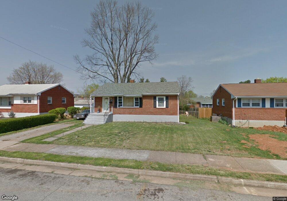
148 Hurst Ave NE Roanoke, VA 24012
Preston Park NeighborhoodEstimated Value: $186,645 - $235,000
3
Beds
1
Bath
929
Sq Ft
$226/Sq Ft
Est. Value
About This Home
This home is located at 148 Hurst Ave NE, Roanoke, VA 24012 and is currently estimated at $209,661, approximately $225 per square foot. 148 Hurst Ave NE is a home located in Roanoke City with nearby schools including Monterey Elementary School, Breckinridge Middle School, and William Fleming High School.
Ownership History
Date
Name
Owned For
Owner Type
Purchase Details
Closed on
Jan 10, 2014
Sold by
Missy 3000 Llc
Bought by
White Pine Ventures Llc
Current Estimated Value
Home Financials for this Owner
Home Financials are based on the most recent Mortgage that was taken out on this home.
Original Mortgage
$84,000
Outstanding Balance
$23,577
Interest Rate
4.29%
Mortgage Type
Purchase Money Mortgage
Estimated Equity
$186,084
Purchase Details
Closed on
May 20, 2011
Sold by
Lewis Elizabeth F
Bought by
Missy 3000 Llc
Create a Home Valuation Report for This Property
The Home Valuation Report is an in-depth analysis detailing your home's value as well as a comparison with similar homes in the area
Home Values in the Area
Average Home Value in this Area
Purchase History
| Date | Buyer | Sale Price | Title Company |
|---|---|---|---|
| White Pine Ventures Llc | $105,000 | First American Title Ins Co | |
| Missy 3000 Llc | $54,000 | Mult |
Source: Public Records
Mortgage History
| Date | Status | Borrower | Loan Amount |
|---|---|---|---|
| Open | White Pine Ventures Llc | $84,000 |
Source: Public Records
Tax History Compared to Growth
Tax History
| Year | Tax Paid | Tax Assessment Tax Assessment Total Assessment is a certain percentage of the fair market value that is determined by local assessors to be the total taxable value of land and additions on the property. | Land | Improvement |
|---|---|---|---|---|
| 2025 | $2,061 | $154,300 | $36,600 | $117,700 |
| 2024 | $2,061 | $147,700 | $31,900 | $115,800 |
| 2023 | $1,976 | $135,400 | $28,000 | $107,400 |
| 2022 | $1,586 | $116,900 | $23,700 | $93,200 |
| 2021 | $1,392 | $101,600 | $20,200 | $81,400 |
| 2020 | $1,298 | $95,000 | $20,200 | $74,800 |
| 2019 | $1,229 | $89,300 | $18,700 | $70,600 |
| 2018 | $1,147 | $82,600 | $18,700 | $63,900 |
| 2017 | $1,042 | $81,900 | $18,700 | $63,200 |
| 2016 | $1,028 | $80,700 | $18,700 | $62,000 |
| 2015 | $823 | $80,700 | $18,700 | $62,000 |
| 2014 | $823 | $67,100 | $18,700 | $48,400 |
Source: Public Records
Map
Nearby Homes
- 4018 Hazelridge Rd NW
- 230 Crittendon Ave NE
- 3918 Bohon St NE
- 3417 Crittendon Ave NW
- 208 Wentworth Ave NE
- 202 Frontier Rd NE
- 3411 Frontier Rd NW
- 3237 Christian Ave NW
- 3240 Fleming Ave NW
- 227 Maplelawn Ave NE
- 3344 Crittendon Ave NW
- 223 Oaklawn Ave NE
- 537 Wentworth Ave NE
- 0 Huntington Blvd NE
- 3125 Fleming Ave NW
- 3724 Plantation Rd NE
- 3219 Yardley Dr NW
- 3332 Maplelawn Ave NW
- 4306 Williamson Rd NW
- 3038 Maplelawn Ave NW
- 152 Hurst Ave NE
- 144 Hurst Ave NE
- 157 Christian Ave NE
- 140 Hurst Ave NE
- 156 Hurst Ave NE
- 161 Christian Ave NE
- 153 Christian Ave NE
- 153 Hurst Ave NE
- 165 Christian Ave NE
- 149 Christian Ave NE
- 149 Hurst Ave NE
- 157 Hurst Ave NE
- 136 Hurst Ave NE
- 160 Hurst Ave NE
- 145 Hurst Ave NE
- 161 Hurst Ave NE
- 169 Christian Ave NE
- 145 Christian Ave NE
- 165 Hurst Ave NE
- 139 Hurst Ave NE