Estimated Value: $56,507 - $789,000
Studio
--
Bath
--
Sq Ft
45,738
Sq Ft
About This Home
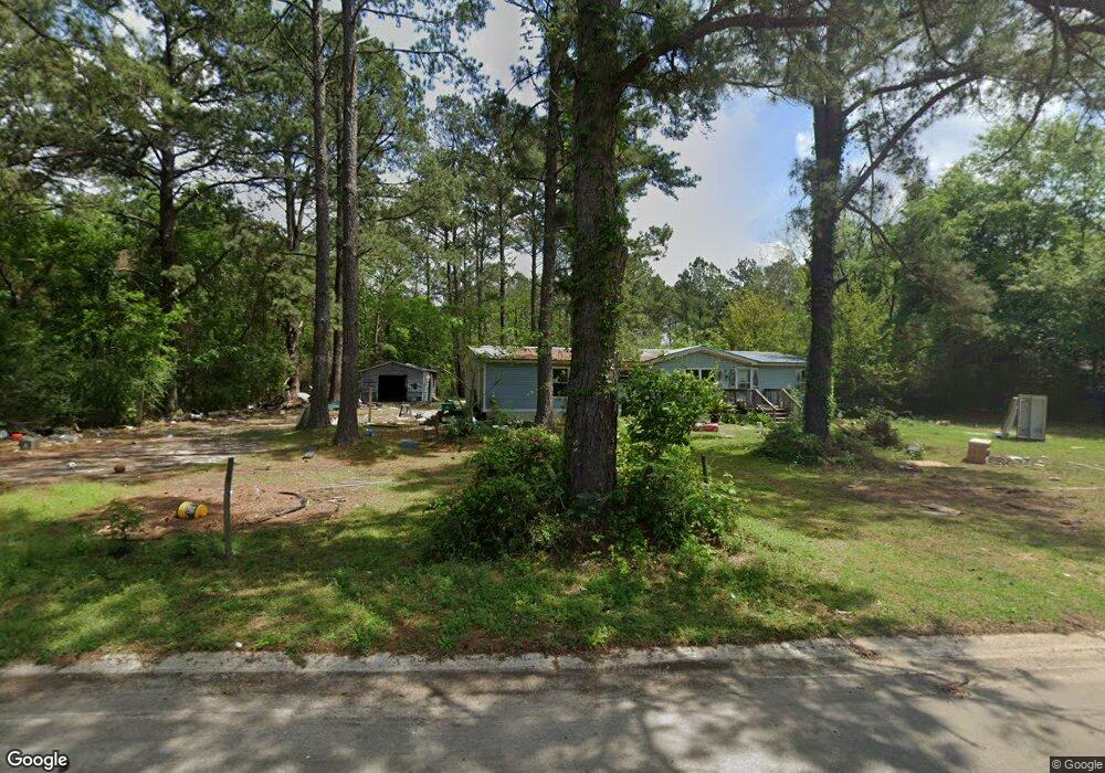
This home is located at 148 Jamie Rd, Cairo, GA 39828 and is currently estimated at $267,127. 148 Jamie Rd is a home with nearby schools including Calvary Christian School.
Ownership History
Date
Name
Owned For
Owner Type
Purchase Details
Closed on
Jul 1, 2024
Sold by
Palafox Roman David
Bought by
Palafox Properties Llc
Current Estimated Value
Purchase Details
Closed on
Oct 31, 2022
Sold by
Kuhne Brenda Gail
Bought by
Palafox Roman David
Purchase Details
Closed on
Apr 7, 2014
Sold by
Kuhne Richard
Bought by
Kuhne Richard D and Ii
Purchase Details
Closed on
Sep 27, 2011
Sold by
Deutsche Bank National
Bought by
E H Pooled 1010 Lp
Purchase Details
Closed on
Dec 9, 2008
Sold by
Sheffield Daniel S
Bought by
Deutsche Bank National
Purchase Details
Closed on
May 25, 2001
Sold by
Godwin Glenn J
Bought by
Sheffield Daniel S
Purchase Details
Closed on
Feb 13, 1995
Sold by
Grayson Margie
Bought by
Godwin Glenn J
Purchase Details
Closed on
Nov 6, 1990
Bought by
Grayson Margie
Create a Home Valuation Report for This Property
The Home Valuation Report is an in-depth analysis detailing your home's value as well as a comparison with similar homes in the area
Purchase History
| Date | Buyer | Sale Price | Title Company |
|---|---|---|---|
| Palafox Properties Llc | -- | -- | |
| Palafox Roman David | $100,000 | -- | |
| Kuhne Richard D | -- | -- | |
| E H Pooled 1010 Lp | $11,800 | -- | |
| Deutsche Bank National | -- | -- | |
| Sheffield Daniel S | $36,500 | -- | |
| Godwin Glenn J | $44,000 | -- | |
| Grayson Margie | $5,000 | -- |
Source: Public Records
Tax History
| Year | Tax Paid | Tax Assessment Tax Assessment Total Assessment is a certain percentage of the fair market value that is determined by local assessors to be the total taxable value of land and additions on the property. | Land | Improvement |
|---|---|---|---|---|
| 2024 | $163 | $6,952 | $5,440 | $1,512 |
| 2023 | $163 | $5,305 | $3,200 | $2,105 |
| 2022 | $163 | $5,305 | $3,200 | $2,105 |
| 2021 | $164 | $5,305 | $3,200 | $2,105 |
| 2020 | $164 | $5,305 | $3,200 | $2,105 |
| 2019 | $164 | $5,305 | $3,200 | $2,105 |
| 2018 | $154 | $5,305 | $3,200 | $2,105 |
| 2017 | $147 | $5,305 | $3,200 | $2,105 |
| 2016 | $148 | $5,305 | $3,200 | $2,105 |
| 2015 | -- | $5,305 | $3,200 | $2,105 |
| 2014 | $110 | $4,000 | $3,200 | $800 |
| 2013 | -- | $2,176 | $3,200 | $2,176 |
Source: Public Records
Map
Nearby Homes
- 275 Lewis Ln
- 262 Crawford Ln
- 1104 Lewis Rd
- 279-1C Lewis Ln
- 2ACR Lewis Rd
- 298 Pine Cone Ln
- 1217 Pine Park Rd
- 140 Elderberry Ln
- 1870 Oakdale Rd SE
- 1891 Lakewood Dr SE
- 309 Sunset Ln
- 198 Oakdale Rd SE
- 0 111 Hwy Unit 396477
- 112 Cakebread Dr
- 1405 Platt Ave
- 1406 Platt Ave
- 770 Pierce Chapel Rd
- 130 17th Ave SE
- 4103 Hadley Ferry Rd
- 530 6th St
Your Personal Tour Guide
Ask me questions while you tour the home.