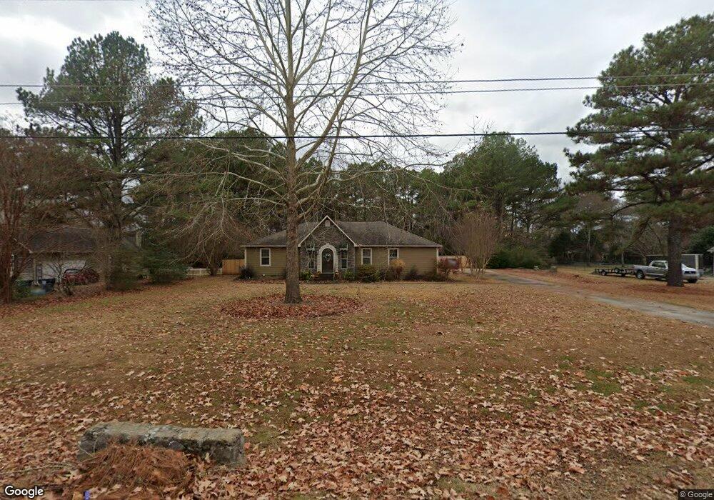
148 Matt Phillips Rd NW Huntsville, AL 35806
Research Park NeighborhoodEstimated Value: $343,128 - $458,000
--
Bed
1
Bath
2,137
Sq Ft
$177/Sq Ft
Est. Value
About This Home
This home is located at 148 Matt Phillips Rd NW, Huntsville, AL 35806 and is currently estimated at $377,782, approximately $176 per square foot. 148 Matt Phillips Rd NW is a home with nearby schools including Monrovia Elementary School, Monrovia Middle School, and Sparkman High School.
Ownership History
Date
Name
Owned For
Owner Type
Purchase Details
Closed on
Jun 30, 2005
Sold by
Sirva Relocation Llc
Bought by
Hogan James R
Current Estimated Value
Home Financials for this Owner
Home Financials are based on the most recent Mortgage that was taken out on this home.
Original Mortgage
$128,900
Outstanding Balance
$67,287
Interest Rate
5.66%
Mortgage Type
New Conventional
Estimated Equity
$310,495
Create a Home Valuation Report for This Property
The Home Valuation Report is an in-depth analysis detailing your home's value as well as a comparison with similar homes in the area
Home Values in the Area
Average Home Value in this Area
Purchase History
| Date | Buyer | Sale Price | Title Company |
|---|---|---|---|
| Hogan James R | $169,900 | -- |
Source: Public Records
Mortgage History
| Date | Status | Borrower | Loan Amount |
|---|---|---|---|
| Open | Hogan James R | $128,900 |
Source: Public Records
Tax History Compared to Growth
Tax History
| Year | Tax Paid | Tax Assessment Tax Assessment Total Assessment is a certain percentage of the fair market value that is determined by local assessors to be the total taxable value of land and additions on the property. | Land | Improvement |
|---|---|---|---|---|
| 2024 | $934 | $27,040 | $1,500 | $25,540 |
| 2023 | $934 | $26,120 | $1,500 | $24,620 |
| 2022 | $796 | $23,260 | $1,500 | $21,760 |
| 2021 | $741 | $21,740 | $1,500 | $20,240 |
| 2020 | $691 | $20,370 | $1,500 | $18,870 |
| 2019 | $660 | $19,520 | $1,500 | $18,020 |
| 2018 | $610 | $18,160 | $0 | $0 |
| 2017 | $610 | $18,160 | $0 | $0 |
| 2016 | $610 | $18,160 | $0 | $0 |
| 2015 | $610 | $18,160 | $0 | $0 |
| 2014 | $615 | $18,300 | $0 | $0 |
Source: Public Records
Map
Nearby Homes
- 120 Arbery Dr NW
- 115 Misty Hollow Way
- 129 Ivywood Rd
- 140 Lovvorn Ln NW
- 131 Fairington Rd NW
- 111 Kingswood Dr
- 122 Kingswood Dr
- 102 Kretzer Ct
- 229 Brooklet Ct
- 117 Kretzer Ct
- 2031 Blake Bottom Rd NW
- 2031 Blake Bottom Rd NW Unit 2
- 167 Kingswood Dr
- 113 Thomas Woods Ct
- 108 Holbrook Dr
- 138 Holbrook Dr
- 1.4 acres Jeff Rd NW
- 10.4 acres Jeff Rd NW
- 1 ACRE EASEMENT Jeff Rd NW
- 104 Raymon Cir
- 150 Matt Phillips Rd NW
- 146 Matt Phillips Rd NW
- 149 Matt Phillips Rd NW
- 145 Matt Phillips Rd NW
- 144 Matt Phillips Rd NW
- 154 Matt Phillips Rd NW
- 153 Matt Phillips Rd NW
- 371 Lofton Rd NW
- 143 Matt Phillips Rd NW
- 142 Matt Phillips Rd NW
- 366 Lofton Rd NW
- 1797 Blake Bottom Rd NW
- 1797 Blake Bottom Rd NW
- 140 Matt Phillips Rd NW
- 141 Matt Phillips Rd NW
- 356 Lofton Rd NW
- 1789 Blake Bottom Rd NW
- 351 Lofton Rd NW
- 109 Sycamorebend Dr