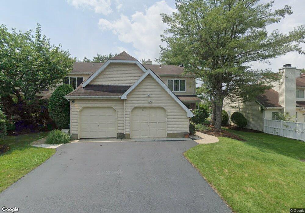
148 Nathan Dr North Brunswick, NJ 08902
Estimated Value: $448,000 - $522,000
2
Beds
3
Baths
1,556
Sq Ft
$310/Sq Ft
Est. Value
About This Home
This home is located at 148 Nathan Dr, North Brunswick, NJ 08902 and is currently estimated at $482,747, approximately $310 per square foot. 148 Nathan Dr is a home located in Middlesex County with nearby schools including Livingston Park Elementary School, Linwood Middle School, and North Brunswick Twp High School.
Ownership History
Date
Name
Owned For
Owner Type
Purchase Details
Closed on
May 15, 2019
Sold by
Brougham Reo Owner Lp
Bought by
Purohit Amrita
Current Estimated Value
Home Financials for this Owner
Home Financials are based on the most recent Mortgage that was taken out on this home.
Original Mortgage
$228,000
Outstanding Balance
$199,640
Interest Rate
4%
Mortgage Type
New Conventional
Estimated Equity
$283,107
Purchase Details
Closed on
May 2, 2018
Sold by
Wilmngotn Savings Fund Society
Bought by
Brougham Reo Woner Lp
Purchase Details
Closed on
Apr 17, 2018
Sold by
Roberts Arlene L
Bought by
Wilmington Savigs Fund Socity Fsb and Primestar H Fund I Trusts
Purchase Details
Closed on
Nov 10, 1999
Sold by
Fekate Paul
Bought by
Roberts Arlene
Home Financials for this Owner
Home Financials are based on the most recent Mortgage that was taken out on this home.
Original Mortgage
$108,750
Interest Rate
7.76%
Create a Home Valuation Report for This Property
The Home Valuation Report is an in-depth analysis detailing your home's value as well as a comparison with similar homes in the area
Home Values in the Area
Average Home Value in this Area
Purchase History
| Date | Buyer | Sale Price | Title Company |
|---|---|---|---|
| Purohit Amrita | $285,000 | None Available | |
| Brougham Reo Woner Lp | -- | None Available | |
| Wilmington Savigs Fund Socity Fsb | -- | Terra Abstract Inc | |
| Roberts Arlene | $145,000 | -- |
Source: Public Records
Mortgage History
| Date | Status | Borrower | Loan Amount |
|---|---|---|---|
| Open | Purohit Amrita | $228,000 | |
| Previous Owner | Roberts Arlene | $108,750 |
Source: Public Records
Tax History Compared to Growth
Tax History
| Year | Tax Paid | Tax Assessment Tax Assessment Total Assessment is a certain percentage of the fair market value that is determined by local assessors to be the total taxable value of land and additions on the property. | Land | Improvement |
|---|---|---|---|---|
| 2025 | $9,187 | $145,000 | $42,500 | $102,500 |
| 2024 | $9,022 | $145,000 | $42,500 | $102,500 |
| 2023 | $9,022 | $145,000 | $42,500 | $102,500 |
| 2022 | $8,715 | $145,000 | $42,500 | $102,500 |
| 2021 | $6,350 | $145,000 | $42,500 | $102,500 |
| 2020 | $8,390 | $145,000 | $42,500 | $102,500 |
| 2019 | $7,482 | $132,000 | $42,500 | $89,500 |
| 2018 | $7,329 | $132,000 | $42,500 | $89,500 |
| 2017 | $7,199 | $132,000 | $42,500 | $89,500 |
| 2016 | $7,049 | $132,000 | $42,500 | $89,500 |
| 2015 | $6,929 | $132,000 | $42,500 | $89,500 |
| 2014 | $6,851 | $132,000 | $42,500 | $89,500 |
Source: Public Records
Map
Nearby Homes
- 174 Nathan Dr
- 1103 Schmidt Ln
- 1074 Schmidt Ln
- 280 Willowbrook Dr
- 1027 Schmidt Ln
- 320 Willowbrook Dr
- 66 Riverbend Dr
- 1008 Schmidt Ln
- 84 Clay St
- 38 Brighton Way Unit H2
- 1 Michael Ct
- 448 Northam Dr Unit A3
- 464 Northam Dr
- 1899 Noah Dr
- 480 Witney Ct
- 1067 Grove St
- 78 Albury Way
- 11 Reins Ct
- 131 Albury Way
- 204 Darwin Ln