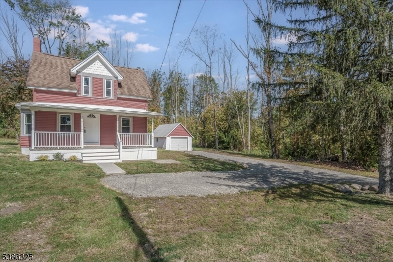
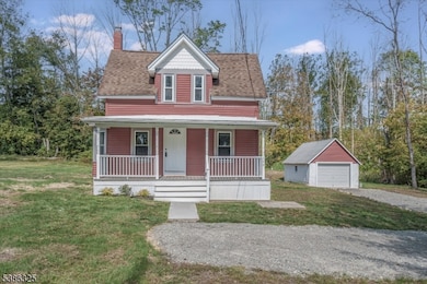
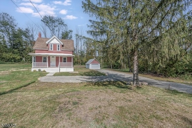
148 Vail Rd Columbia, NJ 07832
Estimated payment $2,444/month
Highlights
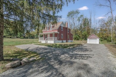
- Cape Cod Architecture
- Formal Dining Room
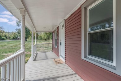
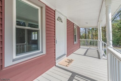
- Porch
- Wood Flooring
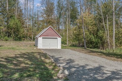
- 1 Car Detached Garage
- Eat-In Kitchen
About This Home
Cape Cod Charm with Major UpgradesMove right in and enjoy peace of mind with a brand-NEW septic system and NEW well already in place. This updated 4-bedroom, 1-bath Cape Cod blends classic charm with modern convenience.Inside, you'll find an open floor plan featuring a fully renovated kitchen with a breakfast island, a separate dining area, and a spacious living room perfect for gathering. The bathroom has been completely updated, the bedrooms feature fresh carpeting, and the entire home has been freshly painted.Relax on the welcoming front porch, or take advantage of the detached 1-car garage for parking or storage. This home offers comfort, style, and worry-free living for years to come.
Home Details
Home Type
- Single Family
Est. Annual Taxes
- $5,331
Year Built
- Built in 1930 | Remodeled
Lot Details
- 10,454 Sq Ft Lot
- Open Lot
Parking
- 1 Car Detached Garage
Home Design
- Cape Cod Architecture
- Vinyl Siding
Interior Spaces
- Living Room
- Formal Dining Room
- Utility Room
- Laundry Room
- Unfinished Basement
- Basement Fills Entire Space Under The House
Kitchen
- Eat-In Kitchen
- Electric Oven or Range
- Microwave
- Dishwasher
Flooring
- Wood
- Wall to Wall Carpet
- Vinyl
Bedrooms and Bathrooms
- 4 Bedrooms
- Primary bedroom located on second floor
- 1 Full Bathroom
- Bathtub with Shower
Outdoor Features
- Patio
- Porch
Schools
- Knowlton Elementary School
- No. Warren Middle School
- No. Warren High School
Utilities
- Heating System Uses Oil Above Ground
- Standard Electricity
- Well
Listing and Financial Details
- Assessor Parcel Number 3013-00040-0000-00010-0000-
Map
Home Values in the Area
Average Home Value in this Area
Tax History
| Year | Tax Paid | Tax Assessment Tax Assessment Total Assessment is a certain percentage of the fair market value that is determined by local assessors to be the total taxable value of land and additions on the property. | Land | Improvement |
|---|---|---|---|---|
| 2025 | $5,332 | $133,900 | $41,200 | $92,700 |
| 2024 | $5,218 | $133,900 | $41,200 | $92,700 |
| 2023 | $5,063 | $133,900 | $41,200 | $92,700 |
| 2022 | $4,930 | $133,900 | $41,200 | $92,700 |
| 2021 | $4,648 | $133,900 | $41,200 | $92,700 |
| 2020 | $4,819 | $133,900 | $41,200 | $92,700 |
| 2019 | $4,622 | $133,900 | $41,200 | $92,700 |
| 2018 | $4,622 | $133,900 | $41,200 | $92,700 |
| 2017 | $4,573 | $133,900 | $41,200 | $92,700 |
| 2016 | $4,474 | $133,900 | $41,200 | $92,700 |
| 2015 | $4,420 | $133,900 | $41,200 | $92,700 |
| 2014 | $4,269 | $133,900 | $41,200 | $92,700 |
Property History
| Date | Event | Price | List to Sale | Price per Sq Ft |
|---|---|---|---|---|
| 11/07/2025 11/07/25 | Pending | -- | -- | -- |
| 09/21/2025 09/21/25 | For Sale | $379,900 | -- | -- |
Purchase History
| Date | Type | Sale Price | Title Company |
|---|---|---|---|
| Deed | $145,000 | None Listed On Document | |
| Interfamily Deed Transfer | -- | -- | |
| Deed | $143,900 | Chicago Title Insurance Co | |
| Deed | $95,970 | -- |
Mortgage History
| Date | Status | Loan Amount | Loan Type |
|---|---|---|---|
| Previous Owner | $195,250 | New Conventional | |
| Previous Owner | $115,000 | No Value Available |
Source: Garden State MLS
MLS Number: 3988183
APN: 13-00040-0000-00010
Disclaimer: Certain information contained herein is derived from information provided by parties other than Homes.com. All information provided is deemed reliable, but is not guaranteed to be accurate and should be independently verified.
![]() The data relating to real estate for sale on this website comes in part from the IDX Program of Garden State Multiple Listing Service, L.L.C. Real estate listings held by other brokerage firms are marked as IDX Listing.
The data relating to real estate for sale on this website comes in part from the IDX Program of Garden State Multiple Listing Service, L.L.C. Real estate listings held by other brokerage firms are marked as IDX Listing.
Information deemed reliable but not guaranteed.
Copyright © 2025 Garden State Multiple Listing Service, L.L.C. All rights reserved.
Notice: The dissemination of listings on this website does not constitute the consent required by N.J.A.C. 11:5.6.1 (n) for the advertisement of listings exclusively for sale by another broker. Any such consent must be obtained in writing from the listing broker.
This information is being provided for Consumers’ personal, non-commercial use and may not be used for any purpose other than to identify prospective properties Consumers may be interested in purchasing.
