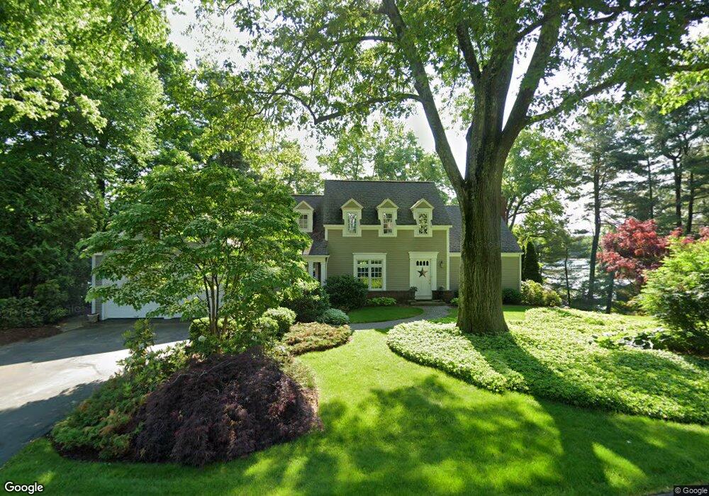
148 Woodpond Rd West Hartford, CT 06107
Estimated Value: $949,000 - $1,351,000
3
Beds
4
Baths
2,373
Sq Ft
$462/Sq Ft
Est. Value
About This Home
This home is located at 148 Woodpond Rd, West Hartford, CT 06107 and is currently estimated at $1,096,711, approximately $462 per square foot. 148 Woodpond Rd is a home located in Hartford County with nearby schools including East Farms School, West Woods Upper Elementary School, and Irving A. Robbins Middle School.
Ownership History
Date
Name
Owned For
Owner Type
Purchase Details
Closed on
Feb 16, 1994
Sold by
Wheeler G Roger and Wheeler Virginia L
Bought by
Ryan George A and Ryan Patricia D
Current Estimated Value
Home Financials for this Owner
Home Financials are based on the most recent Mortgage that was taken out on this home.
Original Mortgage
$120,000
Interest Rate
7.18%
Mortgage Type
Unknown
Create a Home Valuation Report for This Property
The Home Valuation Report is an in-depth analysis detailing your home's value as well as a comparison with similar homes in the area
Home Values in the Area
Average Home Value in this Area
Purchase History
| Date | Buyer | Sale Price | Title Company |
|---|---|---|---|
| Ryan George A | $350,000 | -- |
Source: Public Records
Mortgage History
| Date | Status | Borrower | Loan Amount |
|---|---|---|---|
| Closed | Ryan George A | $120,000 |
Source: Public Records
Tax History Compared to Growth
Tax History
| Year | Tax Paid | Tax Assessment Tax Assessment Total Assessment is a certain percentage of the fair market value that is determined by local assessors to be the total taxable value of land and additions on the property. | Land | Improvement |
|---|---|---|---|---|
| 2025 | $15,628 | $587,090 | $360,430 | $226,660 |
| 2024 | $14,941 | $587,090 | $360,430 | $226,660 |
| 2023 | $14,213 | $587,090 | $360,430 | $226,660 |
| 2022 | $15,377 | $524,450 | $360,420 | $164,030 |
| 2021 | $15,109 | $524,450 | $360,420 | $164,030 |
| 2020 | $14,669 | $524,450 | $360,420 | $164,030 |
| 2019 | $14,669 | $524,450 | $360,420 | $164,030 |
| 2018 | $14,255 | $524,450 | $360,420 | $164,030 |
| 2017 | $15,643 | $586,320 | $378,510 | $207,810 |
| 2016 | $15,115 | $586,320 | $378,510 | $207,810 |
| 2015 | $14,664 | $586,320 | $378,510 | $207,810 |
| 2014 | $14,329 | $586,310 | $378,490 | $207,820 |
Source: Public Records
Map
Nearby Homes
- 7 Brookmoor Rd
- 9 Brookmoor Rd
- 61 Waterside Ln
- 26 Garland Rd
- 236 Ridgewood Rd
- 42 Fairwood Farms Dr
- 29 Fairwood Farms Dr
- 69 Fairwood Farms Dr
- 34 Sandhurst Dr
- 32 Miles Standish Dr
- 117 Tunxis Rd
- 38 Mildred Rd
- 21 Echo Ln
- 00 Old Farm Dr
- 25 Cassandra Blvd Unit 304
- 60 Cassandra Blvd
- 73 Emily Way
- 88 Spring Ln
- 126 Westminster Dr
- 7 Buena Vista Rd
- 141 Woodpond Rd
- 152 Woodpond Rd
- 147 Woodpond Rd
- 140 Woodpond Rd
- 137 Woodpond Rd
- 162 Wood Pond Rd
- 136 Woodpond Rd
- 164 Woodpond Rd
- 159 Woodpond Rd
- 129 Woodpond Rd
- 80 Woodruff Rd
- 76 Woodruff Rd
- 68 Woodruff Rd
- 66 Woodruff Rd
- 60 Woodruff Rd
- 54 Woodruff Rd
- 52 Woodruff Rd
- 50 Woodruff Rd
- 44 Woodruff Rd
- 42 Woodruff Rd