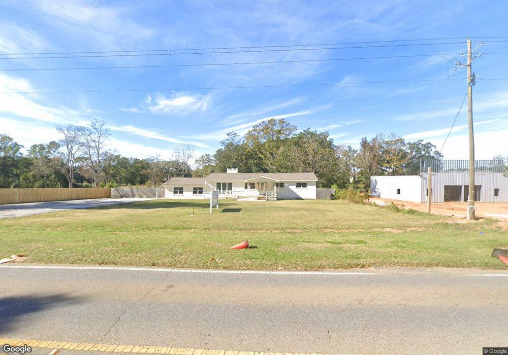
1480 Dawes Rd Mobile, AL 36695
Yorkwood NeighborhoodEstimated Value: $303,000 - $572,425
Studio
1
Bath
2,320
Sq Ft
$176/Sq Ft
Est. Value
About This Home
This home is located at 1480 Dawes Rd, Mobile, AL 36695 and is currently estimated at $407,856, approximately $175 per square foot. 1480 Dawes Rd is a home located in Mobile County with nearby schools including Elsie Collier Elementary School, Bernice J Causey Middle School, and Baker High School.
Create a Home Valuation Report for This Property
The Home Valuation Report is an in-depth analysis detailing your home's value as well as a comparison with similar homes in the area
Home Values in the Area
Average Home Value in this Area
Tax History
| Year | Tax Paid | Tax Assessment Tax Assessment Total Assessment is a certain percentage of the fair market value that is determined by local assessors to be the total taxable value of land and additions on the property. | Land | Improvement |
|---|---|---|---|---|
| 2025 | $3,714 | $76,660 | $11,460 | $65,200 |
| 2024 | $3,714 | $71,580 | $5,680 | $65,900 |
| 2023 | $2,267 | $46,740 | $5,680 | $41,060 |
Source: Public Records
Map
Nearby Homes
- 8555 the Pines of Dawes Dr
- 8565 the Pines of Dawes Dr
- 8577 the Pines of Dawes Dr
- 8601 Grelot Rd
- 0 Air Terminal Dr Unit 7717451
- 1645 Dawes Rd
- 8391 Jeff Hamilton Road Extension
- 8391 Jeff Hamilton Road Extension
- 8367 Calgary Dr S
- 8400 Kendall Ct N
- 1720 Leroy Stevens Rd
- 1350 Schillinger Rd S
- 1350 A Schillinger Rd S
- 1021 Hamilton Bridges Dr E
- 1030 Hamilton Bridges Dr E
- 8053 Stacey Rd Unit 36
- 8521 Desert Oak Ct
- 944 Parliament Ct
- 8621 Grelot Rd
- 2037 Milton Ct
- 1505 Dawes Rd
- 8459 Oak Pointe Ct
- 8449 Oak Pointe Ct
- 8439 Oak Pointe Ct
- 1521 Dawes Rd
- 8429 Oak Pointe Ct
- 1510 Dawes Rd
- 1387 Rosefield Dr E
- 1475 McKinnell Rd
- 8423 Oak Pointe Ct
- 1520 Dawes Rd
- 1535 Dawes Rd
- 8418 Oak Pointe Ct
- 1379 Rosefield Dr E
- 1540 McKinnell Rd
- 8419 Oak Pointe Ct
- 0 Air Terminal Dr Unit 227067
- 0 Air Terminal Dr Unit 226176
- 0 Air Terminal Dr Unit 244087
- 1396 Rosefield Dr
Your Personal Tour Guide
Ask me questions while you tour the home.