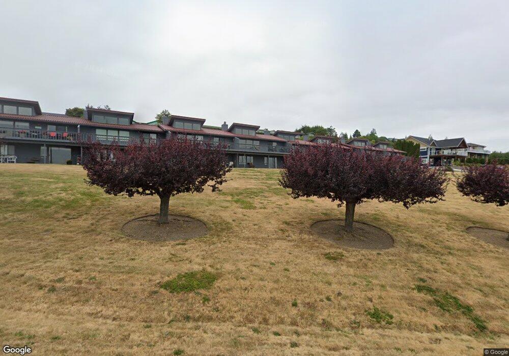
1480 Fairway Dr Unit 6 Camano Island, WA 98282
Estimated Value: $471,072 - $524,000
2
Beds
2
Baths
1,014
Sq Ft
$485/Sq Ft
Est. Value
About This Home
This home is located at 1480 Fairway Dr Unit 6, Camano Island, WA 98282 and is currently estimated at $491,518, approximately $484 per square foot. 1480 Fairway Dr Unit 6 is a home located in Island County with nearby schools including Elger Bay Elementary School, Stanwood Middle School, and Stanwood High School.
Ownership History
Date
Name
Owned For
Owner Type
Purchase Details
Closed on
Mar 25, 2015
Sold by
Howell David Lee and Howell Judith Anne Swanson
Bought by
Chow Charles and Chow Petty
Current Estimated Value
Purchase Details
Closed on
Jun 12, 2014
Sold by
Howell David L and Howell Judith Anne Swanson
Bought by
Howell David Lee and Howell Judith Anne Swanson
Purchase Details
Closed on
Aug 2, 2004
Sold by
Jennings Patricia A
Bought by
Swanson Hayden Judi and Howell David L
Create a Home Valuation Report for This Property
The Home Valuation Report is an in-depth analysis detailing your home's value as well as a comparison with similar homes in the area
Home Values in the Area
Average Home Value in this Area
Purchase History
| Date | Buyer | Sale Price | Title Company |
|---|---|---|---|
| Chow Charles | $202,000 | None Available | |
| Howell David Lee | -- | None Available | |
| Swanson Hayden Judi | $195,000 | Chicago Title Insurance Co |
Source: Public Records
Tax History Compared to Growth
Tax History
| Year | Tax Paid | Tax Assessment Tax Assessment Total Assessment is a certain percentage of the fair market value that is determined by local assessors to be the total taxable value of land and additions on the property. | Land | Improvement |
|---|---|---|---|---|
| 2024 | $3,262 | $421,494 | $180,000 | $241,494 |
| 2023 | $3,262 | $424,580 | $180,000 | $244,580 |
| 2022 | $3,154 | $404,255 | $180,000 | $224,255 |
| 2021 | $2,371 | $339,592 | $175,000 | $164,592 |
| 2020 | $2,420 | $246,106 | $85,000 | $161,106 |
| 2019 | $2,233 | $248,234 | $130,000 | $118,234 |
| 2018 | $1,982 | $229,360 | $100,000 | $129,360 |
| 2017 | $1,803 | $188,109 | $57,777 | $130,332 |
| 2016 | $1,785 | $190,054 | $57,777 | $132,277 |
| 2015 | $1,843 | $180,918 | $57,777 | $123,141 |
| 2013 | -- | $184,489 | $57,777 | $126,712 |
Source: Public Records
Map
Nearby Homes
- 1451 Sloan Place
- 1433 Crestview Dr
- 1529 Thompson Dr
- 1481 SE Camano Dr
- 1490 Country Club Dr
- 1345 Rainbow Ln
- 1267 Beach Dr
- 1273 SE Camano Dr
- 1681 S East Camano Dr
- 1235 View St
- 0 Noble Fir Ln Unit NWM2377874
- 1237 SE Camano Dr
- 174 E Dry Lake Rd
- 1672 Aspen Dr
- 1215 S East Camano Dr
- 1655 Vine Maple Ln
- 1583 Silver Fir Dr
- 1863 Lake Dr
- 0 NHN S Silver Fir Dr
- 38 E Dry Lake Rd
- 1480 Fairway Dr Unit 7
- 1480 Fairway Dr
- 1480 Fairway Dr Unit 8
- 1480 Fairway Dr Unit 1
- 1480 Fairway Dr Unit 2
- 1480 Fairway Dr Unit 5
- 1480 Fairway Dr Unit 4
- 1480 Fairway Dr Unit 3
- 1480 S Fairway Dr Unit 7
- 1450 S Sloan Place
- 1473 Crestview Dr
- 1479 Crestview Dr
- 1485 Crestview Dr
- 1461 Crestview Dr
- 1479 Thompson Dr
- 1467 Fairway Dr
- 1467 Crestview Dr
- 1489 Crestview Dr
- 1457 Crestview Dr
- 1492 Thompson Dr