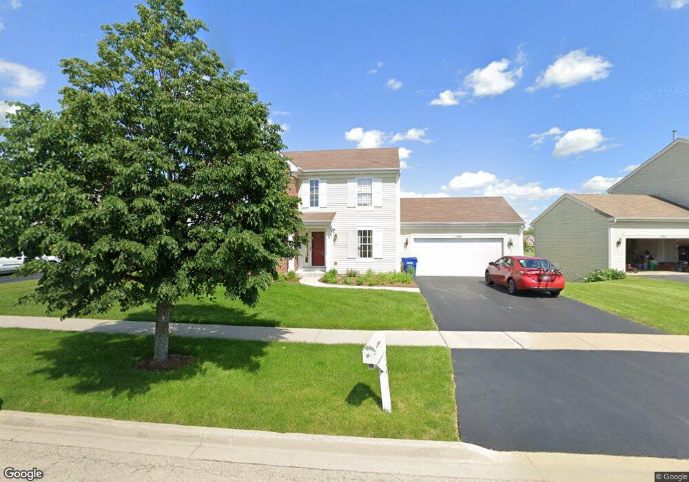
1480 Farmstead Ln Dekalb, IL 60115
Estimated Value: $295,984 - $361,000
--
Bed
--
Bath
--
Sq Ft
9,583
Sq Ft Lot
About This Home
This home is located at 1480 Farmstead Ln, Dekalb, IL 60115 and is currently estimated at $342,246. 1480 Farmstead Ln is a home located in DeKalb County with nearby schools including Malta Elementary School, Huntley Middle School, and De Kalb High School.
Ownership History
Date
Name
Owned For
Owner Type
Purchase Details
Closed on
Aug 22, 2024
Sold by
Rey Eva E and Rey Daniel J
Bought by
Rey Eva E
Current Estimated Value
Purchase Details
Closed on
Mar 2, 2006
Sold by
Wiseman Hughes Enterprises Inc
Bought by
Rey Daniel J and Rey Eva E
Home Financials for this Owner
Home Financials are based on the most recent Mortgage that was taken out on this home.
Original Mortgage
$214,400
Interest Rate
6.2%
Mortgage Type
New Conventional
Create a Home Valuation Report for This Property
The Home Valuation Report is an in-depth analysis detailing your home's value as well as a comparison with similar homes in the area
Home Values in the Area
Average Home Value in this Area
Purchase History
| Date | Buyer | Sale Price | Title Company |
|---|---|---|---|
| Rey Eva E | -- | None Listed On Document | |
| Rey Daniel J | $271,000 | -- |
Source: Public Records
Mortgage History
| Date | Status | Borrower | Loan Amount |
|---|---|---|---|
| Previous Owner | Rey Daniel J | $214,400 |
Source: Public Records
Tax History Compared to Growth
Tax History
| Year | Tax Paid | Tax Assessment Tax Assessment Total Assessment is a certain percentage of the fair market value that is determined by local assessors to be the total taxable value of land and additions on the property. | Land | Improvement |
|---|---|---|---|---|
| 2024 | $6,991 | $92,055 | $14,647 | $77,408 |
| 2023 | $6,991 | $80,264 | $12,771 | $67,493 |
| 2022 | $6,799 | $73,281 | $14,575 | $58,706 |
| 2021 | $6,942 | $68,731 | $13,670 | $55,061 |
| 2020 | $7,088 | $67,635 | $13,452 | $54,183 |
| 2019 | $6,921 | $64,977 | $12,923 | $52,054 |
| 2018 | $6,734 | $62,774 | $12,485 | $50,289 |
| 2017 | $6,769 | $60,342 | $12,001 | $48,341 |
| 2016 | $6,675 | $58,819 | $11,698 | $47,121 |
| 2015 | -- | $55,732 | $11,084 | $44,648 |
| 2014 | -- | $56,449 | $16,039 | $40,410 |
| 2013 | -- | $60,950 | $16,848 | $44,102 |
Source: Public Records
Map
Nearby Homes
- 1563 Farmstead Ln
- 664 Magnolia St
- 685 Persimmon St
- 1723 Goldenrod Turn
- 1548 Moluf St
- 1734 Sunglow Ln
- 1692 Furrow St
- 1663 Furrow St
- 451 Thresher St
- 476 Thresher St
- 643 Plum St
- 1289 Ivy St
- 399 Bantam St
- 356 Ash Ct
- 1143 Quail Run
- 910 Dawn Ct
- 1133 Golf Ct
- 1177 Golf Ct
- 1232 Bellevue Dr Unit 1
- 752 Kensington Blvd
- 1482 Farmstead Ln
- 1478 Farmstead Ln
- 1484 Farmstead Ln
- 1508 Grange Rd
- 1481 Farmstead Ln
- 1483 Farmstead Ln
- 1486 Farmstead Ln
- 550 Horizon Ln
- 1522 Grange Rd
- 1487 Farmstead Ln
- 1488 Farmstead Ln
- 634 Grange Ct
- 538 Horizon Ln
- 1534 Grange Rd
- 601 Magnolia St
- 593 Magnolia St
- 612 Grange Ct
- 617 Magnolia St
- 1491 Farmstead Ln
- 1521 Grange Rd