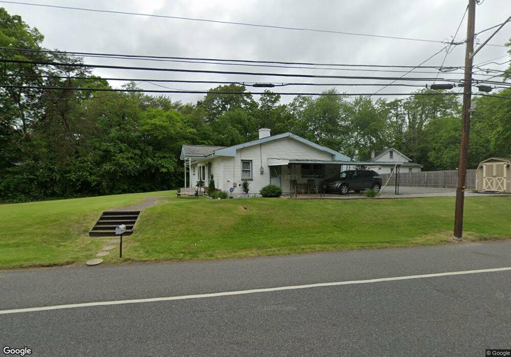
1480 Hurffville Rd Woodbury, NJ 08096
Deptford Township NeighborhoodEstimated Value: $258,340 - $302,000
--
Bed
--
Bath
1,260
Sq Ft
$223/Sq Ft
Est. Value
About This Home
This home is located at 1480 Hurffville Rd, Woodbury, NJ 08096 and is currently estimated at $281,335, approximately $223 per square foot. 1480 Hurffville Rd is a home located in Gloucester County with nearby schools including Deptford Township High School and St. Teresa Regional School.
Ownership History
Date
Name
Owned For
Owner Type
Purchase Details
Closed on
Aug 20, 2001
Sold by
Lopane Joseph A
Bought by
Lopane Joseph A and Lopane Adam
Current Estimated Value
Purchase Details
Closed on
May 25, 2000
Sold by
Palumbo Barbara
Bought by
Lopane Joseph A
Home Financials for this Owner
Home Financials are based on the most recent Mortgage that was taken out on this home.
Original Mortgage
$50,400
Interest Rate
8.28%
Mortgage Type
Stand Alone First
Create a Home Valuation Report for This Property
The Home Valuation Report is an in-depth analysis detailing your home's value as well as a comparison with similar homes in the area
Home Values in the Area
Average Home Value in this Area
Purchase History
| Date | Buyer | Sale Price | Title Company |
|---|---|---|---|
| Lopane Joseph A | -- | -- | |
| Lopane Joseph A | -- | -- | |
| Lopane Joseph A | $63,000 | -- |
Source: Public Records
Mortgage History
| Date | Status | Borrower | Loan Amount |
|---|---|---|---|
| Previous Owner | Lopane Joseph A | $50,400 |
Source: Public Records
Tax History Compared to Growth
Tax History
| Year | Tax Paid | Tax Assessment Tax Assessment Total Assessment is a certain percentage of the fair market value that is determined by local assessors to be the total taxable value of land and additions on the property. | Land | Improvement |
|---|---|---|---|---|
| 2025 | $4,607 | $128,500 | $27,500 | $101,000 |
| 2024 | $4,459 | $128,500 | $27,500 | $101,000 |
| 2023 | $4,459 | $128,500 | $27,500 | $101,000 |
| 2022 | $4,427 | $128,500 | $27,500 | $101,000 |
| 2021 | $4,064 | $128,500 | $27,500 | $101,000 |
| 2020 | $4,314 | $128,500 | $27,500 | $101,000 |
| 2019 | $4,232 | $128,500 | $27,500 | $101,000 |
| 2018 | $4,136 | $128,500 | $27,500 | $101,000 |
| 2017 | $4,026 | $128,500 | $27,500 | $101,000 |
| 2016 | $3,944 | $128,500 | $27,500 | $101,000 |
| 2015 | $3,822 | $128,500 | $27,500 | $101,000 |
| 2014 | $3,723 | $128,500 | $27,500 | $101,000 |
Source: Public Records
Map
Nearby Homes
- 0 Summit Ave
- 434 Summit Ave
- 1924 Rosemore Ave
- 1918 Point Pleasant Ave
- 427 Fern Ave
- 429 Fern Ave
- 1515 Hurffville Rd
- 432 Oak Ave
- 439 Pine Ave
- 1832 County House Rd
- 415 Rankin Ave
- 436 Rankin Ave
- 529 Mcnaughton Ave
- 571 Almonesson Rd
- 0 Ethel Ave
- 28 Hemlock Dr
- 0 1st Ave Unit NJGL2036888
- 47 Jones Ave
- 747 -745 Valley Green Ave
- 137 Treeline Dr
- 1481 Hurffville Rd
- 2006 Pasadena Ave
- 1470 Hurffville Rd
- 1930 Pasadena Ave
- 2009 Asbury Ave
- 1931 Asbury Ave
- 1484 Hurffville Rd
- 2006 Asbury Ave
- 1473 Hurffville Rd
- 1935 Manhassett Ave
- 1947 Pasadena Ave
- 1925 Asbury Ave
- 2008 Pasadena Ave
- 2010 Asbury Ave
- 363 Summit Ave
- 1941 Pasadena Ave
- 1920 Pasadena Ave
- 1917 Asbury Ave
- 1466 Hurffville Rd
- 1929 Pasadena Ave