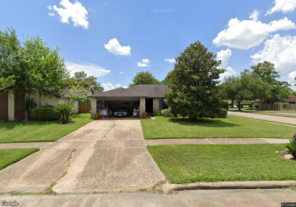
14802 S Silver Green Dr Houston, TX 77015
Estimated Value: $205,000 - $217,000
3
Beds
2
Baths
1,383
Sq Ft
$153/Sq Ft
Est. Value
About This Home
This home is located at 14802 S Silver Green Dr, Houston, TX 77015 and is currently estimated at $211,167, approximately $152 per square foot. 14802 S Silver Green Dr is a home located in Harris County with nearby schools including James B. Havard Elementary School, Cobb 6th Grade Campus, and North Shore Middle School.
Ownership History
Date
Name
Owned For
Owner Type
Purchase Details
Closed on
Feb 17, 1997
Sold by
Branch Pamelam Denise
Bought by
Branch Royce
Current Estimated Value
Purchase Details
Closed on
Nov 29, 1994
Sold by
Denson Ray
Bought by
Branch Pamela D
Home Financials for this Owner
Home Financials are based on the most recent Mortgage that was taken out on this home.
Original Mortgage
$55,930
Interest Rate
8.8%
Purchase Details
Closed on
Sep 27, 1994
Sold by
Beyer Donald G and Beyer Mary Lou
Bought by
Denson Dr Ray
Create a Home Valuation Report for This Property
The Home Valuation Report is an in-depth analysis detailing your home's value as well as a comparison with similar homes in the area
Home Values in the Area
Average Home Value in this Area
Purchase History
| Date | Buyer | Sale Price | Title Company |
|---|---|---|---|
| Branch Royce | -- | -- | |
| Branch Pamela D | -- | Fidelity National Title | |
| Denson Dr Ray | -- | Fidelity National Title |
Source: Public Records
Mortgage History
| Date | Status | Borrower | Loan Amount |
|---|---|---|---|
| Previous Owner | Branch Pamela D | $55,930 |
Source: Public Records
Tax History Compared to Growth
Tax History
| Year | Tax Paid | Tax Assessment Tax Assessment Total Assessment is a certain percentage of the fair market value that is determined by local assessors to be the total taxable value of land and additions on the property. | Land | Improvement |
|---|---|---|---|---|
| 2025 | $463 | $188,829 | $42,791 | $146,038 |
| 2024 | $463 | $201,871 | $42,791 | $159,080 |
| 2023 | $463 | $209,435 | $42,791 | $166,644 |
| 2022 | $3,402 | $173,028 | $42,791 | $130,237 |
| 2021 | $3,404 | $154,030 | $42,791 | $111,239 |
| 2020 | $3,323 | $125,954 | $42,791 | $83,163 |
| 2019 | $3,201 | $116,489 | $42,791 | $73,698 |
| 2018 | $464 | $108,073 | $31,501 | $76,572 |
| 2017 | $2,692 | $90,252 | $19,688 | $70,564 |
| 2016 | $2,447 | $90,252 | $19,688 | $70,564 |
| 2015 | $888 | $73,042 | $10,829 | $62,213 |
| 2014 | $888 | $68,518 | $10,829 | $57,689 |
Source: Public Records
Map
Nearby Homes
- 1423 Seafield Dr
- 1303 Sterling Green Ct
- 14808 Welbeck Dr
- 14806 Beaconsfield Dr
- 14918 Silver Green Dr S
- 14835 Scotter Dr
- 1346 Castle Glen Dr
- 1342 Castle Glen Dr
- 1323 Padstow Ln
- 14951 Scotter Dr
- 14854 Shottery Dr
- 14847 Shottery Dr
- 1610 Evesham Dr
- 14807 Shottery Dr
- 1343 Littleport Ln
- 14615 Woodmaple Ct
- 909 Pennygent Ln
- 1102 Heathfield Dr
- 1915 Aldates Dr
- 111 Ambershadow Dr
- 14806 S Silver Green Dr
- 14898 Easingwold Dr
- 14894 Easingwold Dr
- 14810 S Silver Green Dr
- 14714 S Silver Green Dr
- 14890 Easingwold Dr
- 14902 Easingwold Dr
- 14814 S Silver Green Dr
- 14886 Easingwold Dr
- 14710 S Silver Green Dr
- 14906 Easingwold Dr
- 14882 Easingwold Dr
- 14895 Easingwold Dr
- 14899 Easingwold Dr
- 14706 S Silver Green Dr
- 14910 Easingwold Dr
- 14891 Easingwold Dr
- 14887 Easingwold Dr
- 14903 Easingwold Dr
- 14878 Easingwold Dr