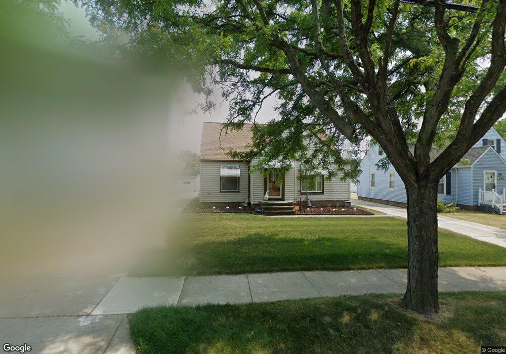
14808 Rockside Rd Maple Heights, OH 44137
Estimated Value: $102,000 - $125,000
2
Beds
1
Bath
868
Sq Ft
$131/Sq Ft
Est. Value
About This Home
This home is located at 14808 Rockside Rd, Maple Heights, OH 44137 and is currently estimated at $113,603, approximately $130 per square foot. 14808 Rockside Rd is a home located in Cuyahoga County with nearby schools including Abraham Lincoln Elementary School, Rockside/ J.F. Kennedy School, and Barack Obama School.
Ownership History
Date
Name
Owned For
Owner Type
Purchase Details
Closed on
Aug 1, 1975
Sold by
Pillar Michael E and K A
Bought by
Meyers John J
Current Estimated Value
Purchase Details
Closed on
Jan 1, 1975
Bought by
Pillar Michael E and K A
Create a Home Valuation Report for This Property
The Home Valuation Report is an in-depth analysis detailing your home's value as well as a comparison with similar homes in the area
Home Values in the Area
Average Home Value in this Area
Purchase History
| Date | Buyer | Sale Price | Title Company |
|---|---|---|---|
| Meyers John J | $32,000 | -- | |
| Pillar Michael E | -- | -- |
Source: Public Records
Tax History
| Year | Tax Paid | Tax Assessment Tax Assessment Total Assessment is a certain percentage of the fair market value that is determined by local assessors to be the total taxable value of land and additions on the property. | Land | Improvement |
|---|---|---|---|---|
| 2025 | $2,166 | $36,575 | $5,880 | $30,695 |
| 2024 | $2,432 | $36,575 | $5,880 | $30,695 |
| 2023 | $1,522 | $22,860 | $4,900 | $17,960 |
| 2022 | $1,555 | $22,860 | $4,900 | $17,960 |
| 2021 | $1,654 | $22,860 | $4,900 | $17,960 |
| 2020 | $1,197 | $17,330 | $3,710 | $13,620 |
| 2019 | $1,183 | $49,500 | $10,600 | $38,900 |
| 2018 | $1,113 | $17,330 | $3,710 | $13,620 |
| 2017 | $1,137 | $16,800 | $3,010 | $13,790 |
| 2016 | $1,094 | $16,800 | $3,010 | $13,790 |
| 2015 | $1,061 | $16,800 | $3,010 | $13,790 |
| 2014 | $1,061 | $17,330 | $3,120 | $14,210 |
Source: Public Records
Map
Nearby Homes
- 14808 James Ave
- 14320 Janice Dr
- 14012 Wheeler Rd
- 5948 Dunham Rd
- 14203 Tabor Ave
- 13804 Rockside Rd
- 14413 Krems Ave
- 5853 Monica Ln
- 14112 Krems Ave
- 13905 Thraves Ave
- 15800 Northwood Ave
- 6045 Dunham Rd
- 13810 Martin Dr
- 15313 Fernway Dr
- 13800 Milo Rd
- 14956 Carol Dr
- 6089 Dunham Rd
- 6039 E 135th St
- 14357 Turney Rd
- 15401 Walvern Blvd
- 14846 Rockside Rd
- 14850 Rockside Rd
- 14716 Rockside Rd
- 14613 Wheeler Rd
- 14609 Wheeler Rd
- 14617 Wheeler Rd
- 14900 Rockside Rd
- 14605 Wheeler Rd
- 14701 Wheeler Rd
- 14601 Wheeler Rd
- 14705 Wheeler Rd
- 14708 Rockside Rd
- 14908 Rockside Rd
- 14805 Rockside Rd
- 14801 Rockside Rd
- 14809 Rockside Rd
- 14813 Rockside Rd
- 14721 Rockside Rd
- 14709 Wheeler Rd
- 14517 Wheeler Rd
Your Personal Tour Guide
Ask me questions while you tour the home.