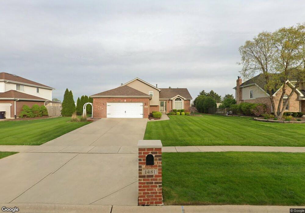
1481 Edmond Ave New Lenox, IL 60451
Estimated Value: $395,030 - $518,000
--
Bed
--
Bath
--
Sq Ft
0.43
Acres
About This Home
This home is located at 1481 Edmond Ave, New Lenox, IL 60451 and is currently estimated at $452,758. 1481 Edmond Ave is a home located in Will County with nearby schools including Oster-Oakview School, Haines Elementary School, and Lincoln Way West.
Ownership History
Date
Name
Owned For
Owner Type
Purchase Details
Closed on
May 5, 2013
Sold by
Drenth Calvin E and Drenth Alice
Bought by
Drenth Calvin E and Drenth Alice
Current Estimated Value
Purchase Details
Closed on
Dec 14, 2001
Sold by
Nlsb
Bought by
Drenth Calvin E and Drenth Alice
Home Financials for this Owner
Home Financials are based on the most recent Mortgage that was taken out on this home.
Original Mortgage
$45,000
Outstanding Balance
$15,560
Interest Rate
6.87%
Estimated Equity
$437,198
Create a Home Valuation Report for This Property
The Home Valuation Report is an in-depth analysis detailing your home's value as well as a comparison with similar homes in the area
Home Values in the Area
Average Home Value in this Area
Purchase History
| Date | Buyer | Sale Price | Title Company |
|---|---|---|---|
| Drenth Calvin E | -- | None Available | |
| Drenth Calvin E | $213,000 | Chicago Title Insurance Co |
Source: Public Records
Mortgage History
| Date | Status | Borrower | Loan Amount |
|---|---|---|---|
| Open | Drenth Calvin E | $45,000 |
Source: Public Records
Tax History Compared to Growth
Tax History
| Year | Tax Paid | Tax Assessment Tax Assessment Total Assessment is a certain percentage of the fair market value that is determined by local assessors to be the total taxable value of land and additions on the property. | Land | Improvement |
|---|---|---|---|---|
| 2024 | $6,031 | $130,505 | $36,940 | $93,565 |
| 2023 | $6,031 | $118,966 | $33,674 | $85,292 |
| 2022 | $6,863 | $109,596 | $31,022 | $78,574 |
| 2021 | $6,952 | $103,071 | $29,175 | $73,896 |
| 2020 | $7,019 | $99,393 | $28,134 | $71,259 |
| 2019 | $6,946 | $96,311 | $27,262 | $69,049 |
| 2018 | $7,043 | $92,992 | $26,323 | $66,669 |
| 2017 | $6,904 | $90,318 | $25,566 | $64,752 |
| 2016 | $6,688 | $87,901 | $24,882 | $63,019 |
| 2015 | $6,453 | $85,134 | $24,099 | $61,035 |
| 2014 | $6,453 | $84,082 | $23,801 | $60,281 |
| 2013 | $6,453 | $85,216 | $24,122 | $61,094 |
Source: Public Records
Map
Nearby Homes
- 208 Redwood Ave
- 200 Redwood Ave
- 1261 S Regan Rd
- 807 Picardy Place
- 1920 Edmonds Ave
- 1344 N Cedar Rd
- 133 Barbara Ln
- 224 Hauser Ct
- 154 Barbara Ln
- 217 Aspen Dr
- 13420 Florence Rd
- 12001 W Route 6
- 13621 W Maple Rd
- Lot 108 S Richard Ave
- Lot 122 S Lynn Pkwy
- 13741 Elizabeth Ln
- 1108 Plaza Dr
- 203 Fir St
- 18909 Ruth Dr
- 125 Kimber Dr
- 1463 Edmond Ave
- 1493 Edmonds Ave
- 1463 Edmonds Ave
- 1493 Edmonds Ave
- 1505 Edmond Ave
- 1445 Edmonds Ave
- 1468 Edmond Ave
- 1519 Edmonds Ave
- 1482 Edmond Ave
- 1519 Edmond Ave
- 1494 Edmond Ave
- 1494 Edmonds Ave
- 1454 Edmond Ave
- 1435 Edmonds Ave
- 1438 Edmonds Ave
- 1438 Edmonds Ave
- 1533 Edmond Ave
- 675 Lenox St
- 1425 Edmonds Ave
- 681 Lenox St