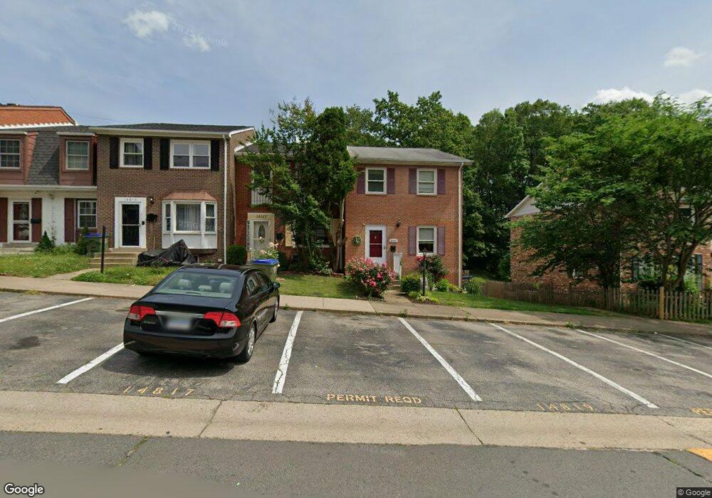
14817 Anderson Ct Woodbridge, VA 22193
Ashdale NeighborhoodEstimated Value: $371,179 - $394,000
3
Beds
1
Bath
1,296
Sq Ft
$296/Sq Ft
Est. Value
About This Home
This home is located at 14817 Anderson Ct, Woodbridge, VA 22193 and is currently estimated at $383,295, approximately $295 per square foot. 14817 Anderson Ct is a home located in Prince William County with nearby schools including Dale City Elementary School, Rippon Middle School, and Freedom High School.
Ownership History
Date
Name
Owned For
Owner Type
Purchase Details
Closed on
Mar 16, 2018
Sold by
Mckinnis Bete R
Bought by
Mckinnis Bete R and Mckinnis Kedrin J
Current Estimated Value
Purchase Details
Closed on
Mar 4, 2002
Sold by
Santamaria Luis A
Bought by
Mckinnis Bete R
Home Financials for this Owner
Home Financials are based on the most recent Mortgage that was taken out on this home.
Original Mortgage
$114,187
Interest Rate
7.05%
Mortgage Type
FHA
Purchase Details
Closed on
Aug 29, 1994
Sold by
Stibbards G H
Bought by
Santamaria Luis A
Home Financials for this Owner
Home Financials are based on the most recent Mortgage that was taken out on this home.
Original Mortgage
$79,959
Interest Rate
8.65%
Create a Home Valuation Report for This Property
The Home Valuation Report is an in-depth analysis detailing your home's value as well as a comparison with similar homes in the area
Home Values in the Area
Average Home Value in this Area
Purchase History
| Date | Buyer | Sale Price | Title Company |
|---|---|---|---|
| Mckinnis Bete R | -- | Multiple | |
| Mckinnis Bete R | $116,000 | -- | |
| Santamaria Luis A | $79,900 | -- |
Source: Public Records
Mortgage History
| Date | Status | Borrower | Loan Amount |
|---|---|---|---|
| Previous Owner | Mckinnis Bete R | $114,187 | |
| Previous Owner | Santamaria Luis A | $79,959 |
Source: Public Records
Tax History Compared to Growth
Tax History
| Year | Tax Paid | Tax Assessment Tax Assessment Total Assessment is a certain percentage of the fair market value that is determined by local assessors to be the total taxable value of land and additions on the property. | Land | Improvement |
|---|---|---|---|---|
| 2025 | $3,069 | $338,700 | $110,900 | $227,800 |
| 2024 | $3,069 | $308,600 | $100,900 | $207,700 |
| 2023 | $3,002 | $288,500 | $93,400 | $195,100 |
| 2022 | $3,006 | $271,400 | $87,300 | $184,100 |
| 2021 | $2,943 | $238,000 | $75,900 | $162,100 |
| 2020 | $3,486 | $224,900 | $71,300 | $153,600 |
| 2019 | $3,315 | $213,900 | $72,000 | $141,900 |
| 2018 | $2,417 | $200,200 | $61,400 | $138,800 |
| 2017 | $2,367 | $188,500 | $72,800 | $115,700 |
| 2016 | $2,241 | $179,800 | $70,800 | $109,000 |
| 2015 | $2,049 | $172,300 | $65,100 | $107,200 |
| 2014 | $2,049 | $160,300 | $62,600 | $97,700 |
Source: Public Records
Map
Nearby Homes
- 3017 Arkendale St
- 14809 Ashdale Ave
- 15019 Ashdale Cir
- 3206 Burbank Ln
- 14717 Barksdale St
- 14748 Barksdale St
- 14595 Charity Ct
- 14496 Aurora Dr
- 14404 Birchdale Ave
- 14657 Cloverdale Rd
- 14413 Brook Dr
- 14871 Cherrydale Dr
- 14875 Cherrydale Dr
- 14648 Bakersfield St
- 15008 Cherrydale Dr
- 15036 Cherrydale Dr
- 15187 Brazil Cir
- 15048 Cherrydale Dr
- 3188 Barbeque Place
- 3615 Felmore Ct
- 14815 Anderson Ct
- 14819 Anderson Ct
- 14813 Anderson Ct
- 14811 Anderson Ct
- 14821 Anderson Ct
- 14809 Anderson Ct
- 14823 Anderson Ct
- 14825 Anderson Ct
- 14805 Anderson Ct
- 14827 Anderson Ct
- 14803 Anderson Ct
- 14829 Anderson Ct
- 14801 Anderson Ct
- 14818 Anderson Ct
- 14816 Anderson Ct
- 14831 Anderson Ct
- 14814 Anderson Ct
- 14820 Anderson Ct
- 14812 Anderson Ct
- 14810 Anderson Ct