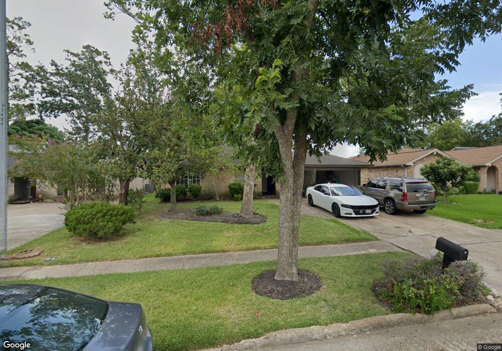
14818 Scotter Dr Houston, TX 77015
Estimated Value: $232,000 - $241,346
3
Beds
2
Baths
1,725
Sq Ft
$136/Sq Ft
Est. Value
About This Home
This home is located at 14818 Scotter Dr, Houston, TX 77015 and is currently estimated at $235,087, approximately $136 per square foot. 14818 Scotter Dr is a home located in Harris County with nearby schools including James B. Havard Elementary School, Cobb 6th Grade Campus, and North Shore Middle School.
Ownership History
Date
Name
Owned For
Owner Type
Purchase Details
Closed on
May 22, 2017
Sold by
Haigh Michael
Bought by
Aguilera Francisco and Aguilera Mirian
Current Estimated Value
Home Financials for this Owner
Home Financials are based on the most recent Mortgage that was taken out on this home.
Original Mortgage
$135,990
Outstanding Balance
$116,475
Interest Rate
5.25%
Mortgage Type
FHA
Estimated Equity
$118,612
Purchase Details
Closed on
Dec 29, 2016
Sold by
Mehringer Yvette Alayne and Guerra Yvette
Bought by
Haigh Michael
Purchase Details
Closed on
Jul 27, 1998
Sold by
Mehringer Michael Albert
Bought by
Mehringer Yvette Alayne and Guerra Yvette
Create a Home Valuation Report for This Property
The Home Valuation Report is an in-depth analysis detailing your home's value as well as a comparison with similar homes in the area
Home Values in the Area
Average Home Value in this Area
Purchase History
| Date | Buyer | Sale Price | Title Company |
|---|---|---|---|
| Aguilera Francisco | -- | Fidelity National Title | |
| Haigh Michael | -- | Fidelity National Title | |
| Mehringer Yvette Alayne | -- | -- |
Source: Public Records
Mortgage History
| Date | Status | Borrower | Loan Amount |
|---|---|---|---|
| Open | Aguilera Francisco | $135,990 |
Source: Public Records
Tax History Compared to Growth
Tax History
| Year | Tax Paid | Tax Assessment Tax Assessment Total Assessment is a certain percentage of the fair market value that is determined by local assessors to be the total taxable value of land and additions on the property. | Land | Improvement |
|---|---|---|---|---|
| 2025 | $4,053 | $225,801 | $41,208 | $184,593 |
| 2024 | $4,053 | $245,621 | $41,208 | $204,413 |
| 2023 | $4,053 | $254,970 | $41,208 | $213,762 |
| 2022 | $4,550 | $205,014 | $41,208 | $163,806 |
| 2021 | $4,553 | $180,696 | $41,208 | $139,488 |
| 2020 | $4,444 | $155,048 | $41,208 | $113,840 |
| 2019 | $4,363 | $143,640 | $41,208 | $102,432 |
| 2018 | $2,147 | $136,442 | $30,384 | $106,058 |
| 2017 | $2,676 | $86,596 | $18,990 | $67,606 |
| 2016 | $2,595 | $86,596 | $18,990 | $67,606 |
| 2015 | $1,682 | $76,875 | $10,445 | $66,430 |
| 2014 | $1,682 | $71,980 | $10,445 | $61,535 |
Source: Public Records
Map
Nearby Homes
- 14806 Beaconsfield Dr
- 1303 Sterling Green Ct
- 1342 Castle Glen Dr
- 1346 Castle Glen Dr
- 14918 Silver Green Dr S
- 331 Haymarket Ln
- 1323 Padstow Ln
- 335 Haymarket Ln
- 14615 Woodmaple Ct
- 1102 Heathfield Dr
- 14808 Welbeck Dr
- 1423 Seafield Dr
- 14510 Foxford Way
- 14515 Duncannon Dr
- 909 Pennygent Ln
- 1343 Littleport Ln
- 242 Blackwater Ln
- 14415 Wadebridge Way
- 1610 Evesham Dr
- 1123 Maclesby Ln
- 14822 Scotter Dr
- 14814 Scotter Dr
- 14831 Keelby Dr
- 14826 Scotter Dr
- 14835 Keelby Dr
- 14827 Keelby Dr
- 14839 Keelby Dr
- 14823 Keelby Dr
- 14819 Scotter Dr
- 14830 Scotter Dr
- 14823 Scotter Dr
- 14806 Scotter Dr
- 14815 Scotter Dr
- 14827 Scotter Dr
- 14843 Keelby Dr
- 14819 Keelby Dr
- 14811 Scotter Dr
- 14834 Scotter Dr
- 14831 Scotter Dr
- 14802 Scotter Dr