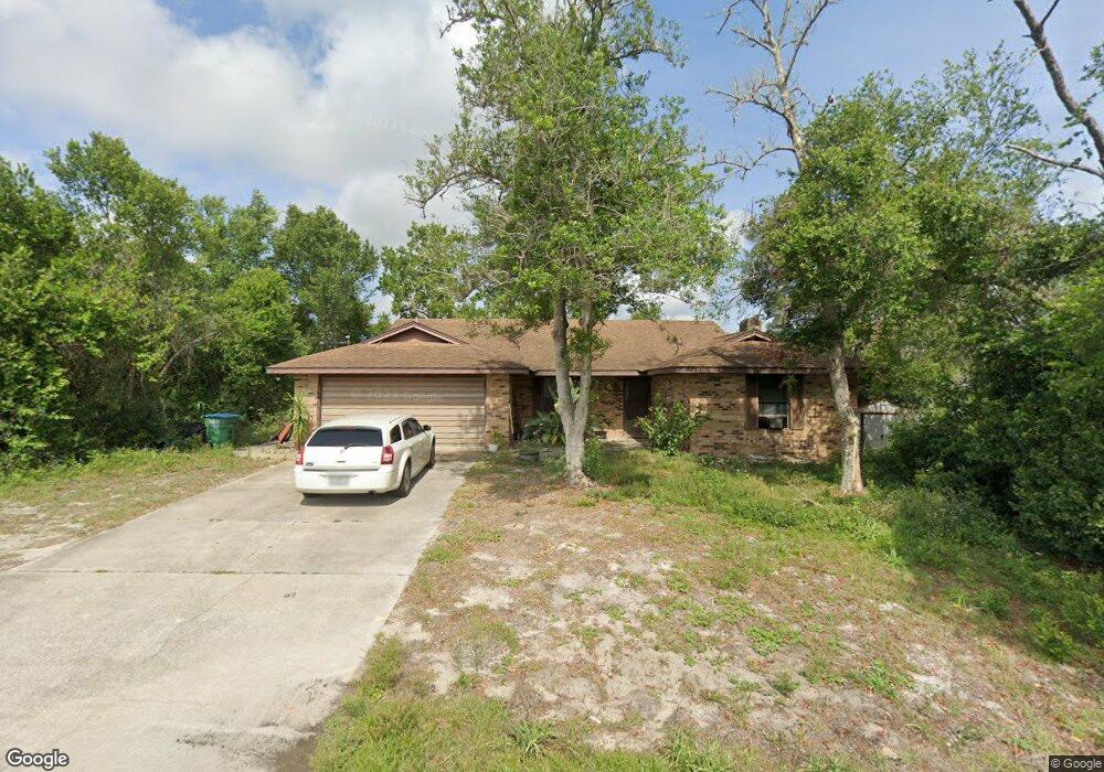
1482 Drysdale Dr Deltona, FL 32725
Estimated Value: $261,000 - $301,000
2
Beds
2
Baths
1,531
Sq Ft
$180/Sq Ft
Est. Value
About This Home
This home is located at 1482 Drysdale Dr, Deltona, FL 32725 and is currently estimated at $275,887, approximately $180 per square foot. 1482 Drysdale Dr is a home located in Volusia County with nearby schools including Deltona Lakes Elementary School, Galaxy Middle School, and Deltona High School.
Ownership History
Date
Name
Owned For
Owner Type
Purchase Details
Closed on
Jul 29, 2004
Sold by
Maharaj Saisnarine D and Maharaj Lutchmin
Bought by
Americas First Home Llp
Current Estimated Value
Purchase Details
Closed on
Jul 13, 2001
Sold by
Brooks Carol A
Bought by
Hoover Yvonne D
Home Financials for this Owner
Home Financials are based on the most recent Mortgage that was taken out on this home.
Original Mortgage
$76,600
Interest Rate
7.23%
Purchase Details
Closed on
Mar 15, 1982
Bought by
Hoover Yvonne D
Create a Home Valuation Report for This Property
The Home Valuation Report is an in-depth analysis detailing your home's value as well as a comparison with similar homes in the area
Home Values in the Area
Average Home Value in this Area
Purchase History
| Date | Buyer | Sale Price | Title Company |
|---|---|---|---|
| Americas First Home Llp | $87,000 | Exceptional Title Ii Llc | |
| Hoover Yvonne D | $79,000 | -- | |
| Hoover Yvonne D | $5,300 | -- |
Source: Public Records
Mortgage History
| Date | Status | Borrower | Loan Amount |
|---|---|---|---|
| Previous Owner | Hoover Yvonne D | $76,600 |
Source: Public Records
Tax History Compared to Growth
Tax History
| Year | Tax Paid | Tax Assessment Tax Assessment Total Assessment is a certain percentage of the fair market value that is determined by local assessors to be the total taxable value of land and additions on the property. | Land | Improvement |
|---|---|---|---|---|
| 2025 | $1,059 | $85,017 | -- | -- |
| 2024 | $1,059 | $82,621 | -- | -- |
| 2023 | $1,059 | $80,215 | $0 | $0 |
| 2022 | $1,030 | $77,879 | $0 | $0 |
| 2021 | $1,029 | $75,611 | $0 | $0 |
| 2020 | $1,018 | $74,567 | $0 | $0 |
| 2019 | $1,036 | $72,891 | $0 | $0 |
| 2018 | $1,027 | $71,532 | $0 | $0 |
| 2017 | $1,015 | $70,061 | $0 | $0 |
| 2016 | $1,003 | $68,620 | $0 | $0 |
| 2015 | $1,024 | $68,143 | $0 | $0 |
| 2014 | $1,001 | $67,602 | $0 | $0 |
Source: Public Records
Map
Nearby Homes
- 1962 La Rue Ave
- 1969 Eden Dr
- 1979 Lindhurst Ave
- 1594 Monica St
- 2055 E Prairie Cir
- 1336 Star Ct
- 1322 Belmar Terrace
- 1811 Oakgrove Ave
- 1302 Belmar Terrace
- 1266 Gladstone Dr
- 1564 Monticello St
- 1618 Airmont Ave
- 1694 April Ave
- 1653 Huntington St
- 1217 Gladstone Dr
- 1725 Hernando Ave
- 1857 E Cooper Dr
- 1977 S Old Mill Dr
- 1757 W Acadian Dr
- 0 Central Pkwy Unit MFRV4938346
- 1501 Elkcam Blvd
- 1474 Drysdale Dr
- 1495 Elkcam Blvd
- 1481 Drysdale Dr
- 0 Dill Ct
- 1473 Drysdale Dr
- 2001 Dixie Belle Ave
- 1521 Elkcam Blvd
- 1489 Elkcam Blvd
- 1465 Drysdale Dr
- 1488 Elkcam Blvd
- 1527 Elkcam Blvd
- 1954 La Rue Ave
- 2007 Dixie Belle Ave
- 1457 Drysdale Dr
- 1470 Dill Ct
- 1533 Elkcam Blvd
- 1450 Drysdale Dr
- 1482 Elkcam Blvd
- 1477 Elkcam Blvd Unit 9