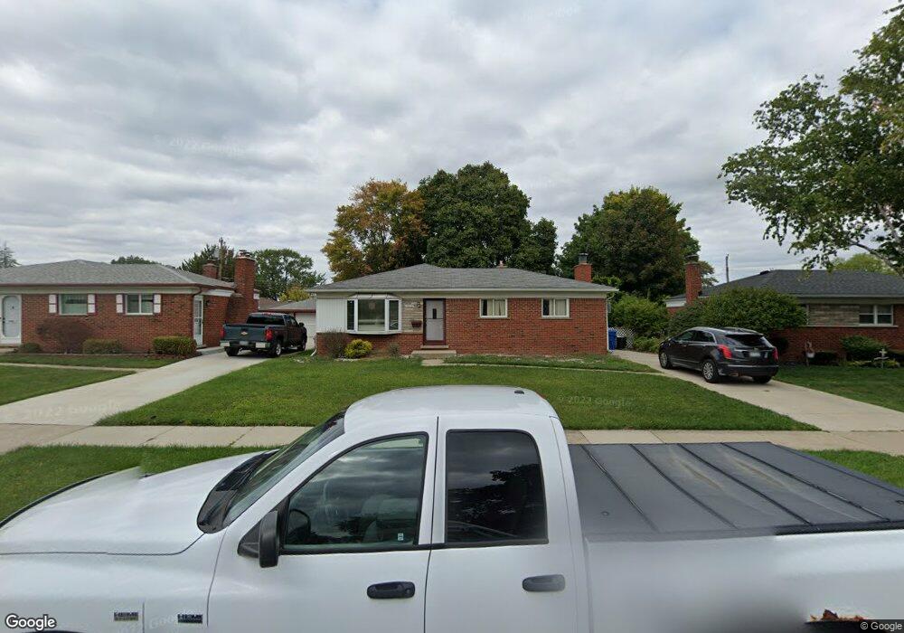
14829 Murthum Ave Warren, MI 48088
Northeast Warren NeighborhoodEstimated Value: $236,951 - $269,000
--
Bed
2
Baths
1,321
Sq Ft
$190/Sq Ft
Est. Value
About This Home
This home is located at 14829 Murthum Ave, Warren, MI 48088 and is currently estimated at $251,238, approximately $190 per square foot. 14829 Murthum Ave is a home located in Macomb County with nearby schools including Wilde Elementary School, Carter Middle School, and Paul K. Cousino High School.
Ownership History
Date
Name
Owned For
Owner Type
Purchase Details
Closed on
May 30, 2023
Sold by
Miller Ronald George
Bought by
Mcdonald Patrick J
Current Estimated Value
Home Financials for this Owner
Home Financials are based on the most recent Mortgage that was taken out on this home.
Original Mortgage
$177,299
Outstanding Balance
$172,558
Interest Rate
6.39%
Mortgage Type
FHA
Estimated Equity
$78,680
Purchase Details
Closed on
Aug 9, 2021
Sold by
Miller Ronald George and Miller Mildred E
Bought by
Miller Ronald George and Miller Mildred E
Create a Home Valuation Report for This Property
The Home Valuation Report is an in-depth analysis detailing your home's value as well as a comparison with similar homes in the area
Home Values in the Area
Average Home Value in this Area
Purchase History
| Date | Buyer | Sale Price | Title Company |
|---|---|---|---|
| Mcdonald Patrick J | $205,000 | First Premier Title | |
| Miller Ronald George | -- | None Available |
Source: Public Records
Mortgage History
| Date | Status | Borrower | Loan Amount |
|---|---|---|---|
| Open | Mcdonald Patrick J | $177,299 |
Source: Public Records
Tax History Compared to Growth
Tax History
| Year | Tax Paid | Tax Assessment Tax Assessment Total Assessment is a certain percentage of the fair market value that is determined by local assessors to be the total taxable value of land and additions on the property. | Land | Improvement |
|---|---|---|---|---|
| 2025 | $3,005 | $120,630 | $0 | $0 |
| 2024 | $2,920 | $110,600 | $0 | $0 |
| 2023 | $2,768 | $100,220 | $0 | $0 |
| 2022 | $2,674 | $87,650 | $0 | $0 |
| 2021 | $2,721 | $82,860 | $0 | $0 |
| 2020 | $2,624 | $80,010 | $0 | $0 |
| 2019 | $2,530 | $74,940 | $0 | $0 |
| 2018 | $72 | $66,910 | $0 | $0 |
| 2017 | $2,537 | $61,370 | $9,910 | $51,460 |
| 2016 | $2,534 | $61,370 | $0 | $0 |
| 2015 | -- | $53,980 | $0 | $0 |
| 2012 | -- | $44,080 | $0 | $0 |
Source: Public Records
Map
Nearby Homes
- 32334 Gloede Dr
- 14717 Colpaert Dr
- 14646 Murthum Ave
- 32717 Beechwood Dr
- 31707 Gloede Dr
- 14514 Peck Dr
- 31341 Hayes Rd
- 31263 Hayes Rd
- 15621 Lauren
- 13842 Jenny Dr
- 33333 Groth Dr
- 13863 Colpaert Dr
- 15668 Masonic
- 33042 Mccoy Dr
- 13738 Jenny Dr
- 33076 Mccoy Dr
- 31070 Hayes Rd
- 33555 Groth Dr
- 33511 Swan Dr
- 33125 Mazara
- 14817 Murthum Ave
- 14841 Murthum Ave
- 14853 Murthum Ave
- 14805 Murthum Ave
- 14738 Jenny Dr
- 14750 Jenny Dr
- 14726 Jenny Dr
- 14714 Jenny Dr
- 14762 Jenny Dr
- 14907 Murthum Ave
- 14751 Murthum Ave
- 14824 Murthum Ave
- 14836 Murthum Ave
- 14812 Murthum Ave
- 14702 Jenny Dr
- 14848 Murthum Ave
- 14810 Jenny Dr
- 14919 Murthum Ave
- 14739 Murthum Ave
- 14902 Murthum Ave