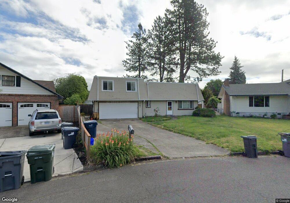
1483 Bar M Dr Eugene, OR 97401
Harlow NeighborhoodEstimated Value: $453,000 - $503,268
4
Beds
3
Baths
1,537
Sq Ft
$317/Sq Ft
Est. Value
About This Home
This home is located at 1483 Bar M Dr, Eugene, OR 97401 and is currently estimated at $487,317, approximately $317 per square foot. 1483 Bar M Dr is a home located in Lane County with nearby schools including Holt Elementary School, Monroe Middle School, and Sheldon High School.
Ownership History
Date
Name
Owned For
Owner Type
Purchase Details
Closed on
Oct 16, 2023
Sold by
Sifuentez Eduardo R
Bought by
Sifuentez Joint Trust and Sifuentez
Current Estimated Value
Purchase Details
Closed on
Sep 18, 2008
Sold by
Yeager Robert L and Yeager Mary Sue
Bought by
Sifuentez Eduardo and Sifuentez Angelina
Home Financials for this Owner
Home Financials are based on the most recent Mortgage that was taken out on this home.
Original Mortgage
$160,000
Interest Rate
6.51%
Mortgage Type
Purchase Money Mortgage
Create a Home Valuation Report for This Property
The Home Valuation Report is an in-depth analysis detailing your home's value as well as a comparison with similar homes in the area
Home Values in the Area
Average Home Value in this Area
Purchase History
| Date | Buyer | Sale Price | Title Company |
|---|---|---|---|
| Sifuentez Joint Trust | -- | None Listed On Document | |
| Sifuentez Eduardo | $200,000 | Western Title |
Source: Public Records
Mortgage History
| Date | Status | Borrower | Loan Amount |
|---|---|---|---|
| Previous Owner | Sifuentez Eduardo | $160,000 |
Source: Public Records
Tax History
| Year | Tax Paid | Tax Assessment Tax Assessment Total Assessment is a certain percentage of the fair market value that is determined by local assessors to be the total taxable value of land and additions on the property. | Land | Improvement |
|---|---|---|---|---|
| 2025 | $4,415 | $226,585 | -- | -- |
| 2024 | $4,360 | $219,986 | -- | -- |
| 2023 | $4,360 | $213,579 | $0 | $0 |
| 2022 | $4,084 | $207,359 | $0 | $0 |
| 2021 | $3,836 | $201,320 | $0 | $0 |
| 2020 | $3,850 | $195,457 | $0 | $0 |
| 2019 | $3,718 | $189,765 | $0 | $0 |
| 2018 | $3,500 | $178,872 | $0 | $0 |
| 2017 | $3,343 | $178,872 | $0 | $0 |
| 2016 | $3,260 | $173,662 | $0 | $0 |
| 2015 | $3,167 | $168,604 | $0 | $0 |
| 2014 | $3,103 | $163,693 | $0 | $0 |
Source: Public Records
Map
Nearby Homes
- 0 Sprig Ln Unit Lot 3
- 0 Sprig Ln Unit Lot 3 766109892
- 2956 Willakenzie Rd
- 1491 Victorian Way
- 1564 Regency Dr
- 1630 Ridgley Blvd
- 1271 Arcadia Dr
- 2580 Elysium Ave
- 825 Waverly St
- 1090 Corydon St
- 950 Coburg Rd
- 2577 Elysium Ave
- 3700 Babcock Ln Unit 106
- 2495 Jeppesen Acres Rd
- 2872 Suffolk Ct
- 2746 Harlow Rd
- 2345 Pioneer Pike
- 2420 Willona Dr
- 600 Cherry Dr Unit 8
- 600 Cherry Dr Unit 3
- 1495 Bar M Dr
- 1479 Bar M Dr
- 1486 Martingale St
- 1488 Martingale St
- 1509 Bar M Dr
- 1480 Martingale St
- 1465 Bar M Dr
- 1500 Martingale St
- 1506 Martingale St
- 1508 Bar M Dr
- 1496 Martingale St
- 1510 Martingale St
- 1452 Martingale St
- 1523 Bar M Dr
- 1520 Martingale St
- 1441 Bar M Dr
- 1456 Bar M Dr
- 1487 Martingale St
- 1542 Martingale St
- 1489 Martingale St
Your Personal Tour Guide
Ask me questions while you tour the home.