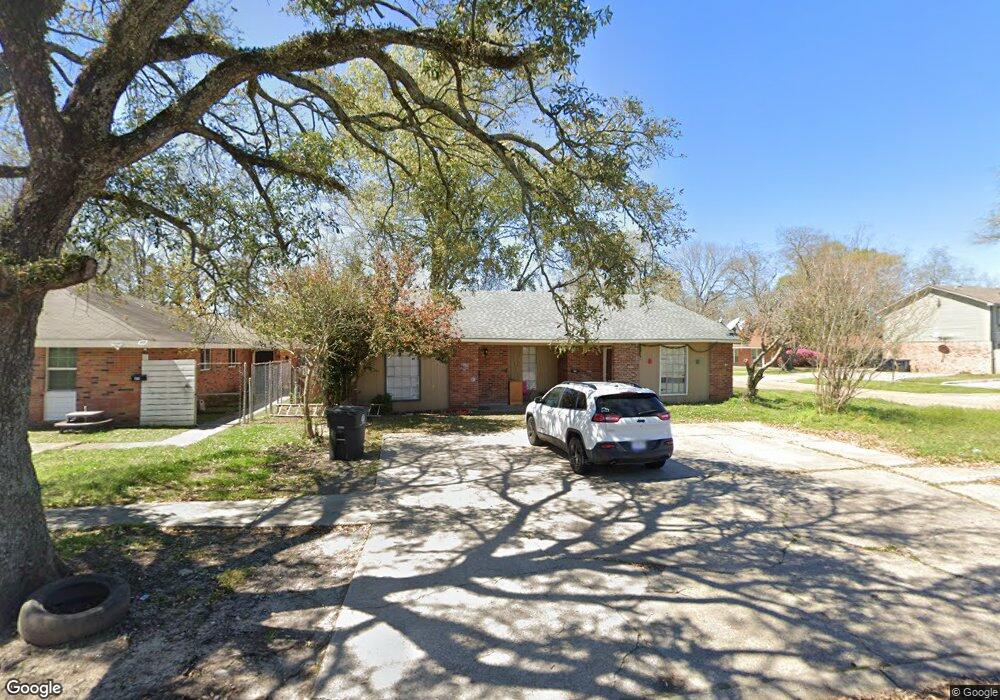
1483 Cristy Dr Baton Rouge, LA 70815
Park Forest/LA North NeighborhoodEstimated Value: $95,047 - $189,000
7
Beds
3
Baths
2,400
Sq Ft
$61/Sq Ft
Est. Value
About This Home
This home is located at 1483 Cristy Dr, Baton Rouge, LA 70815 and is currently estimated at $146,262, approximately $60 per square foot. 1483 Cristy Dr is a home located in East Baton Rouge Parish with nearby schools including LaBelle Aire Elementary School, Park Forest Middle School, and Belaire High School.
Ownership History
Date
Name
Owned For
Owner Type
Purchase Details
Closed on
Dec 13, 2018
Sold by
Deutsche Bank National Trust Company
Bought by
Nguyen Trang
Current Estimated Value
Purchase Details
Closed on
Feb 7, 2018
Sold by
Jenkins Cetrick Carl
Bought by
Deutsche Bank National Trust Company and Argent Securities Inc Asset-Backed Pass-
Purchase Details
Closed on
Feb 10, 2006
Sold by
Ortis Eugene A
Bought by
Jenkins Cetrick C
Home Financials for this Owner
Home Financials are based on the most recent Mortgage that was taken out on this home.
Original Mortgage
$60,000
Interest Rate
6.18%
Mortgage Type
New Conventional
Create a Home Valuation Report for This Property
The Home Valuation Report is an in-depth analysis detailing your home's value as well as a comparison with similar homes in the area
Home Values in the Area
Average Home Value in this Area
Purchase History
| Date | Buyer | Sale Price | Title Company |
|---|---|---|---|
| Nguyen Trang | $48,008 | Premium Title Services Inc | |
| Deutsche Bank National Trust Company | -- | None Available | |
| Jenkins Cetrick C | $75,000 | -- |
Source: Public Records
Mortgage History
| Date | Status | Borrower | Loan Amount |
|---|---|---|---|
| Previous Owner | Jenkins Cetrick C | $60,000 |
Source: Public Records
Tax History Compared to Growth
Tax History
| Year | Tax Paid | Tax Assessment Tax Assessment Total Assessment is a certain percentage of the fair market value that is determined by local assessors to be the total taxable value of land and additions on the property. | Land | Improvement |
|---|---|---|---|---|
| 2024 | $1,346 | $10,000 | $1,000 | $9,000 |
| 2023 | $1,346 | $7,000 | $1,000 | $6,000 |
| 2022 | $1,011 | $7,000 | $1,000 | $6,000 |
| 2021 | $992 | $7,000 | $1,000 | $6,000 |
| 2020 | $827 | $7,000 | $1,000 | $6,000 |
| 2019 | $741 | $6,000 | $1,000 | $5,000 |
| 2018 | $915 | $7,500 | $1,000 | $6,500 |
| 2017 | $915 | $7,500 | $1,000 | $6,500 |
| 2016 | $893 | $7,500 | $1,000 | $6,500 |
| 2015 | $894 | $7,500 | $1,000 | $6,500 |
| 2014 | $891 | $7,500 | $1,000 | $6,500 |
| 2013 | -- | $7,500 | $1,000 | $6,500 |
Source: Public Records
Map
Nearby Homes
- 12547 Lorna Ave
- 12013 Shannon Ave
- 12424 Cate Ave Unit 12426
- 12385&12387 Shay Ave
- 1466 Harco Dr
- 2043 Shady Oaks Dr
- 1734 N Rosedale Dr
- 13070 Wallis St
- 12875 King John Place
- 2148 Oak Knoll Dr
- 2121 Oak Knoll Dr
- 11555 E Black Oak Dr
- 371 Kay Dr
- 11755 Archery Dr
- 2150 N Sherwood Forest Dr
- 379 Wilton Dr
- 388 Wingate Dr
- 305 Woodcliff Dr
- 12511 E Robinhood Dr
- 11625 Archery Dr
- 1461 & 1463 Christy Dr
- 1461 Cristy Dr
- 1447 Cristy Dr
- 1436 S Mike Dr
- 1426 S Mike Dr
- 12217 Warfield Ave
- 12320 & 12322 Warfield Ave
- 12320 &. 12322 Warfield Ave
- 1425 Cristy Dr
- 13235 Robbie Ave
- 12342 Warfield Ave
- 1416 S Mike Dr
- 12207 Warfield Ave
- 12347 Robbie Ave
- 1383 Cristy Dr
- 12343 Warfield Ave
- 12349 Robbie Ave
- 12262 Tams Dr
- 12246 Tams Dr
- 1511 Cristy Dr