Estimated Value: $738,000 - $860,000
6
Beds
4
Baths
4,173
Sq Ft
$187/Sq Ft
Est. Value
About This Home
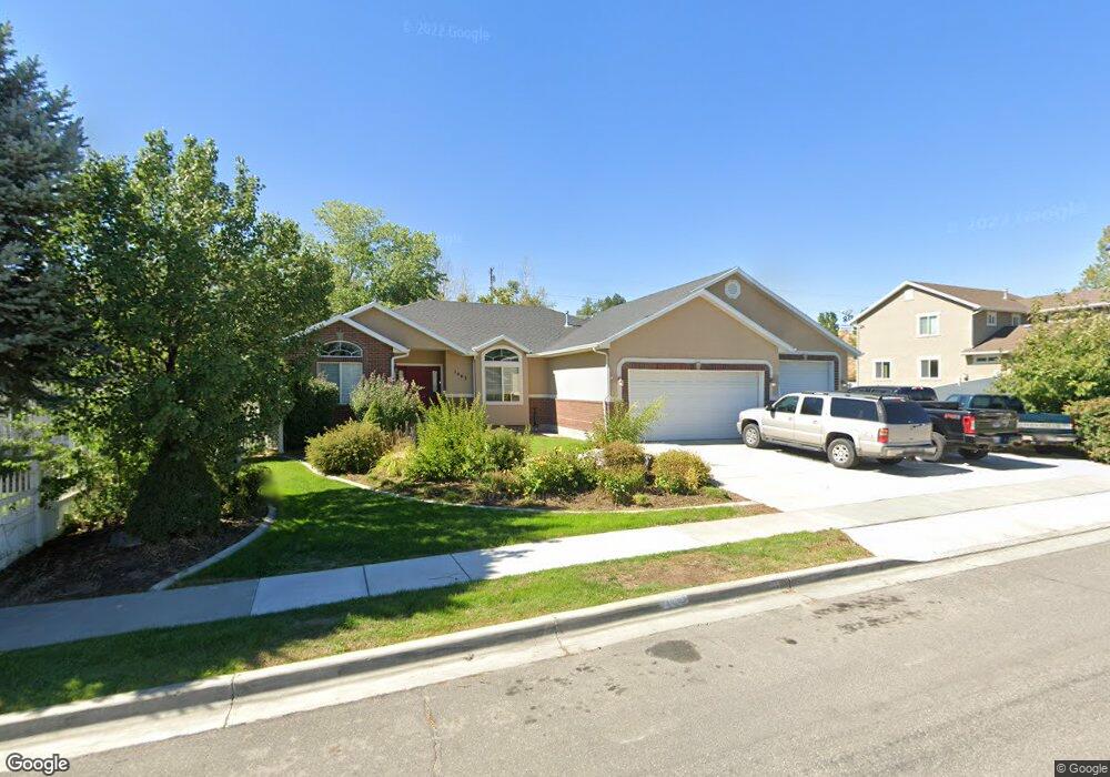
This home is located at 1483 N 250 W, Lehi, UT 84043 and is currently estimated at $779,983, approximately $186 per square foot. 1483 N 250 W is a home located in Utah County with nearby schools including Sego Lily Elementary School, Lehi Junior High School, and Skyridge High School.
Ownership History
Date
Name
Owned For
Owner Type
Purchase Details
Closed on
Aug 13, 2024
Sold by
Langston Rachael
Bought by
Langston David
Current Estimated Value
Purchase Details
Closed on
Nov 6, 2003
Sold by
Brown Lafe and Brown Lori
Bought by
Hinckley Todd and Hinckley Mindy
Home Financials for this Owner
Home Financials are based on the most recent Mortgage that was taken out on this home.
Original Mortgage
$170,000
Interest Rate
5.94%
Mortgage Type
Purchase Money Mortgage
Purchase Details
Closed on
Jun 19, 2001
Sold by
Brown Lafe B and Brown Lori K
Bought by
Brown Lafe and Brown Lori
Home Financials for this Owner
Home Financials are based on the most recent Mortgage that was taken out on this home.
Original Mortgage
$228,500
Interest Rate
7.15%
Purchase Details
Closed on
Feb 16, 2000
Sold by
Hi Valley Development Corp
Bought by
Brown Lafe B and Brown Lori
Home Financials for this Owner
Home Financials are based on the most recent Mortgage that was taken out on this home.
Original Mortgage
$216,000
Interest Rate
7.13%
Purchase Details
Closed on
Jan 30, 2000
Sold by
Brown Lafe B and Brown Lori
Bought by
Brown Lafe B and Brown Lori K
Home Financials for this Owner
Home Financials are based on the most recent Mortgage that was taken out on this home.
Original Mortgage
$216,000
Interest Rate
7.13%
Create a Home Valuation Report for This Property
The Home Valuation Report is an in-depth analysis detailing your home's value as well as a comparison with similar homes in the area
Home Values in the Area
Average Home Value in this Area
Purchase History
| Date | Buyer | Sale Price | Title Company |
|---|---|---|---|
| Langston David | -- | Protitle | |
| Hinckley Todd | -- | Horizon Title Insurance | |
| Brown Lafe | -- | Mountain West Title Co | |
| Brown Lafe B | -- | Mountain West Title Co | |
| Brown Lafe B | -- | Mountain West Title Co |
Source: Public Records
Mortgage History
| Date | Status | Borrower | Loan Amount |
|---|---|---|---|
| Previous Owner | Hinckley Todd | $170,000 | |
| Previous Owner | Brown Lafe | $228,500 | |
| Previous Owner | Brown Lafe B | $216,000 |
Source: Public Records
Tax History Compared to Growth
Tax History
| Year | Tax Paid | Tax Assessment Tax Assessment Total Assessment is a certain percentage of the fair market value that is determined by local assessors to be the total taxable value of land and additions on the property. | Land | Improvement |
|---|---|---|---|---|
| 2025 | $3,058 | $412,060 | $241,700 | $507,500 |
| 2024 | $3,058 | $357,830 | $0 | $0 |
| 2023 | $2,814 | $357,610 | $0 | $0 |
| 2022 | $3,052 | $375,980 | $0 | $0 |
| 2021 | $2,763 | $514,600 | $139,900 | $374,700 |
| 2020 | $2,606 | $479,700 | $129,500 | $350,200 |
| 2019 | $2,456 | $470,000 | $129,500 | $340,500 |
| 2018 | $2,132 | $385,700 | $113,300 | $272,400 |
| 2017 | $2,028 | $195,030 | $0 | $0 |
| 2016 | $1,994 | $177,980 | $0 | $0 |
| 2015 | $1,937 | $164,120 | $0 | $0 |
| 2014 | $1,819 | $153,175 | $0 | $0 |
Source: Public Records
Map
Nearby Homes
- 1755 N 250 W
- 1150 N 200 W Unit 6
- 1329 N 100 E Unit 21
- 1295 N 190 E
- 996 N 200 W
- 4333 N Baiken Ridge Dr Unit 1020
- 155 W State St Unit TRLR 3
- 1817 W Bad Rock Cir
- 902 W 1500 N
- 68 W State St
- 1301 N 900 W Unit 12
- 7 E State St
- 497 W 2200 N
- 443 W 820 N
- 595 W 2200 N
- 1011 W Mountain Way Unit 316
- 1094 W 1425 N
- 1610 N 1125 W
- 497 W 2280 N
- 192 E 2200 N
- 1483 N 250 W Unit 43
- 1465 N 250 W
- 1465 N 250 W Unit 42
- 1505 N 250 W
- 1447 N 250 W
- 1447 N 250 W Unit 41
- 1519 N 250 W
- 1457 N 250 W
- 1484 N 250 W
- 1484 N 250 W Unit 30
- 1519 N 300 W
- 1466 N 250 W
- 1466 N 250 W Unit 31
- 1512 N 250 W
- 1533 N 250 W
- 1429 N 250 W
- 1429 N 250 W Unit 40
- 1448 N 250 W
- 1448 N 250 W Unit 32
- 1526 N 250 W