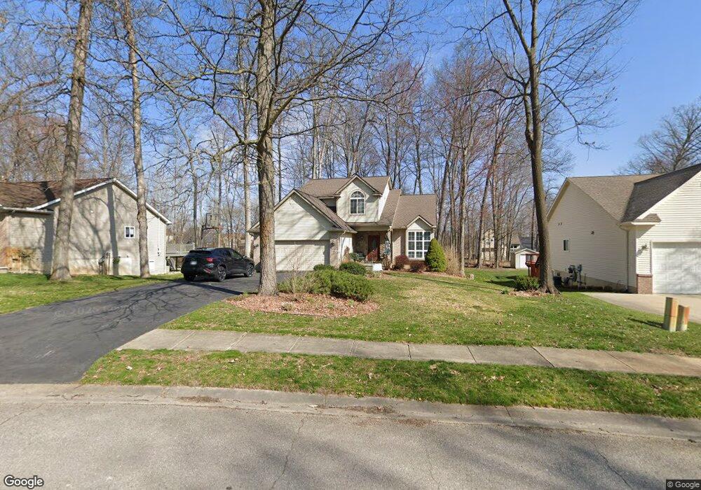
1483 Odette Unit 29 Hartland, MI 48353
Estimated Value: $390,172 - $470,000
4
Beds
3
Baths
1,875
Sq Ft
$231/Sq Ft
Est. Value
About This Home
This home is located at 1483 Odette Unit 29, Hartland, MI 48353 and is currently estimated at $434,043, approximately $231 per square foot. 1483 Odette Unit 29 is a home located in Livingston County with nearby schools including Hartland High School, Charyl Stockwell Academy, and Our Savior Evangelical Lutheran School.
Ownership History
Date
Name
Owned For
Owner Type
Purchase Details
Closed on
Nov 15, 2024
Sold by
Rice Daniel P and Rice Teresa E
Bought by
Rice Daniel Patrick and Rice Teresa Elizabeth
Current Estimated Value
Purchase Details
Closed on
Jul 17, 2000
Sold by
St Dennis Development Inc
Bought by
Rice Daniel P and Rice Teresa E
Home Financials for this Owner
Home Financials are based on the most recent Mortgage that was taken out on this home.
Original Mortgage
$167,900
Interest Rate
8.24%
Purchase Details
Closed on
Jan 28, 2000
Sold by
Hartland Lakes Estates
Bought by
St Dennis Development Inc
Home Financials for this Owner
Home Financials are based on the most recent Mortgage that was taken out on this home.
Original Mortgage
$149,925
Interest Rate
8.21%
Mortgage Type
Construction
Create a Home Valuation Report for This Property
The Home Valuation Report is an in-depth analysis detailing your home's value as well as a comparison with similar homes in the area
Home Values in the Area
Average Home Value in this Area
Purchase History
| Date | Buyer | Sale Price | Title Company |
|---|---|---|---|
| Rice Daniel Patrick | -- | None Listed On Document | |
| Rice Daniel P | $40,000 | -- | |
| St Dennis Development Inc | $42,210 | Tri County Title Agency Inc |
Source: Public Records
Mortgage History
| Date | Status | Borrower | Loan Amount |
|---|---|---|---|
| Previous Owner | Rice Daniel P | $167,900 | |
| Previous Owner | St Dennis Development Inc | $149,925 |
Source: Public Records
Tax History Compared to Growth
Tax History
| Year | Tax Paid | Tax Assessment Tax Assessment Total Assessment is a certain percentage of the fair market value that is determined by local assessors to be the total taxable value of land and additions on the property. | Land | Improvement |
|---|---|---|---|---|
| 2025 | $3,738 | $169,400 | $0 | $0 |
| 2024 | $1,511 | $181,200 | $0 | $0 |
| 2023 | $1,444 | $139,700 | $0 | $0 |
| 2022 | $3,168 | $117,100 | $0 | $0 |
| 2021 | $3,320 | $132,300 | $0 | $0 |
| 2020 | $3,309 | $126,700 | $0 | $0 |
| 2019 | $3,154 | $117,100 | $0 | $0 |
| 2018 | $3,044 | $120,800 | $0 | $0 |
| 2017 | $2,753 | $120,800 | $0 | $0 |
| 2016 | $2,739 | $117,100 | $0 | $0 |
| 2014 | $2,836 | $95,600 | $0 | $0 |
| 2012 | $2,836 | $91,900 | $0 | $0 |
Source: Public Records
Map
Nearby Homes
- 1560 Odette
- 1441 Remsing St Unit 4
- 11639 Island Ct
- 12002 Renfrew Ct
- 1020 Woods Edge Dr
- V/L Highland Rd
- 2.03 Acres Highland Rd
- 2255 Clark Rd
- 1163 Long Lake Dr
- 1412 North Ct
- 12071 Highland Rd
- 2581 Pepper Ct
- V/L Parcel D Old Us-23 Hwy
- V/L Parcels C & D Old Us-23 Hwy
- 000 Highland Rd
- V/L Parcel C Old Us-23 Hwy
- 10456 Viewtop Ct
- 2933 Bullard Rd
- Chase Plan at Hunters Ridge - Landings 5
- Beretta Loft Plan at Hunters Ridge - Landings 5
- 1491 Odette Unit 28
- 1475 Odette Unit 30
- 1467 Odette Unit 31
- 1505 Odette
- 1484 Remsing St Unit 53
- 1476 Remsing St Unit 52
- 1492 Remsing St Unit 54
- 1500 Remsing St
- 1459 Odette Unit 32
- 1468 Remsing St Unit 51
- 0 Odette Rd Unit 30018575
- 0 Odette Rd Unit 4918671
- 0 Odette Rd Unit 212079102
- 1521 Odette
- 1518 Remsing St
- 1460 Remsing St Unit 50
- 1451 Odette Unit 33
- 1520 Odette
- 1524 Remsing St
- 1537 Odette