Estimated Value: $340,000 - $378,000
4
Beds
3
Baths
2,290
Sq Ft
$156/Sq Ft
Est. Value
About This Home
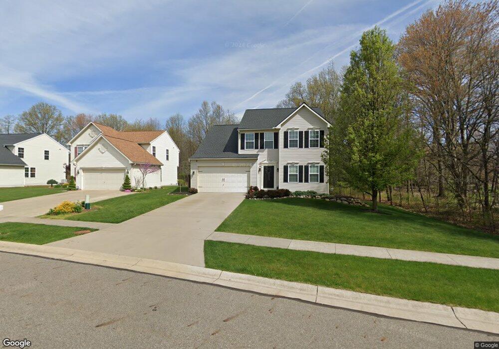
This home is located at 1483 Parsons Dr, Kent, OH 44240 and is currently estimated at $356,717, approximately $155 per square foot. 1483 Parsons Dr is a home located in Portage County with nearby schools including Brimfield Elementary School, Field Middle School, and Field High School.
Ownership History
Date
Name
Owned For
Owner Type
Purchase Details
Closed on
Oct 31, 2008
Sold by
Nvr Inc
Bought by
Brindle Matthew R and Brindle Kelly N
Current Estimated Value
Home Financials for this Owner
Home Financials are based on the most recent Mortgage that was taken out on this home.
Original Mortgage
$177,300
Interest Rate
6.3%
Mortgage Type
Purchase Money Mortgage
Purchase Details
Closed on
Oct 3, 2008
Sold by
Lemmon & Lemmon Inc
Bought by
Nvr Inc and Ryan Homes
Home Financials for this Owner
Home Financials are based on the most recent Mortgage that was taken out on this home.
Original Mortgage
$177,300
Interest Rate
6.3%
Mortgage Type
Purchase Money Mortgage
Purchase Details
Closed on
Feb 23, 2006
Sold by
Casamento Michael R and Flynn John J
Bought by
Lemmon & Lemmon Inc
Create a Home Valuation Report for This Property
The Home Valuation Report is an in-depth analysis detailing your home's value as well as a comparison with similar homes in the area
Home Values in the Area
Average Home Value in this Area
Purchase History
| Date | Buyer | Sale Price | Title Company |
|---|---|---|---|
| Brindle Matthew R | $201,600 | Attorney | |
| Nvr Inc | $37,000 | Attorney | |
| Lemmon & Lemmon Inc | -- | None Available |
Source: Public Records
Mortgage History
| Date | Status | Borrower | Loan Amount |
|---|---|---|---|
| Previous Owner | Brindle Matthew R | $177,300 |
Source: Public Records
Tax History Compared to Growth
Tax History
| Year | Tax Paid | Tax Assessment Tax Assessment Total Assessment is a certain percentage of the fair market value that is determined by local assessors to be the total taxable value of land and additions on the property. | Land | Improvement |
|---|---|---|---|---|
| 2024 | $4,952 | $104,060 | $12,250 | $91,810 |
| 2023 | $4,845 | $81,970 | $12,250 | $69,720 |
| 2022 | $4,858 | $81,970 | $12,250 | $69,720 |
| 2021 | $4,743 | $81,970 | $12,250 | $69,720 |
| 2020 | $4,581 | $71,330 | $12,250 | $59,080 |
| 2019 | $4,516 | $71,330 | $12,250 | $59,080 |
| 2018 | $3,395 | $63,740 | $12,250 | $51,490 |
| 2017 | $3,395 | $63,740 | $12,250 | $51,490 |
| 2016 | $3,388 | $63,740 | $12,250 | $51,490 |
| 2015 | $3,278 | $63,740 | $12,250 | $51,490 |
| 2014 | $3,042 | $61,290 | $12,250 | $49,040 |
| 2013 | $2,970 | $61,290 | $12,250 | $49,040 |
Source: Public Records
Map
Nearby Homes
- 1354 Brimfield Dr
- 4088 Lynwood Dr
- 4682 State Route 43
- 3946 Mctaggart Blvd
- 1088 Irish Rd
- 3793 Ranfield Rd
- 1418 Arcadia Rd
- 3868 Willow Way
- 3579 Elmhurst Ct
- 3672 Elmhurst Ct
- 3658 Elmhurst Ct
- 4837 King Meadow Trail
- 4891 Edson Rd
- 847 Lakeview Ct
- 1330 Highpoint St
- 3517 Jameson Dr
- 1755 Honeychuck Ln
- Poplar Plan at Woodland Reserve
- Nassau Cove Plan at Woodland Reserve
- V/L Sherman Rd
- 1477 Parsons Dr
- 1471 Parsons Dr
- 1499 Parsons Dr
- 1476 Parsons Dr
- 1465 Parsons Dr
- 1507 Parsons Dr
- 1467 Parsons Dr
- 1457 Parsons Dr
- 1502 Parsons Dr
- 1515 Parsons Dr
- 4250 Whitestone Rd
- 4242 Pembroke Dr
- 1510 Parsons Dr
- 1451 Parsons Dr
- 4248 Pembroke Dr
- 4236 Pembroke Dr
- 4244 Whitestone Rd
- 1523 Parsons Dr
- 1518 Parsons Dr
- 4230 Pembroke Dr