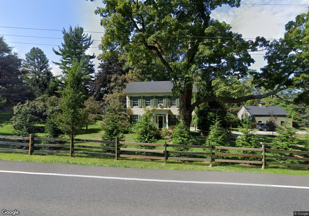
1483 State Route 31 Oxford, NJ 07863
Estimated Value: $382,000 - $591,000
--
Bed
--
Bath
2,264
Sq Ft
$215/Sq Ft
Est. Value
About This Home
This home is located at 1483 State Route 31, Oxford, NJ 07863 and is currently estimated at $487,566, approximately $215 per square foot. 1483 State Route 31 is a home with nearby schools including White Township Consolidated Elementary School.
Ownership History
Date
Name
Owned For
Owner Type
Purchase Details
Closed on
Jul 6, 2001
Sold by
Malina Gerald
Bought by
Pozarycki Christopher
Current Estimated Value
Home Financials for this Owner
Home Financials are based on the most recent Mortgage that was taken out on this home.
Original Mortgage
$238,500
Outstanding Balance
$92,312
Interest Rate
7.2%
Mortgage Type
Purchase Money Mortgage
Estimated Equity
$395,254
Create a Home Valuation Report for This Property
The Home Valuation Report is an in-depth analysis detailing your home's value as well as a comparison with similar homes in the area
Home Values in the Area
Average Home Value in this Area
Purchase History
| Date | Buyer | Sale Price | Title Company |
|---|---|---|---|
| Pozarycki Christopher | $265,000 | Chicago Title Insurance Co |
Source: Public Records
Mortgage History
| Date | Status | Borrower | Loan Amount |
|---|---|---|---|
| Open | Pozarycki Christopher | $238,500 |
Source: Public Records
Tax History Compared to Growth
Tax History
| Year | Tax Paid | Tax Assessment Tax Assessment Total Assessment is a certain percentage of the fair market value that is determined by local assessors to be the total taxable value of land and additions on the property. | Land | Improvement |
|---|---|---|---|---|
| 2025 | $8,238 | $329,500 | $108,000 | $221,500 |
| 2024 | $7,911 | $329,500 | $108,000 | $221,500 |
| 2023 | $7,602 | $329,500 | $108,000 | $221,500 |
| 2022 | $7,602 | $329,500 | $108,000 | $221,500 |
| 2021 | $7,071 | $329,500 | $108,000 | $221,500 |
| 2020 | $7,190 | $329,500 | $108,000 | $221,500 |
| 2019 | $6,791 | $329,500 | $108,000 | $221,500 |
| 2018 | $6,791 | $329,500 | $108,000 | $221,500 |
| 2017 | $7,048 | $329,500 | $108,000 | $221,500 |
| 2016 | $7,186 | $329,500 | $108,000 | $221,500 |
| 2015 | $6,900 | $329,500 | $108,000 | $221,500 |
| 2014 | $6,844 | $329,500 | $108,000 | $221,500 |
Source: Public Records
Map
Nearby Homes
- 1497 New Jersey 31
- 8 Buttzville Rd
- 349 New Jersey 31
- 7 Buttzville Ct
- 301 New Jersey 31
- 305 Route 31
- 14 Tamarack Rd
- 21 Olde Forge
- 11 Scranton Pkwy
- 50 Green Pond Rd
- 77 Shippen Ridge
- 49 Henry St
- 138 Belvidere Ave
- 45 Bush St
- 20 Belvidere Ave
- 50 Zulauf Ln
- 9 Front St
- 11 Front St
- 40 Washington Ave
- 15 Henderson St
- 221 E Quarry Rd
- 1484 State Route 31
- 219 E Quarry Rd
- 476 State Route 31 N
- 1488 State Route 31
- 223 E Quarry Rd
- 1489 State Route 31
- 217 E Quarry Rd
- 1486 State Route 31
- 1486 New Jersey 31
- 215 E Quarry Rd
- 1491 State Route 31
- 213 E Quarry Rd
- 1497 State Route 31
- 211 E Quarry Rd
- 1495 State Route 31
- 1 Jones Farm Ln
- 3 Jones Farm Ln
- 5 Jones Farm Ln
- 7 Jones Farm Ln