Estimated Value: $530,000 - $568,297
4
Beds
2
Baths
2,110
Sq Ft
$259/Sq Ft
Est. Value
About This Home
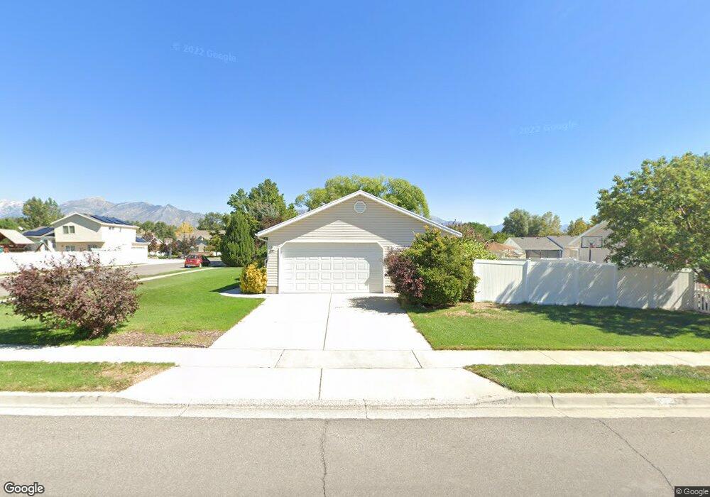
This home is located at 1484 N 250 W, Lehi, UT 84043 and is currently estimated at $547,324, approximately $259 per square foot. 1484 N 250 W is a home located in Utah County with nearby schools including Sego Lily Elementary School, Lehi Junior High School, and Skyridge High School.
Ownership History
Date
Name
Owned For
Owner Type
Purchase Details
Closed on
Apr 27, 2017
Sold by
Squire Robert G and Squire Michele Bangerter
Bought by
Nay Garrett K and Nay Eve B
Current Estimated Value
Home Financials for this Owner
Home Financials are based on the most recent Mortgage that was taken out on this home.
Original Mortgage
$183,000
Outstanding Balance
$125,116
Interest Rate
4.3%
Mortgage Type
New Conventional
Estimated Equity
$422,208
Purchase Details
Closed on
Mar 15, 2013
Sold by
Squire Robert and Squire Michelle
Bought by
Squire Robert G and Squire Michelle Bengerter
Home Financials for this Owner
Home Financials are based on the most recent Mortgage that was taken out on this home.
Original Mortgage
$188,368
Interest Rate
4.51%
Mortgage Type
FHA
Purchase Details
Closed on
Nov 9, 2009
Sold by
Johnson Kirk H and Johnson Rachael Atwood
Bought by
Squire Robert and Squire Michelle
Home Financials for this Owner
Home Financials are based on the most recent Mortgage that was taken out on this home.
Original Mortgage
$201,286
Interest Rate
4.83%
Mortgage Type
FHA
Purchase Details
Closed on
Aug 17, 2006
Sold by
Sparks Hal S and Sparks Denise
Bought by
Johnson Kirk H
Home Financials for this Owner
Home Financials are based on the most recent Mortgage that was taken out on this home.
Original Mortgage
$203,200
Interest Rate
6.76%
Mortgage Type
New Conventional
Purchase Details
Closed on
Sep 1, 1999
Sold by
Csr Enterprises Llc
Bought by
Hi Valley Development Corp
Home Financials for this Owner
Home Financials are based on the most recent Mortgage that was taken out on this home.
Original Mortgage
$130,000
Interest Rate
7.56%
Purchase Details
Closed on
Aug 26, 1999
Sold by
Brown Lafe B and Brown Lori
Bought by
Sparks Hal S and Sparks Denise
Home Financials for this Owner
Home Financials are based on the most recent Mortgage that was taken out on this home.
Original Mortgage
$130,000
Interest Rate
7.56%
Purchase Details
Closed on
Mar 30, 1999
Sold by
Hi Valley Development Corp
Bought by
Brown Lafe B and Brown Lori
Home Financials for this Owner
Home Financials are based on the most recent Mortgage that was taken out on this home.
Original Mortgage
$105,000
Interest Rate
6.79%
Mortgage Type
Construction
Create a Home Valuation Report for This Property
The Home Valuation Report is an in-depth analysis detailing your home's value as well as a comparison with similar homes in the area
Home Values in the Area
Average Home Value in this Area
Purchase History
| Date | Buyer | Sale Price | Title Company |
|---|---|---|---|
| Nay Garrett K | -- | None Available | |
| Squire Robert G | -- | None Available | |
| Squire Robert | -- | Equity Title West Jordan | |
| Johnson Kirk H | -- | First American Title Agency | |
| Johnson Kirk H | -- | Equity Title Production F | |
| Hi Valley Development Corp | -- | Mountain West Title Co | |
| Sparks Hal S | -- | Mountain West Title Co | |
| Brown Lafe B | -- | Mountain West Title Co |
Source: Public Records
Mortgage History
| Date | Status | Borrower | Loan Amount |
|---|---|---|---|
| Open | Nay Garrett K | $183,000 | |
| Previous Owner | Squire Robert G | $188,368 | |
| Previous Owner | Squire Robert | $201,286 | |
| Previous Owner | Johnson Kirk H | $203,200 | |
| Previous Owner | Johnson Kirk H | $25,400 | |
| Previous Owner | Sparks Hal S | $130,000 | |
| Previous Owner | Brown Lafe B | $105,000 |
Source: Public Records
Tax History Compared to Growth
Tax History
| Year | Tax Paid | Tax Assessment Tax Assessment Total Assessment is a certain percentage of the fair market value that is determined by local assessors to be the total taxable value of land and additions on the property. | Land | Improvement |
|---|---|---|---|---|
| 2025 | $2,148 | $284,405 | $218,900 | $298,200 |
| 2024 | $2,148 | $251,350 | $0 | $0 |
| 2023 | $1,988 | $252,560 | $0 | $0 |
| 2022 | $2,193 | $270,160 | $0 | $0 |
| 2021 | $1,943 | $361,800 | $126,700 | $235,100 |
| 2020 | $1,831 | $337,000 | $117,300 | $219,700 |
| 2019 | $1,615 | $309,100 | $117,300 | $191,800 |
| 2018 | $1,558 | $281,900 | $102,600 | $179,300 |
| 2017 | $1,475 | $141,845 | $0 | $0 |
| 2016 | $1,477 | $131,780 | $0 | $0 |
| 2015 | $1,417 | $120,010 | $0 | $0 |
| 2014 | $1,341 | $112,915 | $0 | $0 |
Source: Public Records
Map
Nearby Homes
- 1755 N 250 W
- 1329 N 100 E Unit 21
- 1150 N 200 W Unit 6
- 1295 N 190 E
- 4333 N Baiken Ridge Dr Unit 1020
- 996 N 200 W
- 155 W State St Unit TRLR 3
- 68 W State St
- 1817 W Bad Rock Cir
- 902 W 1500 N
- 1301 N 900 W Unit 12
- 7 E State St
- 497 W 2200 N
- 443 W 820 N
- 595 W 2200 N
- 1011 W Mountain Way Unit 316
- 1094 W 1425 N
- 1610 N 1125 W
- 497 W 2280 N
- 192 E 2200 N