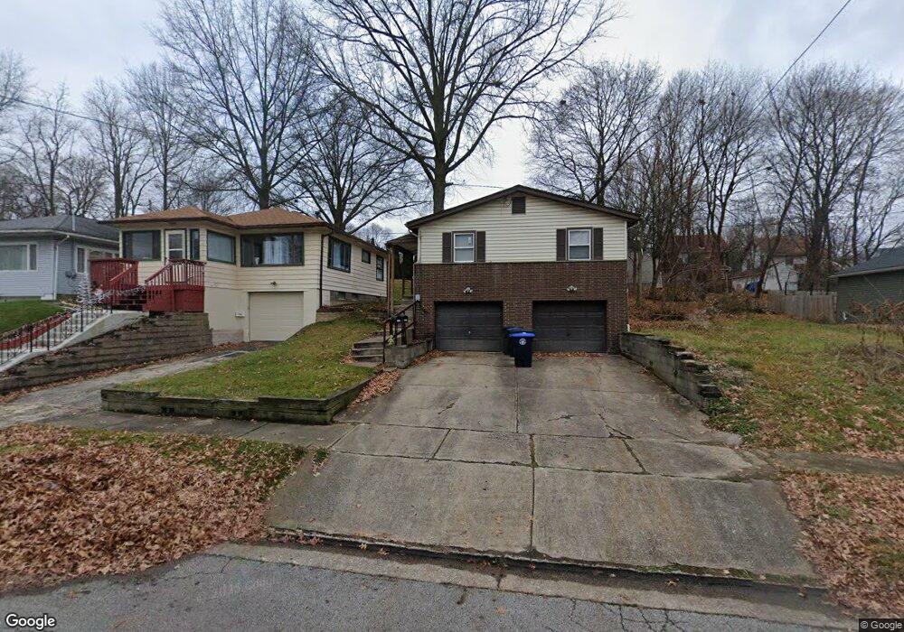
1484 Rockaway St Unit 1486 Akron, OH 44314
Kenmore NeighborhoodEstimated Value: $98,000 - $113,963
4
Beds
2
Baths
1,352
Sq Ft
$79/Sq Ft
Est. Value
About This Home
This home is located at 1484 Rockaway St Unit 1486, Akron, OH 44314 and is currently estimated at $106,241, approximately $78 per square foot. 1484 Rockaway St Unit 1486 is a home located in Summit County with nearby schools including Pfeiffer Elementary School, Kenmore Garfield Community Learning Center, and St. Bernard-St. Mary Elementary School.
Ownership History
Date
Name
Owned For
Owner Type
Purchase Details
Closed on
Aug 10, 2018
Sold by
Powell Lealer B
Bought by
Level Property Ltd
Current Estimated Value
Purchase Details
Closed on
Oct 3, 2014
Sold by
Staggs Karen S
Bought by
Powell Lealer B
Home Financials for this Owner
Home Financials are based on the most recent Mortgage that was taken out on this home.
Original Mortgage
$39,225
Interest Rate
4.13%
Mortgage Type
New Conventional
Create a Home Valuation Report for This Property
The Home Valuation Report is an in-depth analysis detailing your home's value as well as a comparison with similar homes in the area
Home Values in the Area
Average Home Value in this Area
Purchase History
| Date | Buyer | Sale Price | Title Company |
|---|---|---|---|
| Level Property Ltd | -- | None Available | |
| Powell Lealer B | $52,300 | American Land Title Affiliat |
Source: Public Records
Mortgage History
| Date | Status | Borrower | Loan Amount |
|---|---|---|---|
| Previous Owner | Powell Lealer B | $39,225 |
Source: Public Records
Tax History Compared to Growth
Tax History
| Year | Tax Paid | Tax Assessment Tax Assessment Total Assessment is a certain percentage of the fair market value that is determined by local assessors to be the total taxable value of land and additions on the property. | Land | Improvement |
|---|---|---|---|---|
| 2025 | $1,466 | $26,387 | $5,208 | $21,179 |
| 2024 | $1,466 | $26,387 | $5,208 | $21,179 |
| 2023 | $1,466 | $26,387 | $5,208 | $21,179 |
| 2022 | $1,296 | $18,197 | $3,591 | $14,606 |
| 2021 | $1,297 | $18,197 | $3,591 | $14,606 |
| 2020 | $1,279 | $18,200 | $3,590 | $14,610 |
| 2019 | $1,682 | $22,090 | $4,260 | $17,830 |
| 2018 | $1,660 | $22,090 | $4,260 | $17,830 |
| 2017 | $1,822 | $22,090 | $4,260 | $17,830 |
| 2016 | $1,824 | $23,960 | $4,260 | $19,700 |
| 2015 | $1,822 | $23,960 | $4,260 | $19,700 |
| 2014 | $1,808 | $23,960 | $4,260 | $19,700 |
| 2013 | $1,880 | $25,500 | $4,260 | $21,240 |
Source: Public Records
Map
Nearby Homes
- 710 Clearview Ave
- 741 Jason Ave
- 788 Saxon Ave
- 754 Russell Ave
- 828 Marie Ave
- 0 East Ave
- 545 Thelma Ave
- 543 Thelma Ave
- 539 Thelma Ave
- 1174 La Croix Ave
- 546 Thelma Ave
- 534 Thelma Ave
- 905 National Ave
- 530 Thelma Ave
- 738 Longview Ave
- 1574 East Ave
- 1702 Leighton Ave
- 853 Russell Ave
- 1637 East Ave Unit 1639
- 940 Lakewood Blvd
- 1486 Rockaway St
- 1488 Rockaway St
- 1480 Rockaway St
- 1492 Rockaway St
- 1476 Rockaway St
- 1483 Hite St
- 1479 Hite St
- 1487 Hite St
- 1475 Hite St
- 1500 Rockaway St
- 1485 Rockaway St
- 1495 Hite St
- 1481 Rockaway St
- 1471 Hite St
- 1489 Rockaway St
- 1477 Rockaway St
- 1493 Rockaway St
- 1467 Hite St
- 1497 Rockaway St
- 1464 Rockaway St