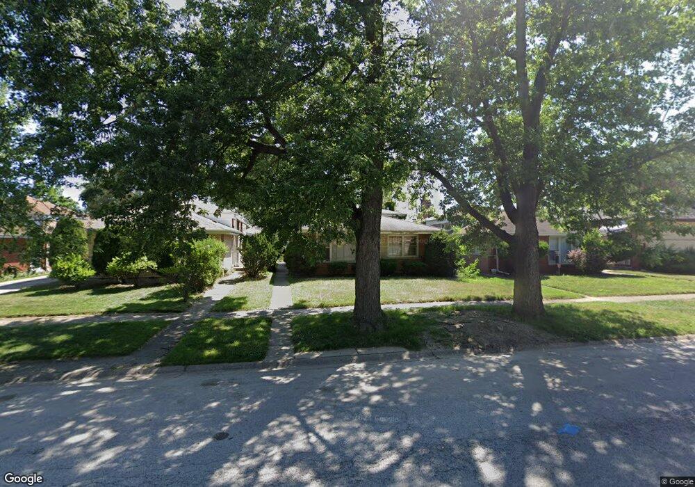
14840 Shepard Dr Dolton, IL 60419
Estimated Value: $153,000 - $200,000
3
Beds
2
Baths
1,091
Sq Ft
$161/Sq Ft
Est. Value
About This Home
This home is located at 14840 Shepard Dr, Dolton, IL 60419 and is currently estimated at $176,008, approximately $161 per square foot. 14840 Shepard Dr is a home located in Cook County with nearby schools including Berger-Vandenberg Elementary School, Creative Communications Academy, and School Of Fine Arts Academy.
Ownership History
Date
Name
Owned For
Owner Type
Purchase Details
Closed on
Jan 25, 2010
Sold by
Deutsche Bank National Trust Company
Bought by
Castagnier Joyce
Current Estimated Value
Purchase Details
Closed on
Oct 22, 2009
Sold by
Junuis
Bought by
Deutsche Bank National Trust Company
Purchase Details
Closed on
May 18, 2006
Sold by
Reed Quintrell and Reed Charmaine
Bought by
Junius Lillian
Home Financials for this Owner
Home Financials are based on the most recent Mortgage that was taken out on this home.
Original Mortgage
$117,700
Interest Rate
7.99%
Mortgage Type
Unknown
Create a Home Valuation Report for This Property
The Home Valuation Report is an in-depth analysis detailing your home's value as well as a comparison with similar homes in the area
Home Values in the Area
Average Home Value in this Area
Purchase History
| Date | Buyer | Sale Price | Title Company |
|---|---|---|---|
| Castagnier Joyce | $47,000 | Cti | |
| Deutsche Bank National Trust Company | -- | None Available | |
| Junius Lillian | $147,500 | Attorneys Title Guaranty Fun |
Source: Public Records
Mortgage History
| Date | Status | Borrower | Loan Amount |
|---|---|---|---|
| Previous Owner | Junius Lillian | $117,700 |
Source: Public Records
Tax History
| Year | Tax Paid | Tax Assessment Tax Assessment Total Assessment is a certain percentage of the fair market value that is determined by local assessors to be the total taxable value of land and additions on the property. | Land | Improvement |
|---|---|---|---|---|
| 2025 | $4,532 | $14,000 | $2,125 | $11,875 |
| 2024 | $4,532 | $14,000 | $2,125 | $11,875 |
| 2023 | $4,001 | $14,000 | $2,125 | $11,875 |
| 2022 | $4,001 | $11,684 | $1,875 | $9,809 |
| 2021 | $3,918 | $11,683 | $1,875 | $9,808 |
| 2020 | $7,516 | $11,683 | $1,875 | $9,808 |
| 2019 | $7,767 | $10,651 | $1,750 | $8,901 |
| 2018 | $7,735 | $10,651 | $1,750 | $8,901 |
| 2017 | $7,318 | $10,651 | $1,750 | $8,901 |
| 2016 | $6,462 | $10,136 | $1,625 | $8,511 |
| 2015 | $6,242 | $10,136 | $1,625 | $8,511 |
| 2014 | $6,163 | $10,136 | $1,625 | $8,511 |
| 2013 | $5,407 | $9,480 | $1,625 | $7,855 |
Source: Public Records
Map
Nearby Homes
- 14737 Kimbark Ave
- 14731 Kimbark Ave
- 14738 Dante Ave
- 14738 Blackstone Ave
- 14761 Lincoln Ave
- 14637 Kenwood Ave
- 14720 Shepard Dr
- 1314 E 151st St
- 15043 Meadow Ln
- 15020 Woodlawn Ave
- 14635 Woodlawn Ave
- 14708 Shepard Dr
- 1212 E 151st St
- 15119 Meadow Ln
- 1138 E 151st St
- 14610 Blackstone Ave
- 15133 Diekman Ct
- 1425 Kasten Dr
- 14521 Kenwood Ave
- 15201 Sunset Dr
- 14836 Shepard Dr
- 14846 Shepard Dr
- 14832 Shepard Dr
- 14850 Shepard Dr
- 14835 Kimbark Ave
- 14821 Kimbark Ave
- 14865 Lincoln Ave
- 14833 Shepard Dr
- 14852 Shepard Dr
- 14869 Lincoln Ave
- 14869 Lincoln Ave
- 14873 Lincoln Ave
- 14814 Kenwood Ave
- 14856 Shepard Dr
- 14879 Lincoln Ave
- 14879 Lincoln Ave
- 14810 Kenwood Ave
- 14858 Shepard Dr
- 14819 Shepard Dr
- 14821 Kenwood Ave
Your Personal Tour Guide
Ask me questions while you tour the home.