Estimated Value: $115,000 - $154,000
Studio
--
Bath
--
Sq Ft
130,680
Sq Ft
About This Home
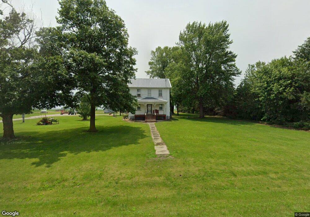
This home is located at 1485 10th Ave, Avon, IL 61415 and is currently estimated at $130,122. 1485 10th Ave is a home with nearby schools including Bushnell-Prairie City Elementary School, Bushnell-Prairie City Junior High School, and Bushnell-Prairie City High School.
Ownership History
Date
Name
Owned For
Owner Type
Purchase Details
Closed on
Apr 15, 2014
Sold by
Dallefeld Elden E and Dallefeld Patricia L
Bought by
Pendarvis Jeff D and Pendarvis Amy J
Current Estimated Value
Home Financials for this Owner
Home Financials are based on the most recent Mortgage that was taken out on this home.
Original Mortgage
$75,000
Interest Rate
4.33%
Mortgage Type
Purchase Money Mortgage
Purchase Details
Closed on
Oct 30, 2007
Sold by
Dallefeld Elden E and Dallefeld Patricia L
Bought by
Dallefeld Elden E and Dallefeld Patricia L
Create a Home Valuation Report for This Property
The Home Valuation Report is an in-depth analysis detailing your home's value as well as a comparison with similar homes in the area
Purchase History
| Date | Buyer | Sale Price | Title Company |
|---|---|---|---|
| Pendarvis Jeff D | $85,000 | None Available | |
| Dallefeld Elden E | -- | None Available |
Source: Public Records
Mortgage History
| Date | Status | Borrower | Loan Amount |
|---|---|---|---|
| Previous Owner | Pendarvis Jeff D | $75,000 |
Source: Public Records
Tax History
| Year | Tax Paid | Tax Assessment Tax Assessment Total Assessment is a certain percentage of the fair market value that is determined by local assessors to be the total taxable value of land and additions on the property. | Land | Improvement |
|---|---|---|---|---|
| 2024 | $2,639 | $34,180 | $5,090 | $29,090 |
| 2023 | $2,639 | $32,320 | $4,810 | $27,510 |
| 2022 | $2,285 | $30,050 | $4,470 | $25,580 |
| 2021 | $2,231 | $29,150 | $4,340 | $24,810 |
| 2020 | $2,294 | $29,150 | $4,340 | $24,810 |
| 2019 | $2,273 | $28,570 | $4,250 | $24,320 |
| 2018 | $2,391 | $29,920 | $4,280 | $25,640 |
| 2017 | $2,351 | $29,330 | $4,200 | $25,130 |
| 2016 | $2,317 | $28,650 | $4,100 | $24,550 |
| 2015 | -- | $27,580 | $3,950 | $23,630 |
| 2014 | -- | $27,190 | $3,890 | $23,300 |
| 2013 | -- | $26,170 | $3,980 | $22,190 |
Source: Public Records
Map
Nearby Homes
- 20620 N 2300th Rd
- 20620 N 2300 Rd
- 21 Bricker Cir
- 140 Palemino Dr
- 235 N Smith St
- See Aerial Map Attached To Listing
- 306 S Main St
- 203 E Washington St
- 108 E Grant St
- 307 E Clinton
- 315 E Washington St
- 14 Hiel Dr
- 4 Hiel Dr
- 897 20th Ave
- 924 N Crafford St
- 497 Walnut St
- 555 N Jackson St
- 777 Cole St
- 682 N Rile St
- 651 N Sperry St
Your Personal Tour Guide
Ask me questions while you tour the home.